The Monsal Trail is perfect for walkers, cyclists, horse riders, and wheelchair users who can enjoy a peaceful journey through the beautiful limestone dales of the Derbyshire Peak District National Park.
Spanning approximately 8.5 miles, the trail connects Blackwell Mill (Just outside of Buxton) in Chee Dale to Coombs Road in Bakewell.
It’s easily accessible from several nearby villages like Great Longstone, Little Longstone, Cressbrook Mill, Litton Mill, and Tideswell Dale.
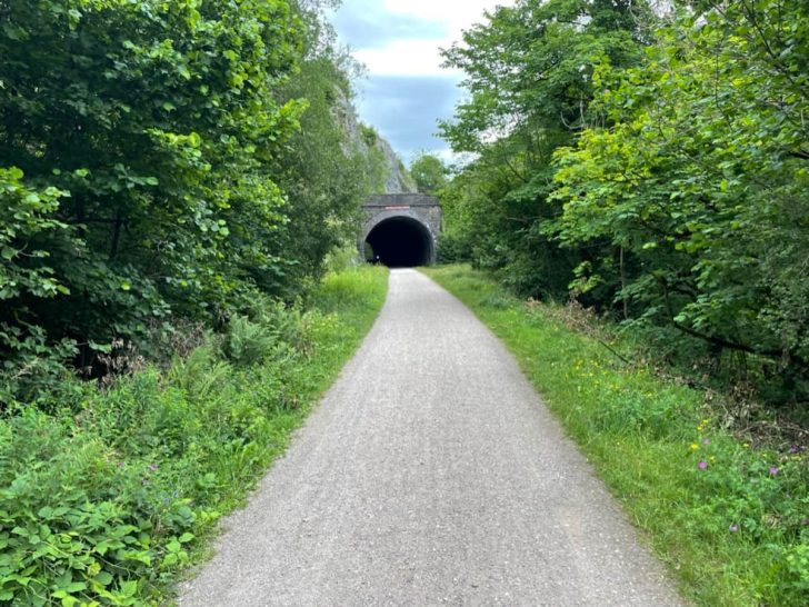
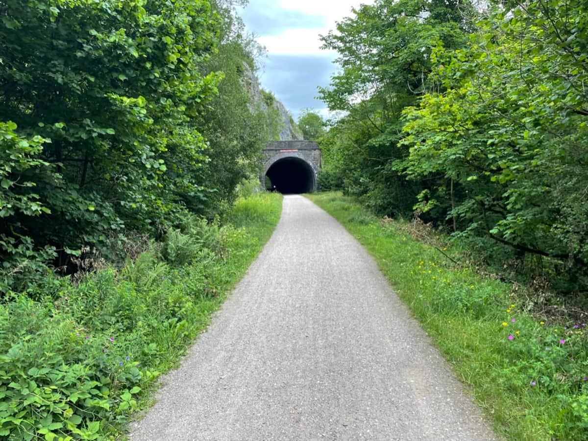
The trail was once a former midland railway line connecting Manchester to London, which closed in 1968, with many tunnels reopened in 2011 by the national park authority.
The railway line now creates a wide, flat path that cuts through the hills with tunnels and crosses gouges with stunning bridges.
Trail Overview
Download file for GPSDistance (One way): 15.45KM 9.6mi with 106m (350 ft) of declining elevation
Approximate walking time (One way): 3-4.5 hrs
Approximate Cycle time (One way): 0.7-1.2 hrs
Approximate Running time (One way): 1-2 hrs
Outside of Buxton:
- Topley Pike Junction
- Chee Tor No. 1 Tunnel
- Millers Dale – Main end/start
- Millers Dale Viaducts
- Litton Tunnel
- Cressbrook Tunnel
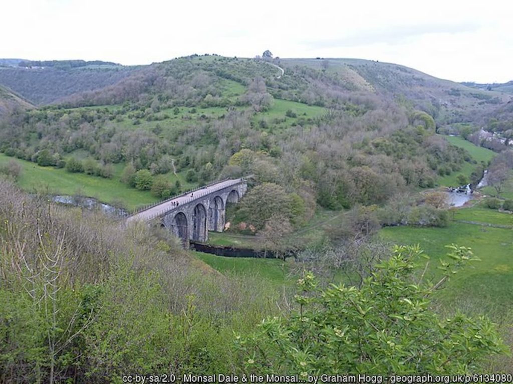
- Monsal Dale (Next to Monsal Head)
- Headstone Viaduct
- Headstone Tunnel
- Great Longstone
- Hassop
- Bakewell – Main end/start
- Coombs Road Viaduct (end of trail)
Further along:
- Haddon Tunnel – closed
- Rowsley (proposed extension)
- Rowsley South
- Darley Dale
- Matlock Riverside
- Peak Rail Line
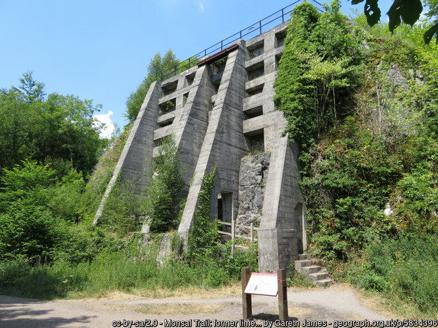
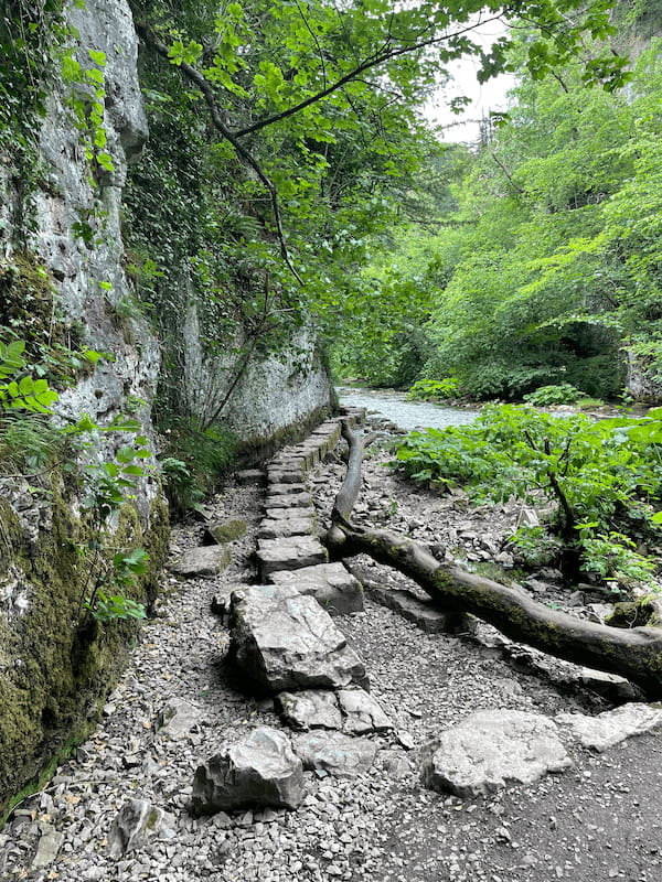
Along the route, you’ll find various clues about the existing railway, such as the stations and their platforms, as well as limestone kilns from the area’s industrial past.
Facilities and Access Points
- Parking: You can park at the old stations in Bakewell, Hassop, and Millers Dale. There’s also parking available at Tideswell Dale and Wyedale. However, do note that the trail from Monsal Head involves a steep walk. Below are all of the major car parks along the route. Wyedale at the far end and Bakewell at the other:
- Wyedale Car Park – A6, Buxton SK17 9TE
- Millers Dale Car Park – Wormhill, Buxton SK17 8SN
- Monsal Head Car Park – Ashford in the Water, Bakewell DE45 1NL
- Hassop Station Car Park – Hassop Station, Hassop Rd, Bakewell DE45 1NW
- Bakewell Station Car Park – Bakewell DE45 1GE
- Bakewell Agricultural Business Centre – Agricultural Way, Bakewell DE45 1AH
- Café and Toilets: Enjoy the conveniences of cafés and toilets at Hassop and Millers Dale stations. Millers Dale Station also has a Goods Shed offering visitor information and shelter.
- Picnics: Feel free to have a picnic at many points along the trail. Remember to take your litter home and note that BBQs are not permitted.
View the full list of things to do in Bakewell, or other top walks around Bakewell if you want to spend some time in the town.
Visiting with Pets
Dogs are welcome on the trail, but please keep them on a lead. Be mindful of livestock in adjacent fields and use designated bins for any mess.
Bike Hire
For those who enjoy cycling, the Monsal Trail is an ideal spot. Bike hire centres are conveniently located at Blackwell Mill and Hassop Station, both easily accessible from the National Cycle Network.
View the bike hire centres for more information here:
Blackwell Mill – 01298 70838
Hassop Station – 01629 815 668
Accessibility
The trail is accessible at several points, especially suitable for wheelchair and mobility scooter users at Bakewell Station, Hassop Station, Great Longstone Station, and Millers Dale Station.
Bus services from Nottingham, Derby, Manchester, Chesterfield, and Sheffield provide easy access to the Monsal Trail. The nearest train stations are at Buxton and Matlock.
Highlights of the trail
Viaducts: The trail features impressive structures like the Headstone Viaduct, offering a glimpse into its historical railway heritage. The image below is from Monsal Head, one of the best viewing points in the Peak District.
Historical Sites: Discover the past industries like cotton mills at Litton Mill and Cressbrook Mill, and the limekilns near Millers Dale Station.
Stepping Stone: The famous Chee Dale Stepping Stones are just a short distance from the Wyedale end of the trail, where the footpath heads down to the river wye.
Headstone: The Headstone Tunnel is one of the longer tunnels, over 400 metres long, and spans a long distance. Thankfully, during daylight hours, the tunnel is lit.
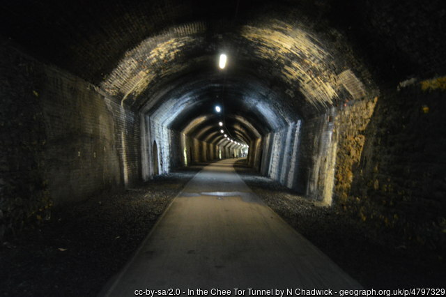
Other Tunnels
The trail passes through the following tunnels
- Headstone: 487 m (533 yards)
- Cressbrook: 431 m (471 yards)
- Litton: 471 m (515 yards)
- Chee Tor 1: 367 m (401 yards)
- Chee Tor 2: 83 m (91 yards)
- Rusher Cutting Tunnel: 111 m (121 yards)
Another tunnel, Haddon Tunnel, is currently closed due to safety issues, but there is a discussion it could be reopened.
The Monsal Trail offers a unique blend of natural beauty, historical interest, and recreational opportunities.
Whether you’re a hiker, cyclist, nature lover, or history enthusiast, this trail has something for everyone. Enjoy your journey through one of Derbyshire’s most scenic routes!
If you love the Monsal trail, you should check out the Tissington trail, an equally stunning former railway line.
Monsal Trail FAQs
How long is the Monsal Trail walk?
The Monsal Trail walk spans approximately 13.7 kilometres (8.5 miles). If you’re walking the trail, it’ll typically take you between 3 to 4.5 hours to cover this distance in one go.
The trail’s relatively flat and wide nature makes it a comfortable journey for walkers.
How difficult is the Monsal Trail?
The Monsal Trail is known for being accessible and not too challenging. It’s ideal for a range of visitors, including walkers, cyclists, horse riders, and wheelchair users.
The trail follows a former railway line, offering a relatively flat and wide path that cuts through scenic landscapes. This makes it a great option for all, from casual walkers to more seasoned hikers.
Is Monsal Trail flat?
Yes, the Monsal Trail is mostly flat. It was once a railway line, and this heritage has resulted in a trail that’s wide and level.
The path smoothly cuts through hills with tunnels and crosses gorges with bridges, offering easy navigation and enjoyable views without the challenge of steep inclines or rough terrain.
This flat nature makes it suitable for a diverse range of users, including those on bicycles or in wheelchairs.