
Discover the charm of Win Hill, a beautiful hill nestled around some of the most iconic Peak District spots, known for its steep ascents, panoramic views, and a historic battle from long ago.
This guide is your companion to explore, providing essential details about access, parking, walking routes, local facilities, and answers to commonly asked questions, ensuring your visit is as smooth and enjoyable as possible.
So, lace up your walking boots and step into the serene landscapes of Win Hill.
Getting to Win Hill
Accessing the starting point of Win Hill is most conveniently done by car, as only one bus route services the area with reasonable regularity.
Parking at Win Hill
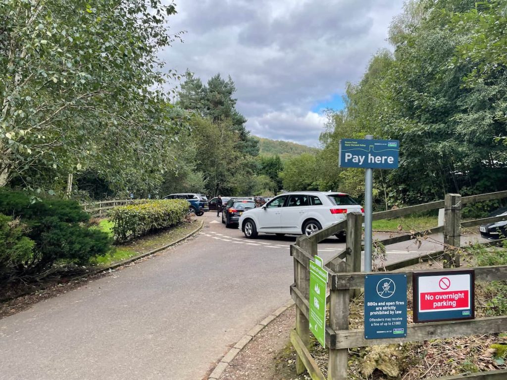
The principal parking area is at Heatherdene Car Park, which can become quite busy. Alternatively, there is free parking available at lay-bys in the surrounding area, though some may require a bit of additional walking.
Heatherdene Car Park (Paid)
Address: A6013, Hope Valley S33 0BY (Exact Location: ///beads.rigs.jetting)
Heatherdene Car Park is the best choice; it provides amenities such as toilets, picnic benches, Boot washing stations and a water refill point, serving as the perfect starting point for the hike.
However, it does tend to fill up quickly, especially during weekends and summer holidays, so arriving early is advisable.
The parking charges are as follows:
- 2 Hours: £3.50
- All Day: £6.00
This has increased from £3.00 all day a few months ago, if it seems higher.
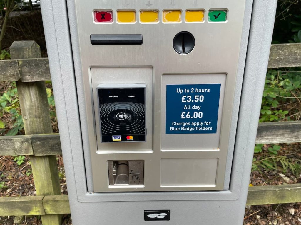
The Win Hill walk typically takes approximately 2 hours. However, for those who prefer a leisurely pace, wish to take rest stops, or encounter adverse conditions, the walk may extend beyond this estimated time, making the “All Day” parking option a safer choice.
Lay-bys (Free)
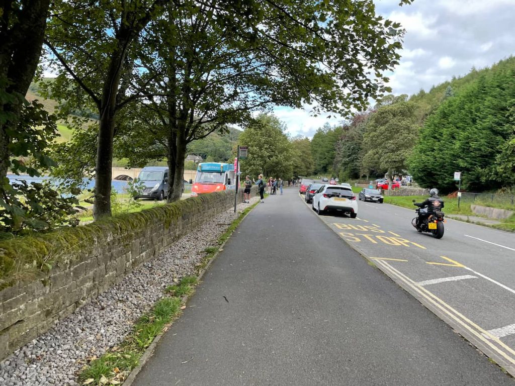
There are several free parking options around Heatherdene Car Park. The first is the lay-by directly outside, offering about ten spaces and overlooking the reservoir.
A second option is located a substantial distance further down the road, just before the Ladybower Reservoir bridge on the A57, which features several hundred metres of parallel parking.
- Right outside Heatherdene Car Park. Location: ///sweat.described.trash
- This lay-by has about ten spaces but is usually full.
- A57 (Snake Rd) Layby parking. Location: ///afraid.twitching.flash
- This long layby has around 30 spaces but is a 15-minute walk to reach the starting point of the Win Hill walk. If you have a small car you’ll usually find a spot to squeeze into.
Win Hill by Public Transport
Public transport options to Win Hill and the starting point at Heatherdene car park are limited.
However, the 257, operated by Hulleys of Baslow, departs from Sheffield and stops directly outside Heatherdene, with the nearest marked stop on the timetable being the “Ladybower Inn”. The journey should take around half an hour. The service also operates in the other direction via Bakewell, Baslow, Eyam, and Bamford. The timetable can be viewed here.
Win Hill Walk Map & Route
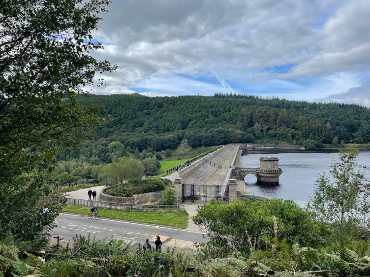
Download file for GPSThe walk traverses the Ladybower dam before ascending a particularly steep hill for around 1 km (0.6 mi), leading you to the summit of Win Hill, where you can enjoy breathtaking 360-degree views. The walk then gently meanders downhill, through the forest, and back over the dam, returning you to the car park shortly.
Which hiking map app should I use? I recommend OS Maps Online for its unparalleled accuracy. However, if you’re a beginner, you might find AllTrails to be more user-friendly. For a detailed review of the best UK map apps, read my full review.
Note: The initial steepness of the hill can be challenging for those unaccustomed to steep inclines. If this is the case, it’s recommended to approach the walk in an anti-clockwise direction; after crossing the dam wall, turn right instead of left, allowing for a more gradual ascent.
Win Hill Walk Step by Step – 6km (3.7mi) ~ 2hr
1.Exit Heatherdene car park, pass the toilets, and proceed along the path.
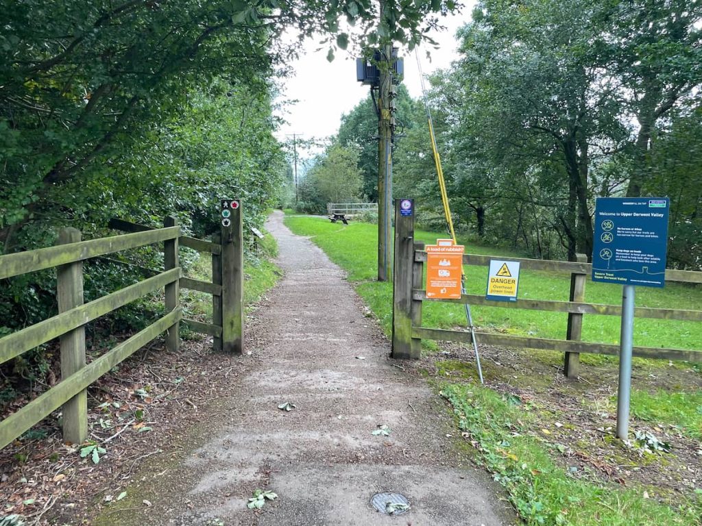
2. Continue following the tree-lined path until you reach a junction leading right and downhill to the road.

Interesting: As you go, make sure to peek to the right where you should be able to spot the top of Win Hill in the distance through the gaps in the trees.
3. Cross the road and proceed onto the reservoir wall. Be cautious; this is quite a busy road, and cars tend to travel at high speeds here.
4. On the reservoir wall, traverse across, taking in the surrounding views of Ladybower Reservoir and, if the water level is sufficient, the plugholes!
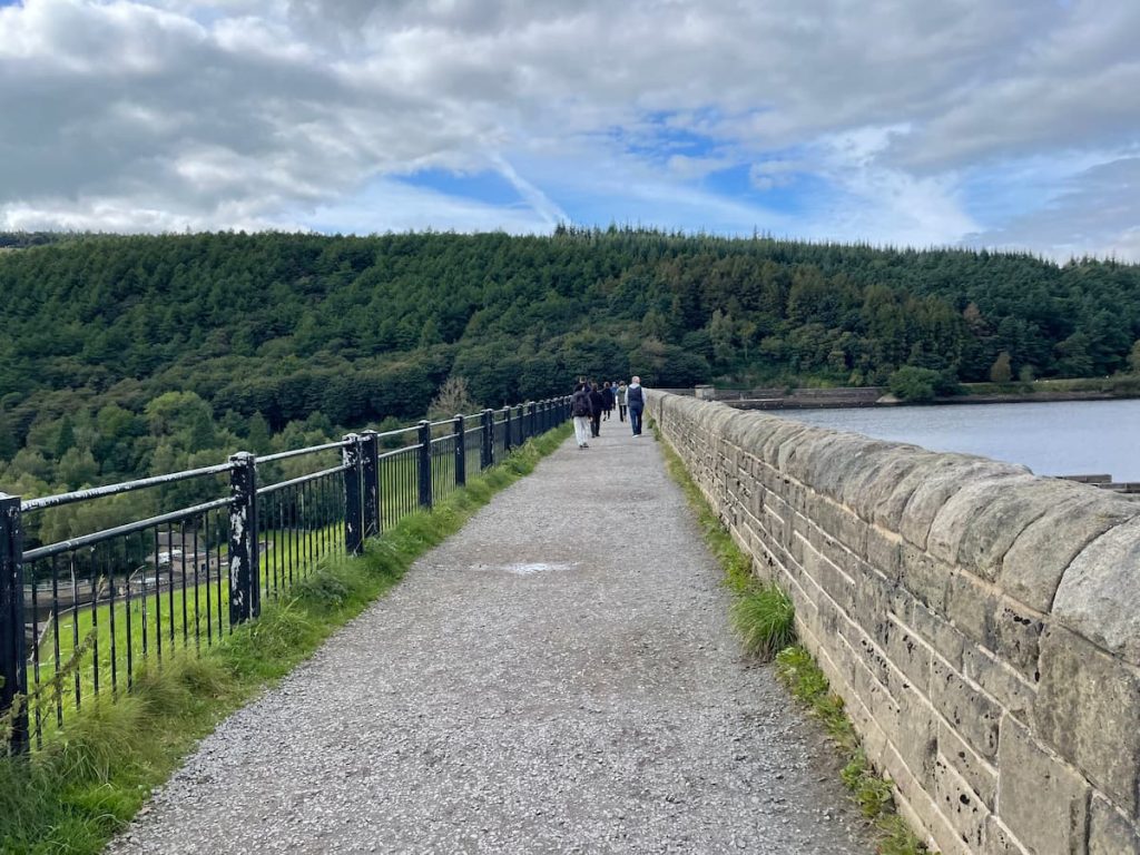
5. Upon reaching the end of the dam path, pass through the gate and take a sharp left onto the paved road and follow it down hill.
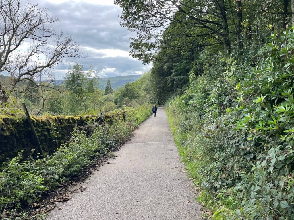
6. After a while, you’ll reach a right-leading path; follow it until you encounter the stream and an uphill path on the right.
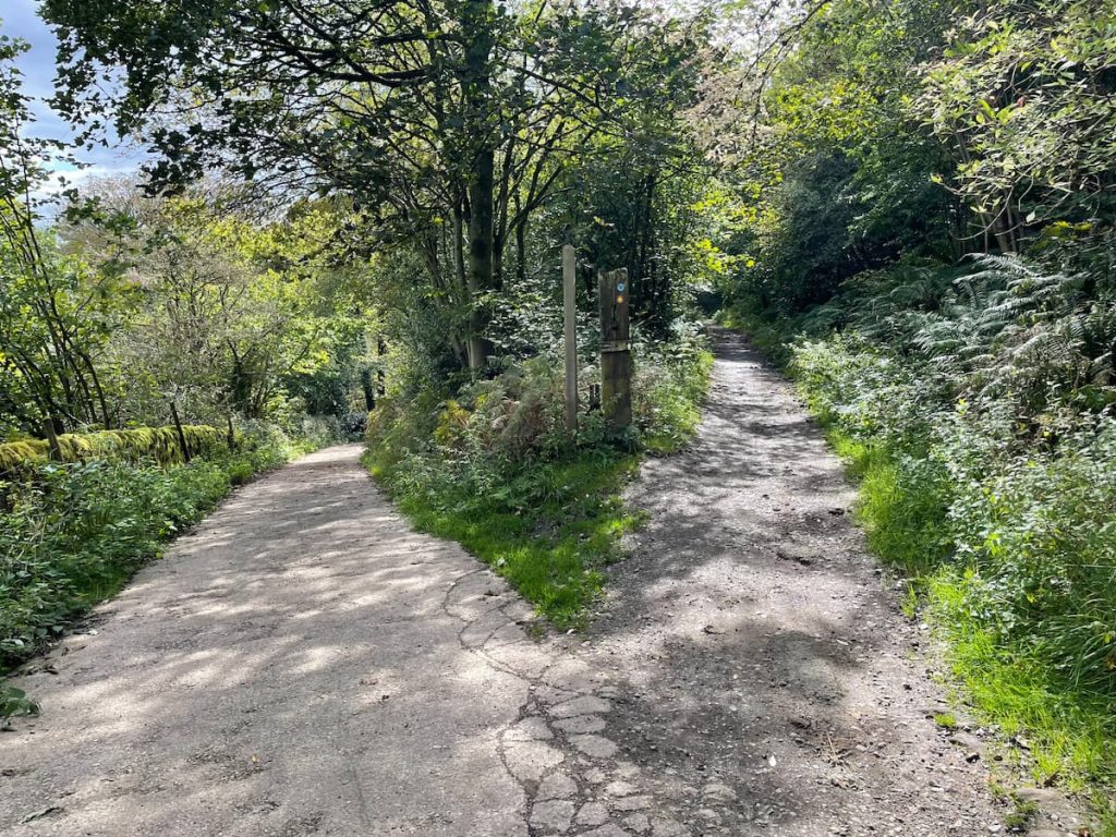
7. Begin the ascent up the path—beware, it can get muddy here.
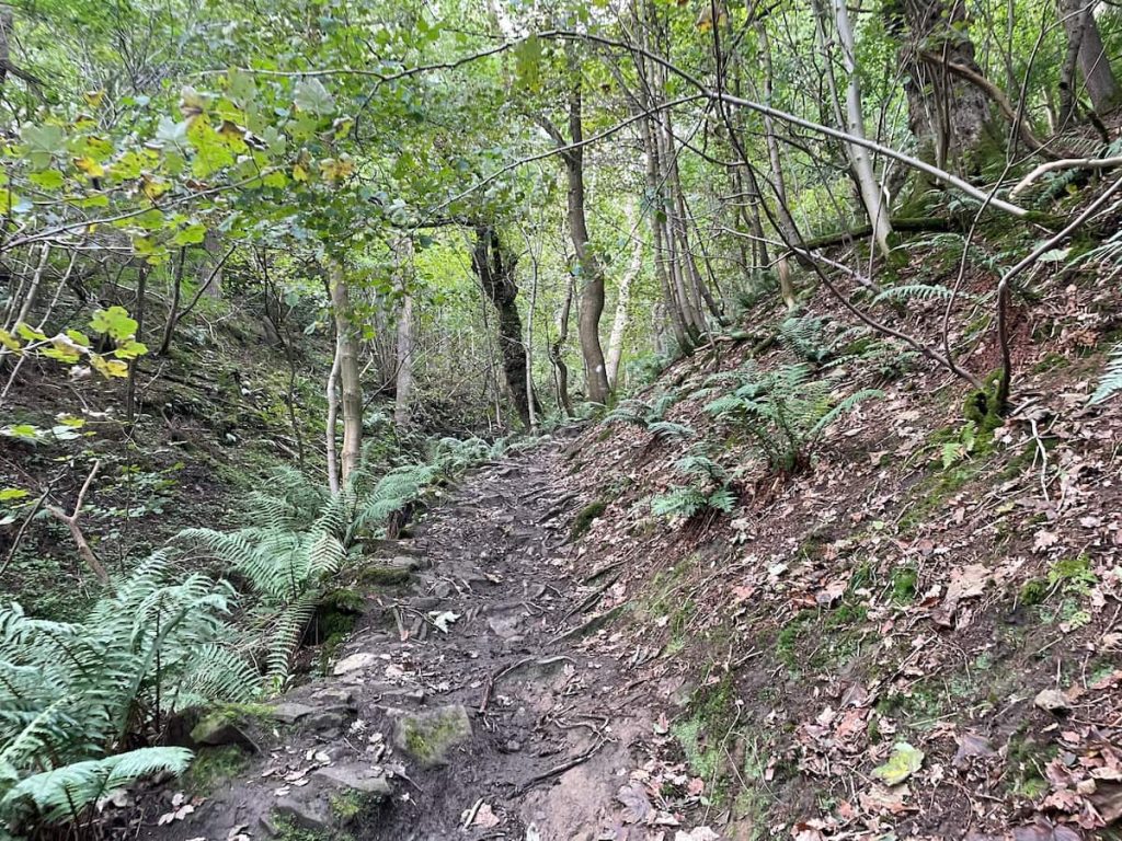
Warning: This section is exceptionally steep, essentially a staircase, gaining 300m (1000ft) of elevation over 1km (0.6mi). The first section features a particularly steep rocky path, challenging even for seasoned hikers.
8. After some distance, you’ll reach a gate where the woodland area opens up a bit; pass through the gate and continue uphill.

9. Shortly, you’ll exit the treeline and notice a distinctive stone path to follow. Ensure to look back occasionally to admire the stunning view you’ve already achieved.

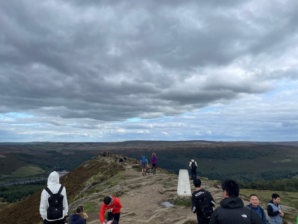
10. Continue following the path as it winds uphill. The summit remains concealed until you reach the top, where you’ll find the white trig point marking the summit of Win Hill! Revel in the stunning 360-degree views, spanning from Lose Hill in the East to Castleton, Hope, Bamford Edge, Stanage Edge, and Derwent Dam in the North, to name a few.
11. Once done, continue downwards on the gentle path.
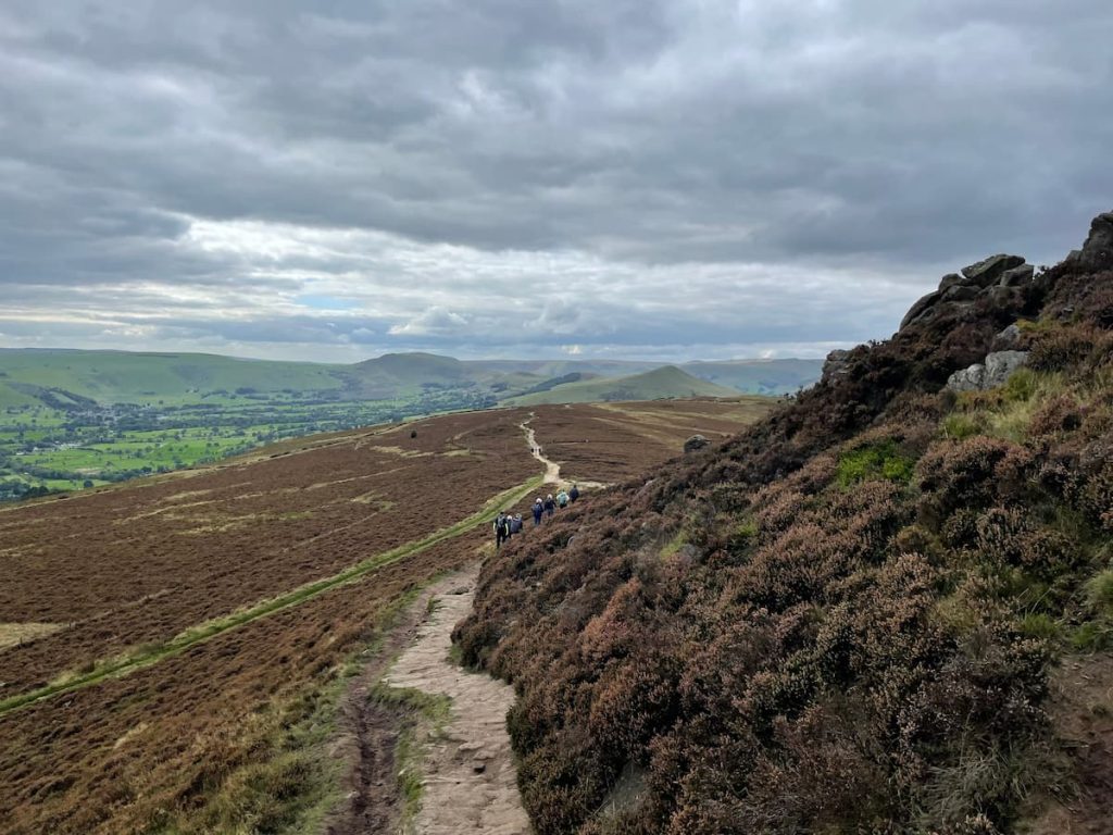
12. Eventually, you’ll reach a crossroads; turn right but almost double back on yourself and continue down the path weaving through the heather-clad hillside.

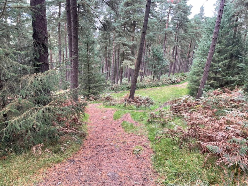
13. Savor the final views as you eventually reach a gate leading into a wooded area. Proceed through and downhill.

14. As you approach the bottom, choose the right-leading path and continue to follow it.
15. Persist in following the path indicated by the map and eventually, you’ll emerge at the edge of the reservoir. Walk a short distance to the right, and you’ll be back at the dam crossing. From here, simply retrace your steps back to the car park.

- Daypack: Choose a 10-20L daypack to carry all your gear comfortably.
- Clothing: Wear layered, moisture-wicking clothing and pack a waterproof jacket and waterproof trousers for changing weather.
- Footwear: Sturdy walking boots or trail shoes are essential for the varied terrain.
- Water & Snacks: Carry enough water (at least 1L per hour) and bring energy-rich snacks.
- Navigation: Always have a map and compass, and optionally, bring a reliable GPS app to stay on track.
- First Aid Kit: Include essential items like blister treatments and painkillers. A compact First Aid Kit is ideal.
- Emergency Items: A headtorch, whistle, and multi-tool can be vital in unforeseen situations.
Please note some of these links may earn us a commission from qualified purchases at no additional cost to you, which helps fund the free content we provide.
Win Hill Amenities & Facilities
Win Hill offers an escape to nature, but with this comes a lack of facilities on the hill itself. Walkers are advised to be prepared, bringing along everything they might need for the day.
However, there are some facilities and food options in the surrounding area:
Heatherdene Car Park Facilities:
- Toilet Block: For those last-minute stops before embarking on your journey.
- Water Fountain: Essential for staying hydrated, especially during the warmer months.
- Boot Washing Station: Handy for those muddy days on the trails.
- Picnic Benches: Ideal for a pre-walk snack or a post-walk relaxation spot.
Food and Refreshments:
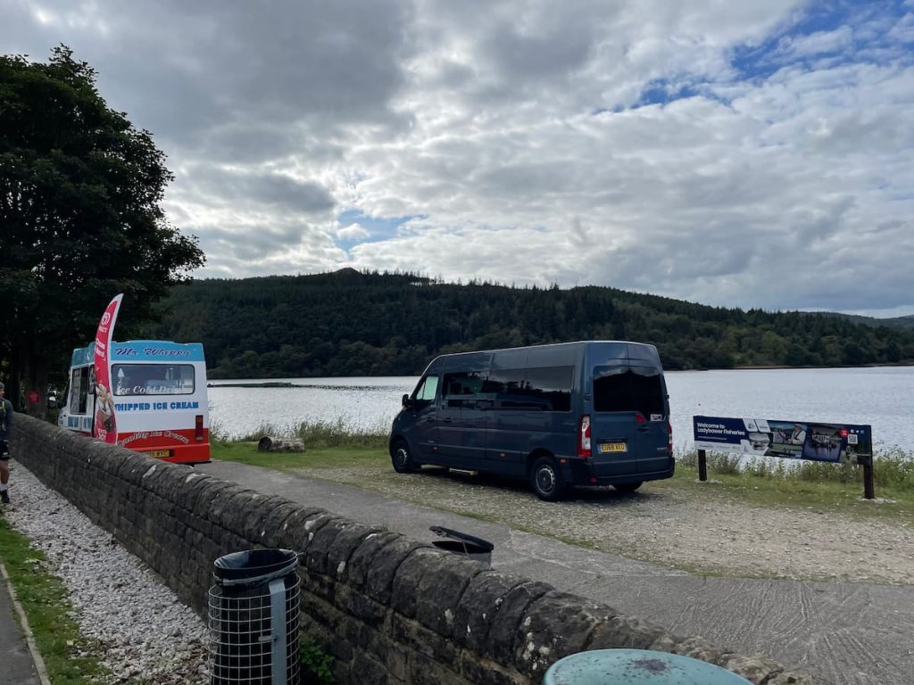
- Ice Cream Van: Typically present on sunny days, located next to the reservoir outside Heatherdene car park.
- Yorkshire Bridge Inn: A large pub is just down the road from the starting point and within walking distance, offering a selection of meals and refreshments. As well as being a dog-friendly hotel.
- The Anglers Rest, Bamford: Located a mere 5-minute drive away in Bamford, providing another option for food and drink.
Local Shops:
- Nisa Local: The closest general small grocery store, attached to the Texaco petrol station next to Bamford railway station, is a short 10-minute drive away.
While the hill may lack direct amenities, the surrounding area provides sufficient options to refuel and refresh. Just remember, always leave no trace and pack away your rubbish, keeping the beautiful Peak District landscapes pristine for future visitors.
Win Hill FAQs
How long is the Win Hill Walk?
The walk is approximately 6 km (3.7 mi) and typically takes around 2 hours to complete.
Is Win Hill a hard walk?
The walk can be challenging due to steep sections, but it is generally considered short and manageable for most walkers.
Why is it called Win Hill?
It is named Win Hill due to a legendary battle in 626 AD between King Edwin of Northumbria and King Cuicholm of Wessex. King Edwin emerged victorious, thus the names Win Hill and Lose Hill for the opposing hill. So the legend goes!
How high is Win Hill?
The summit’s trig point of Win Hill is at 463 metres above sea level. This makes it the 40th-highest hill in the Peak District.
What is the postcode for Win Hill?
A postcode is not precise for Win Hill due to the vast area it covers. Using ‘What3Words’, the summit is at ///range.adjusting.arrived, and the nearest parking and start point for the walk is at ///beads.rigs.jetting.
S Lowndes
Saturday 24th of August 2024
Thanks for all your efforts here. As a hiker, teacher, scout leader & DofE supervisor, I found your guidance really enjoyable and professionally thorough. Your attention to detail & the information given gives hikers a great insight into what to expect. Your site is a great find and I'm for one very appreciative. Thanks so much.
Alex
Tuesday 17th of September 2024
@S Lowndes, thanks appreciate your kind words!
KarenP
Sunday 16th of June 2024
Disappointed with the facilities. Went there with my two young ones and found that the toilet facilities were lacking. Not what I expected at all. They really need to do better for families.
EcoWarrior22
Thursday 4th of July 2024
Understand your point KarenP, but it's also about minimizing impact on the environment in such natural settings. Maybe more portable solutions could be both family-friendly and eco-conscious?
Pete_the_Walker
Saturday 9th of March 2024
Good guide but remember to tell folks to wear proper boots, paths can get muddy. Also, the Lay-bys fill up fast on weekends so early bird gets the worm, as they say.
Derek_smith
Saturday 10th of February 2024
LucyM
Thursday 4th of July 2024
Literally your backyard? Must be nice waking up to those views!
Timmy87
Friday 15th of December 2023
First time doing the Win Hill walk, and the directions were spot on! The view from the top was absolutely worth the climb. Will definitely bring friends next time.