
Discover the historic Kinder Scout in the highest hills of the Peak District National Park.
This incredible hike offers breathtaking views and is a must for your Peak bucket list.
So, lace up your boots as we go over everything you need to know before your next visit!
Getting to Kinder Scout
Kinder Scout and the village of Edale, the starting point for this circular walk, are easily accessible by both car and public transport.
By car, it’s just a 15-minute drive from the main A6, passing by Mam Tor as you descend into the village.
By public transport, Edale is on the Hope Valley line, which connects Sheffield and Manchester Piccadilly with hourly departures. The trip takes approximately:
- 44 minutes from Manchester Piccadilly
- 32 minutes from Sheffield
Most services are operated by Northern Trains. View the timetable here.
Kinder Scout Parking (In Edale)
Edale Car Park – HPBC

- Address: Water Meadows, Hope Rd, Edale, Hope Valley S33 7ZQ
- Cost: Upto 1 hr: £1.80 -> 1-2 Hrs: £2.90 -> 2-4 Hrs: £4.50 -> Upto 10hrs: £6.80 -> 24hrs: £7.90
This is the main 138-space car park in Edale, offering the most parking spaces in the area. It features onsite toilets and is connected to the village hall.
Edale Train Station & Overflow Car Park
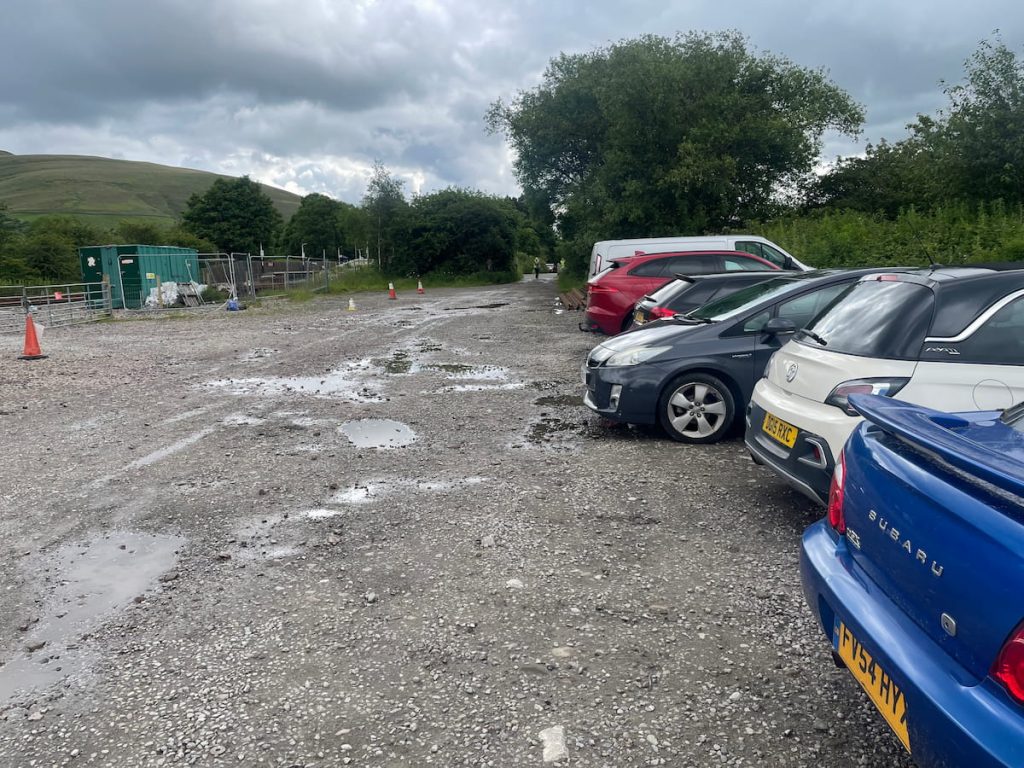
- Address: Edale Station, Station Road, Edale, Derbyshire, S33 7ZN
- Cost: £4 All day – Overflow £5 all-day
If the main car park is full, the train station just around the corner has a small number of spaces.
Additionally, a few metres down from the station, there’s an overflow car park run by the village, offering plenty more spaces for £5 all-day parking.
Kinder Scout Walk Map & Route
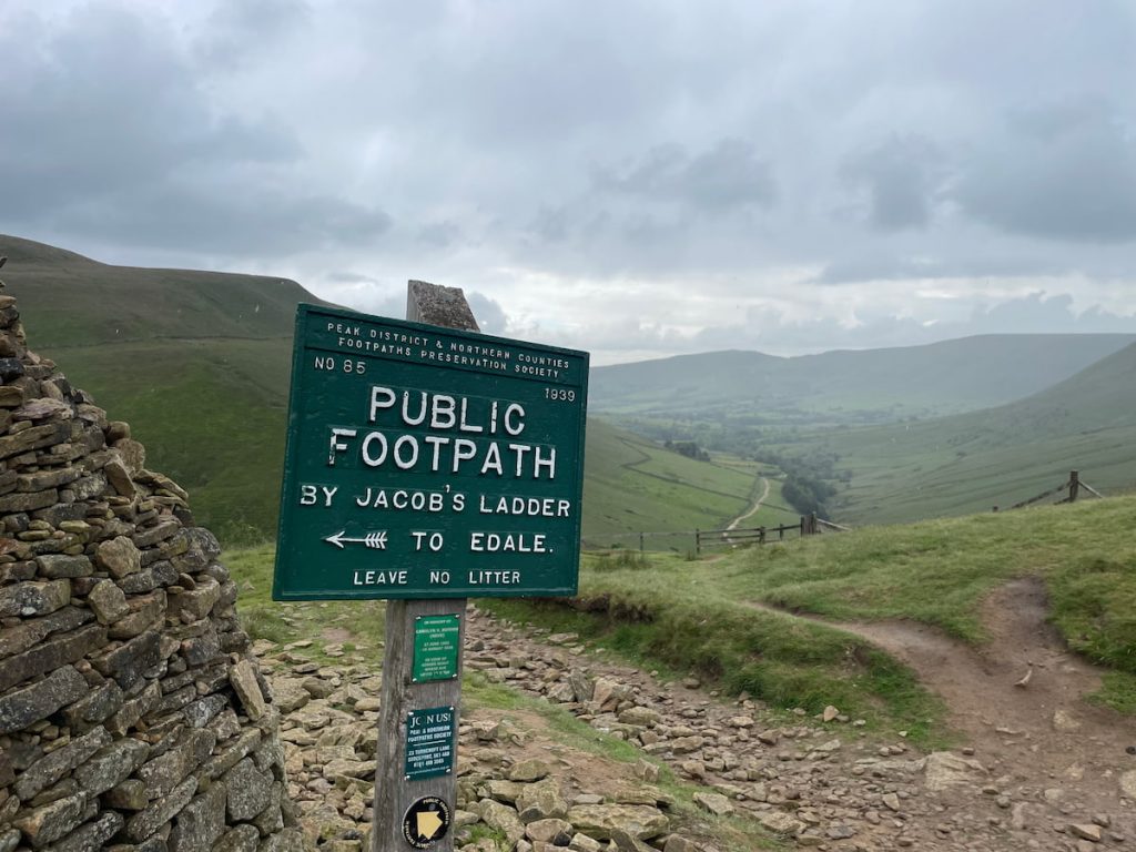
Download file for GPSThe route heads through the village of Edale and out via the Pennine Way, winding through the valley and starting the climb up to the Kinder plateau via Jacob’s Ladder. It continues to the trig point of Kinder Low, then traverses the moorland and edge of the valley before descending back into the village, completing the hike.
Which hiking map app should I use? I recommend OS Maps Online for its unparalleled accuracy. However, if you’re a beginner, you might find AllTrails to be more user-friendly. For a detailed review of the best UK map apps, read my full review.
Note: Another popular route runs from Hayfield via Kinder Reservoir to Kinder Downfall. For this journey, though, we’ll stick to the Edale walk option.
Kinder Scout Walk Step by Step – 15 km (9.3 mi) ~ 4-5hrs
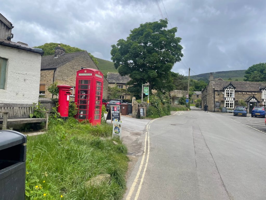
1. Head out of the car park or station and onto the main road. Go under the railway tracks and past the Rambler Inn.

2. Continue up the road (Marys Ln), passing by Edale Visitor Centre, then the village church. Just before you reach The Old Nags Head, there is a path on the left which marks the start of the Pennine Way.
3. The path heads out of the village and through a couple of gates, continuing to follow the Pennine Way.

4. The stone slab path continues through fields, heading uphill slightly.

5. The path then leads into Upper Booth. Head along the tarmac road, taking a right at the crossroads, and follow the road for a good distance until you reach Lee Farm, where there’s a road gate between the two farmhouses.
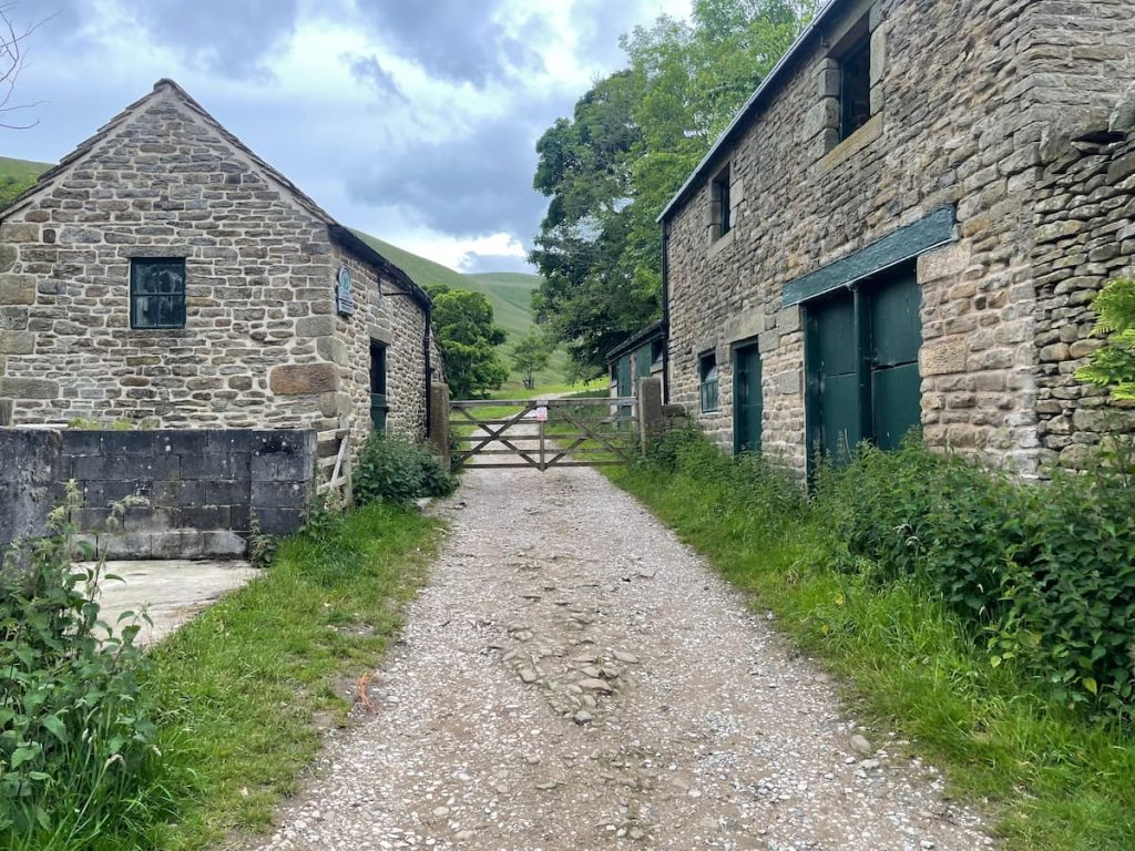
6. Go through the gate and keep going along the path which leads up the Vale of Edale. Eventually, you’ll reach a stone footbridge which crosses the brook, marking the start of Jacob’s Ladder.
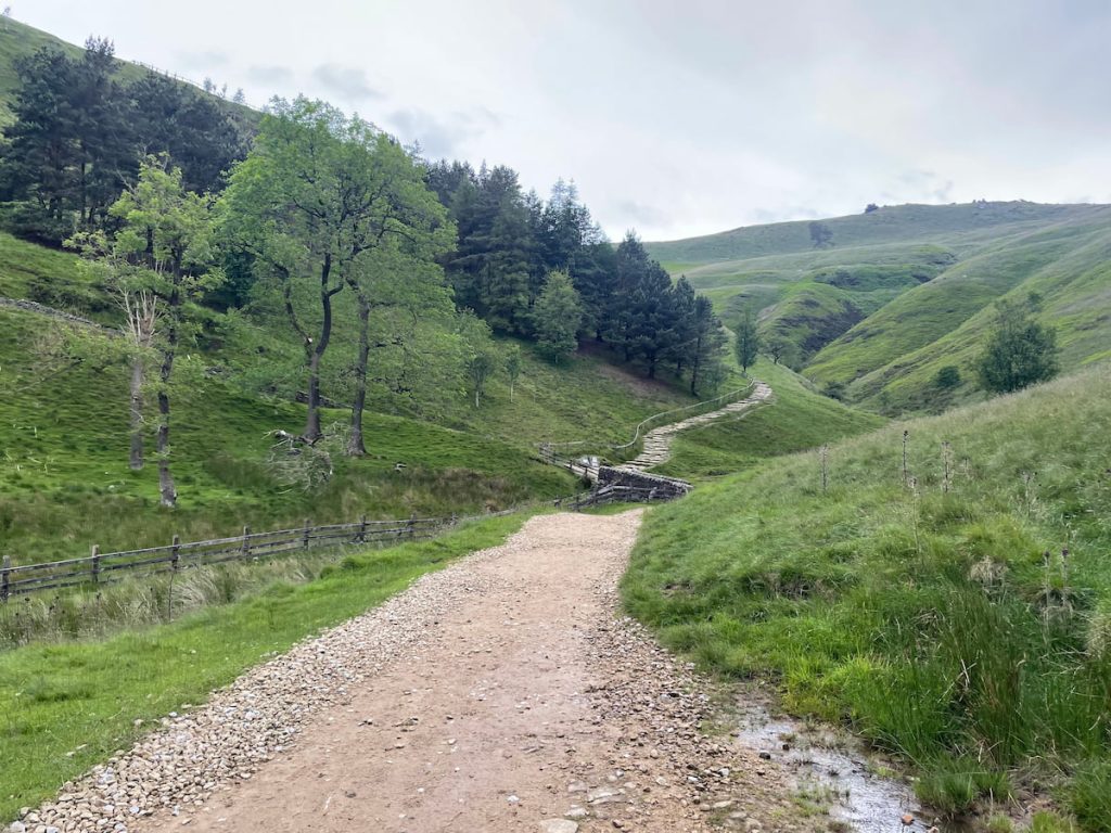
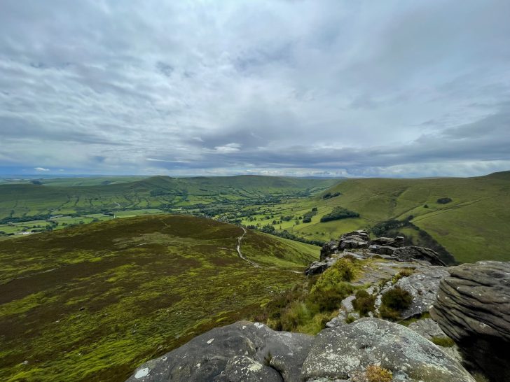
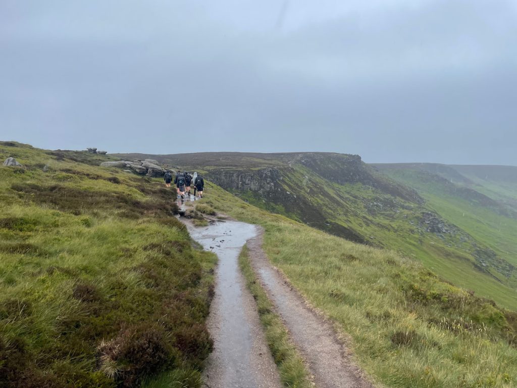
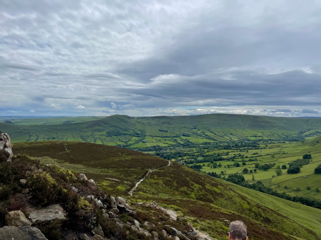
7. Jacob’s Ladder is a steep, staircase-like section in an iconic location in the Peak District and marks the climb towards the Kinder plateau. At the top, you’ll be rewarded with a stunning view of the valley below.
8. The path keeps heading up to the right and continues to follow the Pennine Way. Make sure you stay on the designated path along this stretch, as several routes converge around this point of the walk.
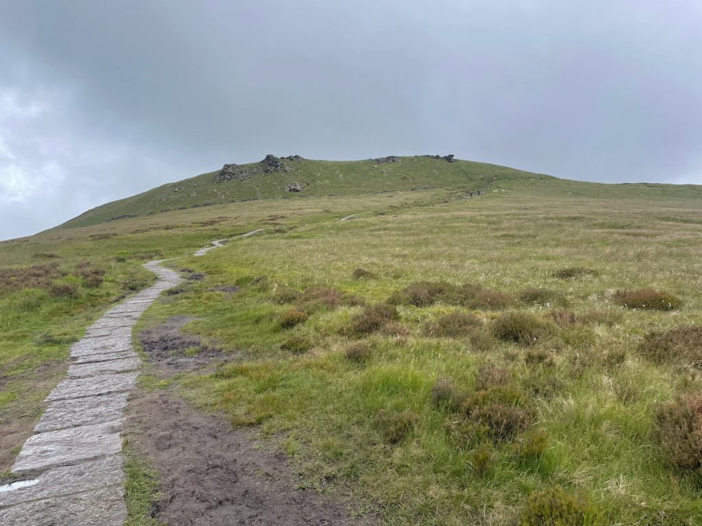
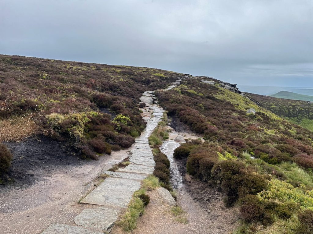
9. This marks the final stretch to the Kinder Low trig point, the highest trig point in the Peak District. Although the technical highest point is a few hundred meters away, it is a far less impressive view.

10. From here, you can either head back down the same way for a few hundred meters on the solid path before taking a left, or follow the route I’ve marked on the map. The shortcut will converge a bit further down, though this way can be a bit muddy and less ideal in low visibility.
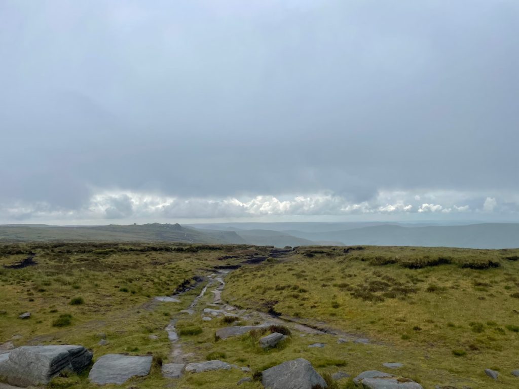
11. The route continues through the boulder-like landscape past Pym Chair, Wool Packs, and Crowden Tower rock formations. It can get quite muddy in sections here, so pick your line carefully.

12. The path curves around slightly as it joins a point where you can cross the stream.
Shorter Option: If you’re looking to shorten the walk or get down from the moorland as soon as possible, there is a path that goes right and downhill following Grindsbrook Clough. This path follows the stream all the way back into Edale.
13. Staying high up, the route crosses the stream, curves around, and continues to follow the hillside around Upper Tor and over Nether Tor.
14. Eventually, you’ll take a path to the right, starting your descent down the hilly outcrop.
15. The path will zig-zag slightly as you descend quickly. The village church should now be visible through the tree line.

16. Rejoin the stone slab path and follow it until you cross the footbridge over Grinds Brook. Then, simply follow the road back to the village centre where you started a few hours ago. You can retrace your steps past the church and pubs, maybe stopping off for a post-hike pint!

- Daypack: Choose a 10-20L daypack to carry all your gear comfortably.
- Clothing: Wear layered, moisture-wicking clothing and pack a waterproof jacket and waterproof trousers for changing weather.
- Footwear: Sturdy walking boots or trail shoes are essential for the varied terrain.
- Water & Snacks: Carry enough water (at least 1L per hour) and bring energy-rich snacks.
- Navigation: Always have a map and compass, and optionally, bring a reliable GPS app to stay on track.
- First Aid Kit: Include essential items like blister treatments and painkillers. A compact First Aid Kit is ideal.
- Emergency Items: A headtorch, whistle, and multi-tool can be vital in unforeseen situations.
Please note some of these links may earn us a commission from qualified purchases at no additional cost to you, which helps fund the free content we provide.
Edale & Kinder Scout Amenities & Facilities
Within the village of Edale there is a small range of pubs and cafes as well as a public toilet on the main car park.
These include:
Cafes
- The Penny Pot Cafe (Next to the station): Welcoming atmosphere with delicious homemade cakes, excellent coffee, and options for vegetarians and gluten-free diets
- Newfold Farm Cafe: Licensed café and bar serving fresh, locally sourced food and drinks, including free-range meat, local dairy, and Fair Trade coffee.
Pubs
- The Old Nags Head: Historic pub offering a diverse menu of classic British pub food and a wide selection of drinks, making it a perfect stop for hikers and visitors.
- The Rambler Inn (Next to the station): Warm and pub with large outdoor seating, great for when the sun is out.
Edale Moorland Visitor Centre

The Edale Visitors Centre, located at the start of the Pennine Way, serves as a hub for moorland research and visitor engagement. Its unique design features a sedum turf roof and a waterfall, showcasing eco-friendly architecture.
The knowledgeable staff are ready to assist visitors in exploring the area’s stunning landscapes.
Amenities Near Edale
The closest other villages with a few more pubs, cafes and restaurants would be Castleton or Hope on the other side of the valley, just a 10-15 minute drive away.
The closest major town is Chapel-en-le-Frith in the High Peak, which as both an Aldi and Morrisons around a 15-minute drive away just outside the Peak District boundary with Buxton being slightly bigger further up the A6.
History & Significance of the Area

Kinder Scout, the highest point in the Peak District at 636 metres (2,087 feet), is not just a natural landmark but also a historical one. This moorland plateau, designated as a National Nature Reserve, holds a prominent place in British history due to the 1932 Mass Trespass.
This significant event involved ramblers from nearby cities peacefully protesting the lack of public access to private land. Their actions led to changes in legislation, granting people the right to roam on uncultivated land, and eventually contributed to the establishment of the Peak District as Britain’s first National Park in 1951.
Kinder Scout is part of the Dark Peak Site of Special Scientific Interest and is managed by the National Trust as part of its High Peak Estate. The area offers stunning views of the Greater Manchester conurbation, Winter Hill, and, in good weather, even the mountains of Snowdonia.
Points of interest on the plateau include Kinder Downfall, the tallest waterfall in the Peak District, and Mermaid’s Pool, steeped in local legend.
Kinder Scout Frequently Asked Questions
Is Kinder Scout a difficult walk?
Yes, Kinder Scout is challenging, with steep climbs, long distances, and uneven terrain. However, this should be manageable for hikers with some past experience.
Why is Kinder Scout famous?
Kinder Scout is renowned for its historical mass trespass in 1932 and stunning views.
Do you need walking boots for Kinder Scout?
Yes, sturdy walking boots are recommended for safety and comfort.
Is Kinder Scout a scramble?
No, the route outlined does not require a scramble.
If you choose another path, there may be some scrambling.
Can kids climb Kinder Scout?
Yes, but only if they are fit and accompanied by experienced adults.
Assess your own child’s ability before.
Can you see Snowdon from Kinder Scout?
Yes, on particularly clear days, it is possible to view Snowdon or Yr Wyddfa from Kinder Scout, which is around 151 km/94 mi away.
Kinder Scout is considered one of the best viewing points in the Peaks.
Does Kinder Scout get busy?
Yes, especially on weekends and holidays.
It’s a popular area of the Peak District and well-connected via parking and public transport.
Is Kinder Scout a hill or a mountain?
It is a high plateau, often referred to as a mountain.
View the full list of Peak District Mountains and hills.
JenG
Thursday 4th of July 2024
Does anyone know if there are toilets nearby the parking areas? With little ones, it's always a concern!
ParkyPete
Thursday 4th of July 2024
Yes, JenG, there are facilities near the main car park in Edale, not far from the start of the walking routes.
Marge H
Tuesday 2nd of July 2024
I found the Kinder Scout walk more challenging than expected. The paths aren't very friendly for those of us with mobility issues. Wish there were more accessible routes.
dav3k
Friday 28th of June 2024
can u get wifi up on kinder scout asking for a friend lol
Si_the_Walker
Wednesday 26th of June 2024
Kinder Scout is a must for any serious hiker! The views are unbeatable. Just make sure you're prepared for British weather!
LizzyQ
Saturday 22nd of June 2024
Fascinating to see Kinder Scout's history highlighted. It's been a crucial site for public access rights, but I wonder how its historical significance measures against environmental preservation efforts today. Any thoughts on balancing the two criteria?