
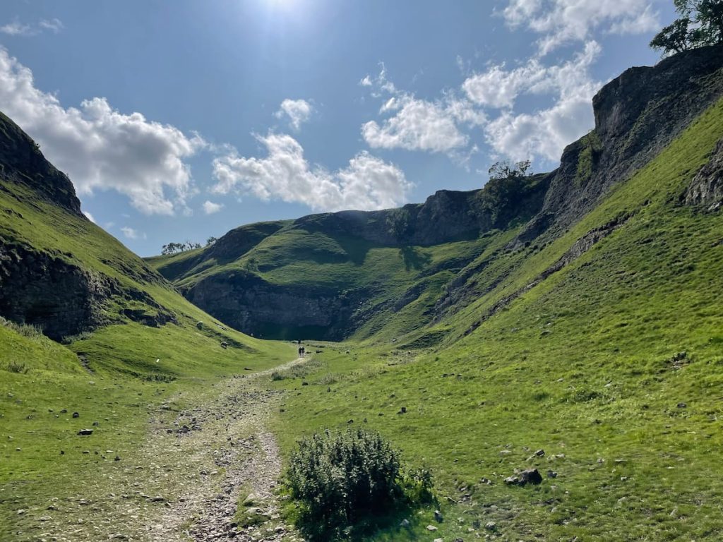
Nestled on the fringes of the charming village of Castleton, Cave Dale weaves a tale of ancient limestone valleys and echoes of times long gone.
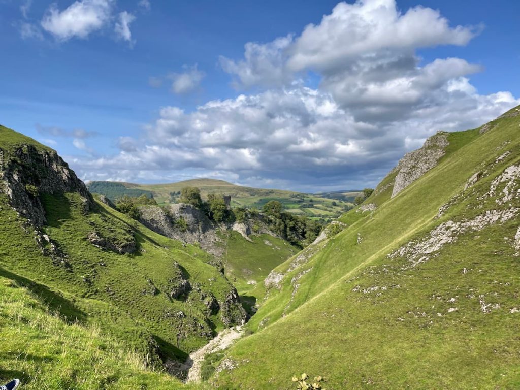
A must-visit in the Peak District’s Hope Valley, this dry limestone valley promises awe-inspiring views, overlooking the crumbling Peveril Castle and the valley beyond.
Join me as we take a closer look at this blue gem in the heart of the Peak District.
Getting to Cave Dale (Castleton)
Cave Dale is situated just outside the Village of Castleton and will be the main starting point for accessing the Cave Dale walk.
Castleton itself does not have a train station but does have a frequent bus service. However, the most convenient way to reach Castleton is by car.
Cave Dale – By Car & Parking
Cave Dale and Castleton are best accessed by car, with only two roads in and out of Castleton.
It’s nestled under the winnat pass and is stunning if visiting from the West.
From the major towns and cities, you can expect the following journey times:
- Buxton (10 Miles): 25 Mins
- Manchester (29 Miles): 1 Hour
- Sheffield (17 Miles): 40 Mins
Parking
There are plenty of parking options in Castleton, and all are relatively close to the starting point of the Cave Dale walk.
Castleton Museum & Visitors Centre
Address: Castleton Visitor Centre, Buxton Rd, Castleton S33 8WN
The central car park in Castleton is the museum and visitors centre, which is right in the middle of the village.
The prices are as follows:
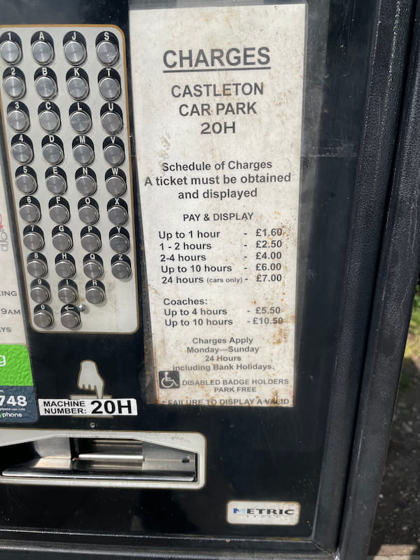
The machine only takes coins, but you can use the PaybyPhone app to use your card via a mobile device, of which there’s good cell service inside Castleton.
If it’s busy, there are some other options, such as:
- Peak Cavern Car Park
- Road Side Parking (Along Old Mam Tor Rd)
Public Transport
The easiest way to access Castleton via Public transport is to get the train to Hope, where trains stop between Sheffield – Manchester.
From Hope, you’ll then be able to catch a bus for 5-6 mins to Castleton.
You can view the bus timetable here.
Cave Dale Walking Map & Route
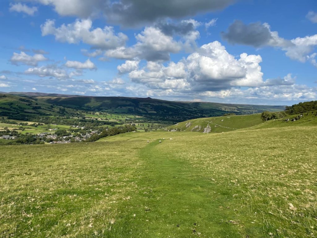
Download file for GPSThe walk from Castleton, meandering up between the almost vertical valley sides; with the more height you gain, the better the views get, before getting a view of the valley and the crumbling Peveril Castle. At the top of the valley, the path levels out. You’ll cross some fields heading back into Castleton, with views of the left-hand Hope Valley.
Which hiking map app should I use? I recommend OS Maps Online for its unparalleled accuracy. However, if you’re a beginner, you might find AllTrails to be more user-friendly. For a detailed review of the best UK map apps, read my full review.
Cave Dale Walk – Short & Circular: 4.3km (2.7mi) – 1-2 hours
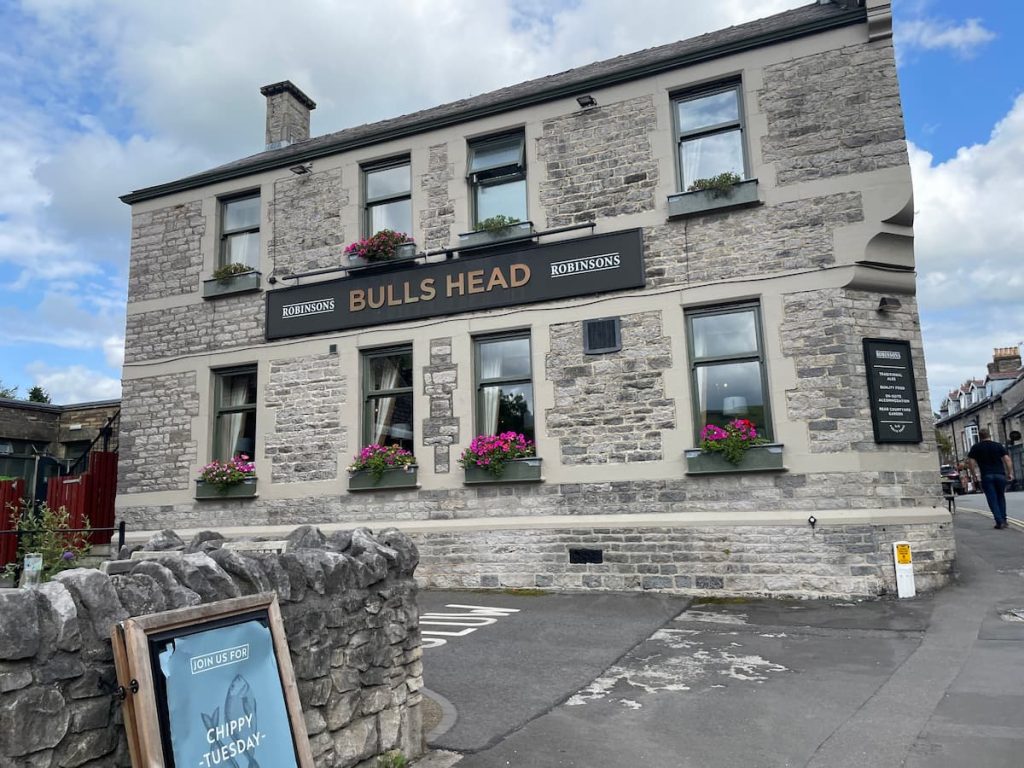
- The walk starts at the Castleton Museum and Visitor Centre. Exit the car park to the left at the roundabout and proceed uphill, passing the Bulls Head pub and notable jewellery shops.
- When you reach the ‘Ye Olde Nags Head’ at the corner, turn right onto Back St. You will emerge at a turning circle where the Castleton War Memorial is located.
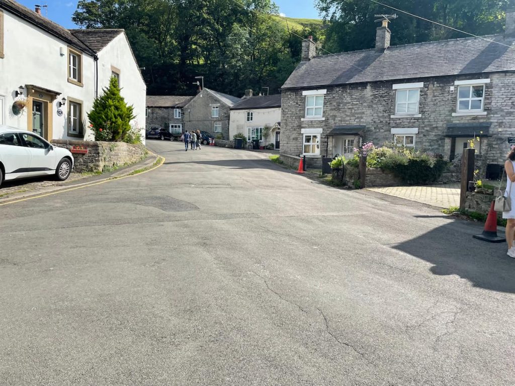
- Continue straight up the slight gradient until you see a sign labelled “Cave Dale” and spot a narrow alleyway on your right.

- Venture up the alleyway. You’ll soon begin to observe the rocky outcrops as you approach the gate.
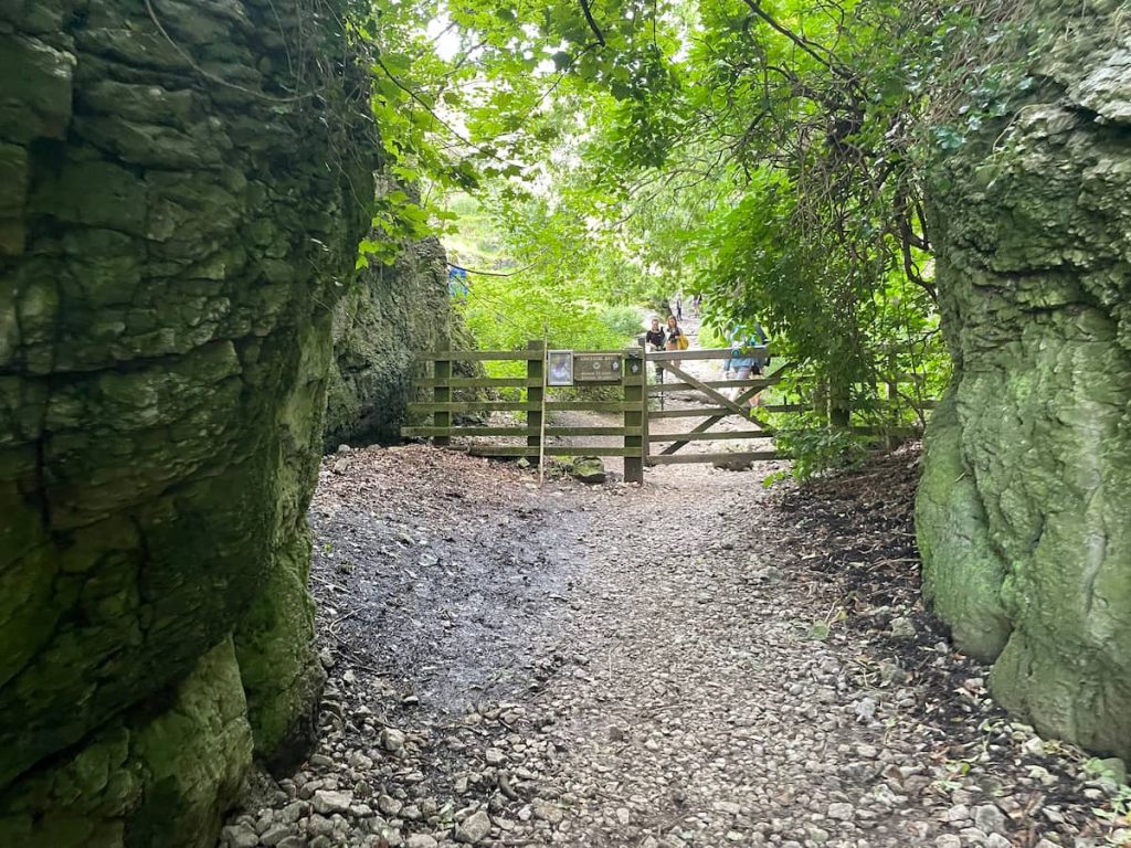
- Pass through the gate, which signifies the commencement of the Limestone Way, and admire the expanding valley sides.
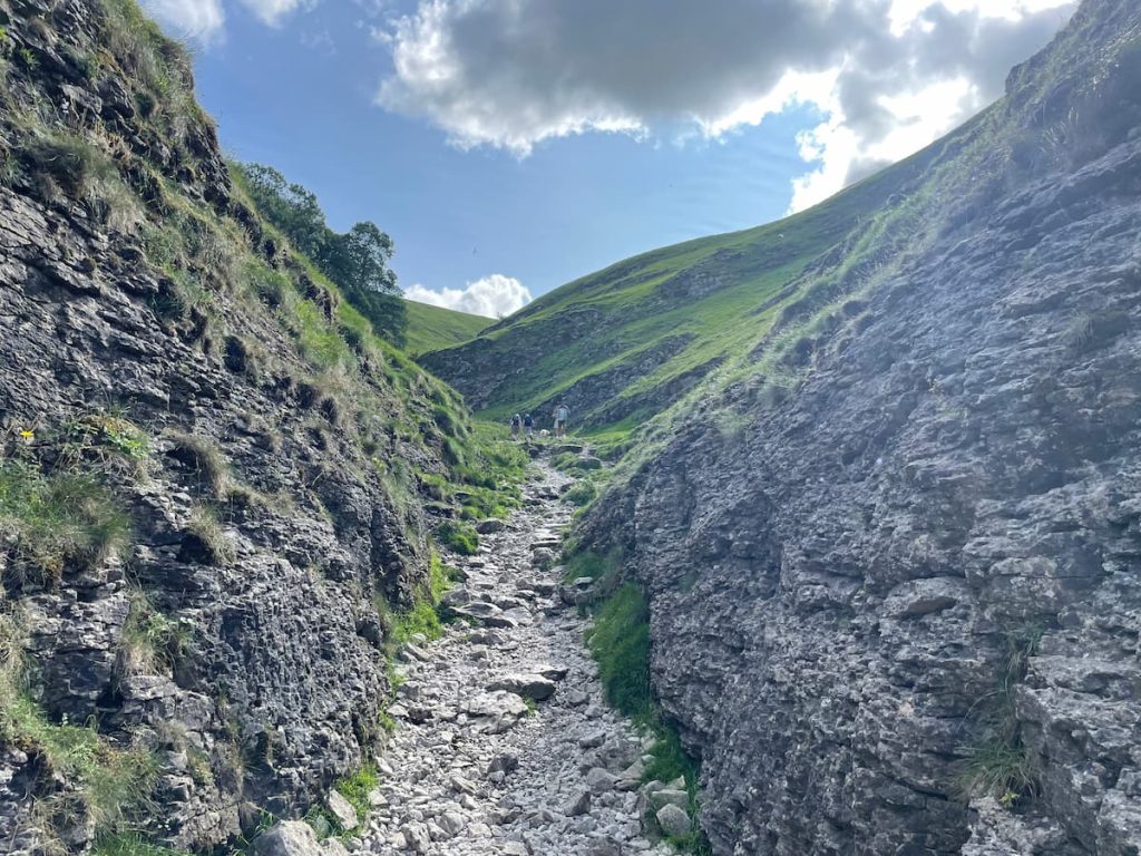
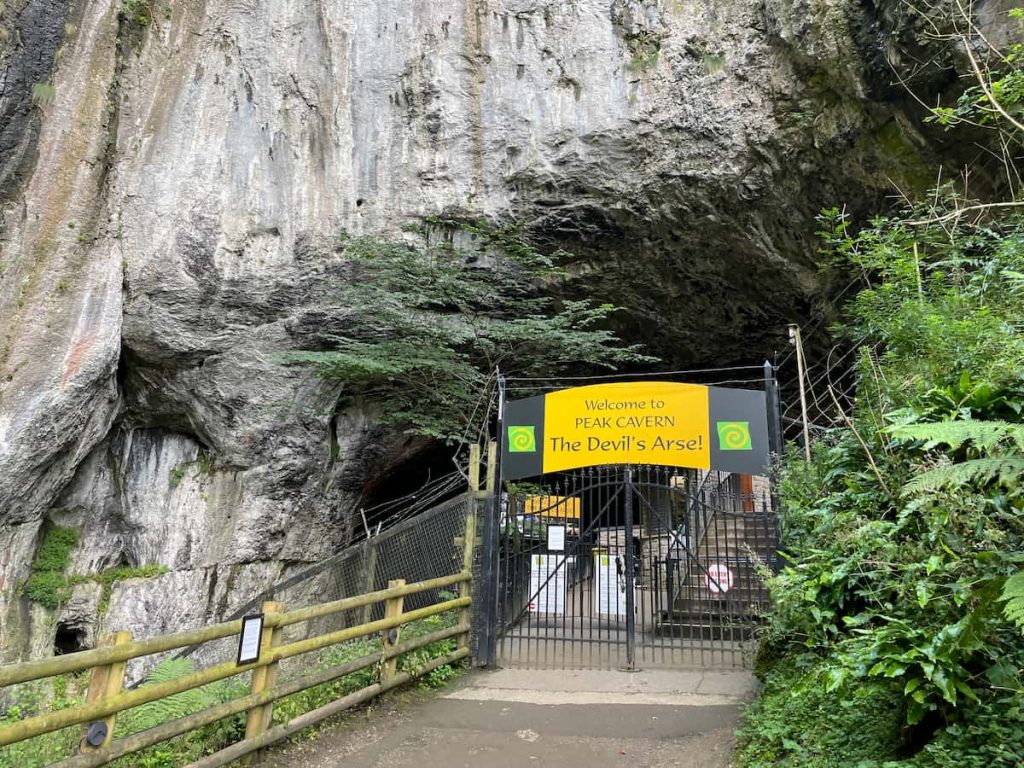
- Continue up the valley. You might spot small caves along the path’s sides, barred to prevent access, as they serve as vents for the Peak Cavern below (A popular Peak District cavern).
- As you ascend and near the summit, there’s a viewing spot on the right offering views of Peveril Castle and a section of the valley.
Note: The path can become slippery in this section, sometimes resembling a makeshift stream with slippery rocks.
- Upon reaching the top, you’ll pass through a walled gate. The steep climb is now behind you!
- Proceed along the path for approximately 1km, passing through another gate. Upon reaching this second gate, take a sharp turn to the right.

- Follow the pathway between the walls until you arrive at a gate situated next to a solitary tree in the field.
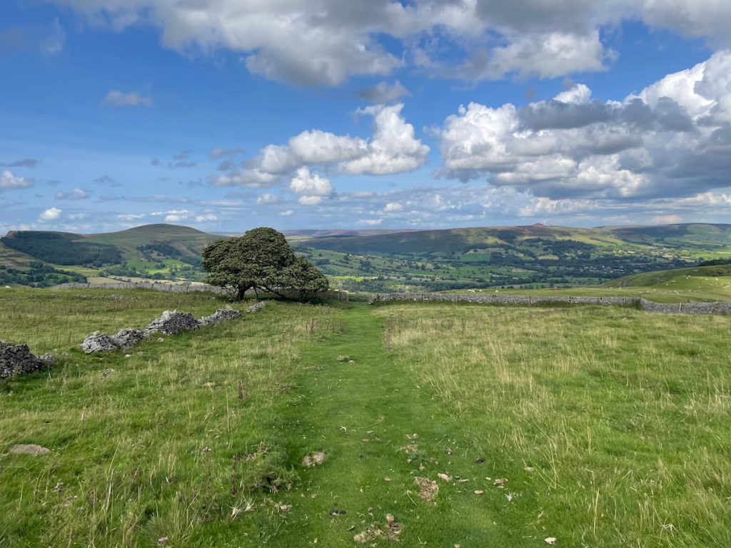
- On a clear day, from this vantage point, you can enjoy panoramic views spanning from Mam Tor on the left to Black Tor, Loose Hill, Win Hill, and Bamford Edge on the right.
- The trail can be tricky to spot here, presenting two options:
- Stick to the well-trodden path that remains elevated, eventually taking a sharp left turn at the treeline, where the hill becomes steeper.
- Follow the footpath indicated on the OS map, which takes a leftward route with a more gentle decline.
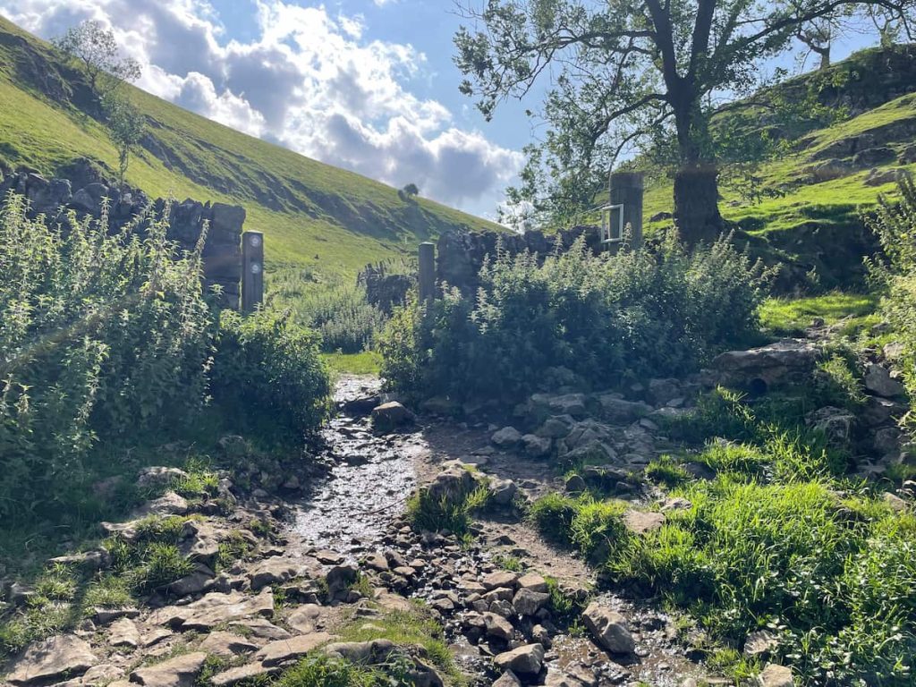
- Once you’ve descended, stay alongside the wall, passing through a gate that leads back to the village of Castleton.
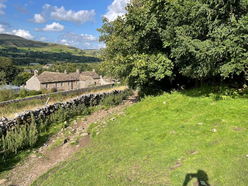
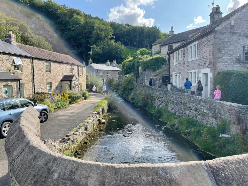
- Within the village, choose any alleyway or path weaving between streams and cottages to return to the main road, which will guide you back to the Visitor Centre.
- Daypack: Choose a 10-20L daypack to carry all your gear comfortably.
- Clothing: Wear layered, moisture-wicking clothing and pack a waterproof jacket and waterproof trousers for changing weather.
- Footwear: Sturdy walking boots or trail shoes are essential for the varied terrain.
- Water & Snacks: Carry enough water (at least 1L per hour) and bring energy-rich snacks.
- Navigation: Always have a map and compass, and optionally, bring a reliable GPS app to stay on track.
- First Aid Kit: Include essential items like blister treatments and painkillers. A compact First Aid Kit is ideal.
- Emergency Items: A headtorch, whistle, and multi-tool can be vital in unforeseen situations.
Please note some of these links may earn us a commission from qualified purchases at no additional cost to you, which helps fund the free content we provide.
Cave Dale Amenities & Facilities (In Castleton)
At Cave Dale itself, there are no facilities, so be prepared to bring everything you need for the walk and take it away with you.
Because the walk starts and ends in Castleton, there are lots of amenities in the village, some of these incude:
Public Toilets:
Public Toilets @ Bus Station (Open 8 am – 6 pm)
Castleton Visitor Centre & Public Toilets (Open 8 am – 5 pm)
Food & Drink:
Cafes & Small Bites:
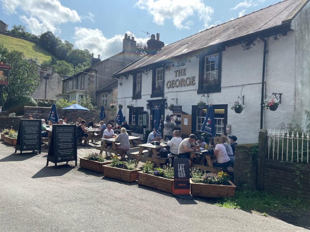
Pubs:
Things to do:
Peak Cavern – Along the end of the walk, the route passes by the cavern, which can be visited
If you have lots of time in Castleton, view my things to do in the Castleton article.
Cave Dale – FAQs
How long is Cave Dale’s walk?
The Cave Dale walk is 4.3km (2.7mi) and typically takes 1-2 hours.
How long is Cave Dale?
The dale rises for several hundred meters before it becomes steeper and culminates in a viewpoint.
After this, the dale levels out, turning into a shallow depression as it stretches out onto the open pastureland between Castleton and Chapel-en-le-Frith.
Where is the start point of the Cave Dale walk?
The walk begins in Castleton. From the centre, you’ll head uphill past Bulls Head pub and the Castleton war memorial, before eventually reaching a sign indicating “Cave Dale”.
The exact starting point to enter Cave Dale is ///laugh.retail.posed
Where do you park for Cave Dale?
The main parking option in Castleton is the museum and visitors centre, situated in the middle of the village. If it’s busy, you can also consider the Peak Cavern Car Park or Road Side Parking along Old Mam Tor Rd.
Cave Dale Postcode?
The postcode for the nearest parking to Cave Dale is S33 8WH
The approximate postcode to the entrance of Cave Dale is S33 8WU (Use ///laugh.retail.posed, for a more accurate location).
Best time to visit Cave Dale?
Considering the amenities in Castleton, the walk itself and daytime hours (especially during the months with good weather) would be ideal for picking the “best time” to visit Cave Dale. The walk provides various scenic points, so a clear day will enhance the experience.
Additionally, consider visiting when facilities like public toilets are open (8 am – 5/6 pm) and when the Castleton amenities such as cafes and pubs are operational and maybe less busy, e.g. weekdays and outside of school holidays.
Dave P
Thursday 4th of July 2024
Fascinating to think of the historical significance of Cave Dale. The valley likely has stories stretching back centuries. Would highly recommend a visit for those interested in the cultural heritage of the Peak District.
Tish McArthur
Wednesday 19th of June 2024
Just a gentle reminder to all my fellow hikers looking to explore Cave Dale - let's keep it beautiful by picking up after ourselves. It's such a gem of a place and preserving its natural beauty is up to us. And don't forget to support local businesses in Castleton!
Sammy J
Thursday 4th of July 2024
Absolutely tish, couldn't agree more. It's our duty to keep it clean.
Graeme L
Monday 8th of April 2024
Can someone tell me if there's a good time of year to visit Cave Dale? Don't fancy getting caught in the rain.
Mikey
Monday 4th of March 2024
cave dale more like cave fail if u get lost lol
Philippa Greene
Thursday 21st of December 2023
I've always said, nothing beats a good stroll through Cave Dale. You folks coming in from the city will love the views. Make sure to pop by the local cafes. They do a cracking cuppa and the scones are to die for. Our little town appreciates the visit - just remember to keep it tidy as you go.
Philippa Greene
Sunday 9th of June 2024
Jenny, you can't go wrong with the Riverside Cafe. Best views while you sip your tea.
Jenny M
Tuesday 2nd of April 2024
sounds lovely philippa which cafe do u recommend?