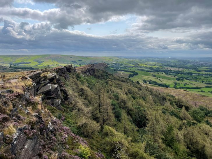

Nestled in the south-west edge of the Peak District, you’ll find The Roaches.
Derived from the French word “roches” – meaning rocks – the name perfectly describes the craggy landscape.
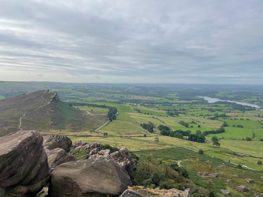
Popular with climbers and hikers alike, it’s a go-to for those looking to scale its peaks or simply admire them. And the reward? Breathtaking views of Staffordshire and the shimmering waters of Tittesworth Reservoir.
Join us as we step into this rocky wonder!
Getting to The Roaches
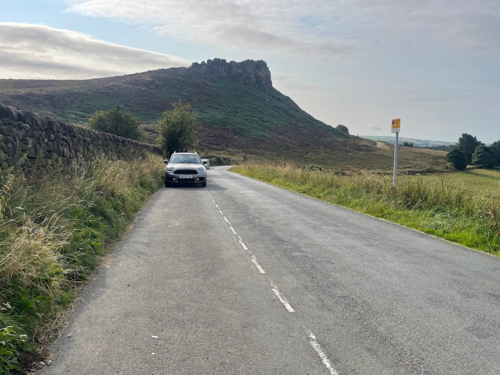
By Car: The Roaches are best accessed by car, situated just off the A53.
Public Transport: Unfortunately, no great public transport options leading directly to The Roaches.
While there aren’t any official car parks designated for The Roaches, there are a generous number of laybys along Roach Rd that offer free parking.
If you’re out of luck and those laybys are full (it can happen on a sunny day), the farm at Roaches Tea Rooms occasionally provides all-day parking in its field for a small fee.
Parking Along Roach Rd (Free)
Address: Roach Rd, Leek ST13 8UA
Parking on Roach Rd extends over a considerable stretch, beginning at ///offstage.catchers.fizzy and concluding approximately a kilometer further at ///acclaimed.tasty.ordering.
The local authority is vigilant in issuing fines for vehicles parked outside these designated zones, so it’s important to ensure you’re within the specified boundaries.
To ensure you secure a parking spot, consider arriving early in the morning or later in the afternoon. The day of the week and season can significantly influence the crowd levels at The Roaches, so plan accordingly.
The Roaches Walking Map & Route
Download file for GPSThe walk covers roughly 6.6km (4.1mi) and takes between 1.5 to 2 hours. It encompasses the major landmarks around The Roaches, including Hen Cloud, and proceeds with a gentle ascent towards The Roaches’ trig point. Part of the route retraces the original path before returning to the starting point. Along the way, walkers can enjoy splendid views of Staffordshire and Tittesworth Reservoir.
Which hiking map app should I use? I recommend OS Maps Online for its unparalleled accuracy. However, if you’re a beginner, you might find AllTrails to be more user-friendly. For a detailed review of the best UK map apps, read my full review.
Step by Step Roaches & Hen Cloud Walk 6.6km (4.1mi) ~ 1.5-2hrs
Given the extensive parking along Roach Road, the starting point may vary. For the sake of simplicity, the route begins at the entrance to Roaches Hall. Walk down the road until you spot the turn-off, signposted as “Roaches Hall”.
1. Proceed down the path for a short distance, where you’ll pass by the front of the hall. Don’t be deterred by the “private property” signs; this route is a public footpath as indicated on the OS maps.

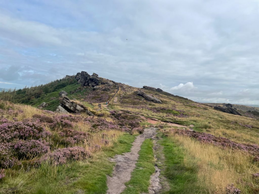
2. After bypassing the hall, there’s a gate on your left leading uphill. Stick to the left until you reach a switchback, which continues uphill until you ascend to the summit of Hen Cloud and its rocky outcrop. From here, the panoramic views are truly a feast for the eyes.

3. Descend the path on the opposite side of Hen Cloud. Reaching the base, you’ll pass through two gates, marking your entry into The Roaches.
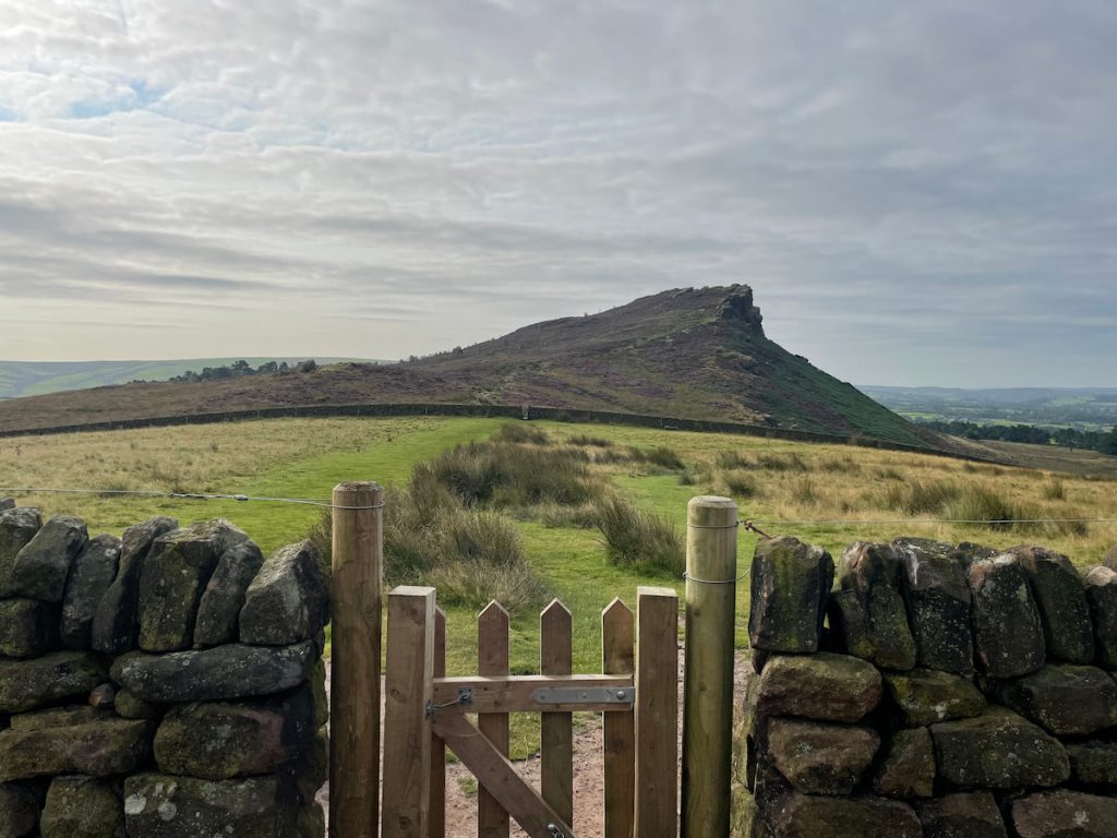
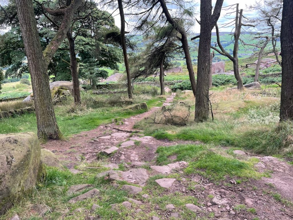
4. Embark on the path, circling the back of the rocks. As you gain altitude, on a steep climb, the silhouette of Hen Cloud becomes visible in your rearview.
5. Upon reaching the ridge, maintain your course on the path, which offers picturesque views of The Roaches forest just beneath you.
6. Continue on, strolling past Doxley Pool – a mysterious water body rumored to be the abode of a mermaid who entices unsuspecting travelers to their watery end. The path persists along the rocky outcrop.

Note: It is currently fenced off due to environmental concerns from the Staffordshire Wildlife Trust.
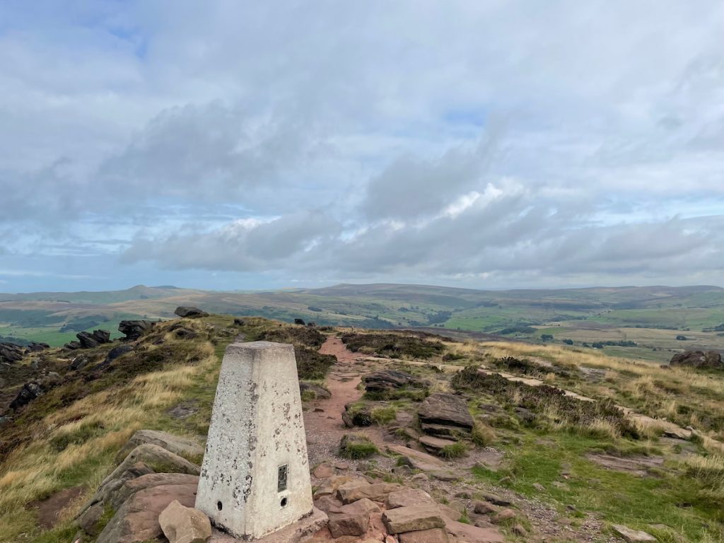
7. Following another ascent, you’ll stand atop The Roaches, marked by a trig point that rises 505m high, distinguishing it as the 27th highest peak in the Peak District.
Fancy a longer stroll? Extend your journey by continuing along the path, eventually arriving at Lud’s Church, another coveted spot in the Peak District. This addition approximates an extra 1.5-2 hours of walking, covering an additional 5.2km (3.24 mi).
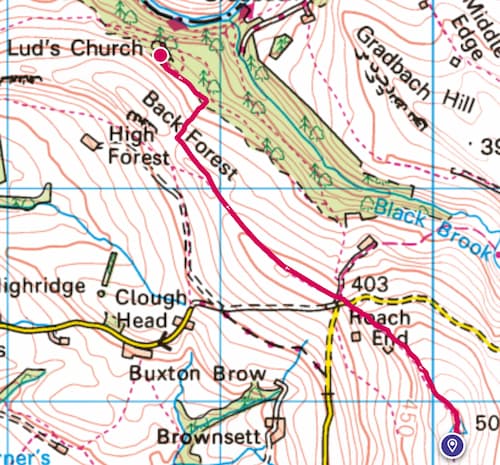
View the full Lud’s church walk, which also starts from the Roaches, here:
8. Retrace your steps on the path until you encounter the designated marker on the map, then veer right, descending into The Roaches forest. Along your route, you might spot a range of bouldering enthusiasts, for which the area is famed for.
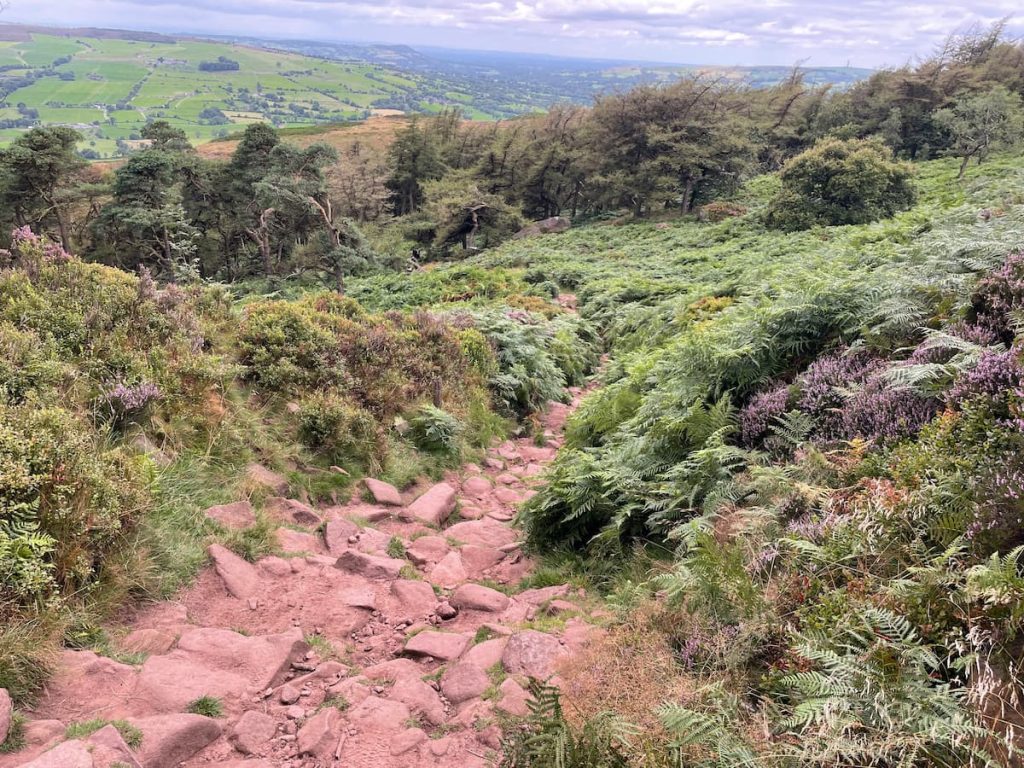
9. Shortly after, you’ll emerge from the tree canopy, continuing your descent. At the fork, bear left and pursue the path that leads back to Roach Road, where the walk started. Depending on your parking spot on the road, you might need to venture a tad further. – There are a rang of paths here, but they all head down towards the main road.
- Daypack: Choose a 10-20L daypack to carry all your gear comfortably.
- Clothing: Wear layered, moisture-wicking clothing and pack a waterproof jacket and waterproof trousers for changing weather.
- Footwear: Sturdy walking boots or trail shoes are essential for the varied terrain.
- Water & Snacks: Carry enough water (at least 1L per hour) and bring energy-rich snacks.
- Navigation: Always have a map and compass, and optionally, bring a reliable GPS app to stay on track.
- First Aid Kit: Include essential items like blister treatments and painkillers. A compact First Aid Kit is ideal.
- Emergency Items: A headtorch, whistle, and multi-tool can be vital in unforeseen situations.
Please note some of these links may earn us a commission from qualified purchases at no additional cost to you, which helps fund the free content we provide.
Amenities & Facilities at The Roaches
Amenities at The Roaches are sparse, so it’s crucial to be self-sufficient by bringing all you need and ensuring you take everything away afterward.
During summer, an ice cream van can often be found in the layby at the base of The Roaches.
For those in search of refreshments, The Roaches Tea Rooms & Restaurant is conveniently located within walking distance and offers a range of food and drink.
If you’re craving something heartier or traditional pub, consider:
- Ye Olde Rock Inn: Located a short way down Roach Road, just off the A53.
- The Winking Man: A renowned pub situated along the A53, a mere 5-10 minute drive away.
For a wider selection of amenities, including supermarkets, the nearest towns to The Roaches are Buxton, about a 20-minute drive away, and Leek, roughly 15 minutes in the opposite direction.
The Roaches – FAQs
Here are some common questions related to The Roaches:
Is The Roaches a hard walk?
The Roaches walk covers a distance of 6.6km (4.1 mi) and generally takes around 1.5-2 hours. While it involves passing through major points such as Hen Cloud, it does require some elevation, but it should be suitable for those familiar with moderate walks.
Why are The Roaches called The Roaches?
Traditionally, the name is believed to be derived from the French word “roches” meaning rocks, indicating the rocky landscape of the area.
Are there still Wallabies on The Roaches?
In the 1930s, five Australian Bennett’s wallabies were released into the wild at The Roaches. This colony persisted into the 21st century. However, it’s believed the wallabies might now be extinct.
Is the roaches walk suitable for dogs?
While the area is open to the public, dog owners should be mindful of the wildlife and the potential for high foot traffic, especially on weekends.
Always keep dogs on a leash, especially near wildlife, and ensure they don’t disturb nesting birds like the peregrine falcons.
Are the Roaches in the Peak District?
Yes, the Roaches are located on the Peak District’s south western edge.
What is the highest point of the Roaches?
The highest point of The Roaches is where the trig point stands, at an elevation of 505m. This makes it the 27th highest peak in the Peak District.
How deep is Doxey pool?
Doxey Pool, sometimes spelled as Docksey, is a small pond measuring about 15 by 10 meters (49 by 33 ft).
While its depth is not specified, it’s known for the legend of the mermaid Jenny Greenteeth or the blue nymph.
Is there a trig point at The Roaches?
Yes, there is a trig point at The Roaches. It is situated at the highest point of The Roaches, standing at 505m tall.
Sue
Thursday 13th of March 2025
There is public transport actually, via the Moorlands Connect
Phil K.
Monday 24th of June 2024
actually, the highest point on the Roaches is 505 metres, and yes, there's a trig point there, provides some of the best views in stafordshire if you ask me
ElizaD
Friday 24th of May 2024
I often take my dog walking at The Roaches, and it's always been a wonderful experience. The trails are well-marked and the scenery is beautiful. It's a great way for both of us to get some exercise and enjoy nature.
TerryG
Wednesday 27th of March 2024
are wallabies still on the roaches? more like are unicorns real, never seen one.
JimboSlice
Thursday 15th of February 2024
walks hard? only if u wear flip flops lol