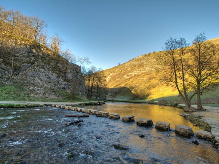
Dovedale, along with its famous stepping stones, has been a favourite spot for visitors in the Peak District for hundreds of years – and it’s not hard to understand why.
This beautiful area boasts a magical valley filled with ancient caves, high hills, and a meandering river that invites exploration, making it an enticing destination.
Let’s dive into everything you should know before you visit!
Getting to Dovedale
Reaching Dovedale and the stepping stones is most convenient by car. There’s a primary car park situated close by, with just a short stroll on a well-kept path to your destination.
As far as I’m aware, there currently aren’t any public transport options available to get to the Dovedale area.
The closest postcode for Dovedale stepping stones is DE6 2AY.
Parking around Dovedale
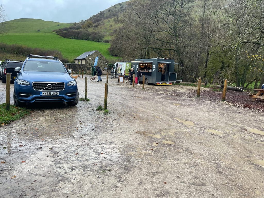
The Dovedale National Trust Car Park is the best and closest place to park for the stepping stones.
You can also find free parking in the nearby village of Thorpe (at Narlow Lane Car Park) and in Ilam, but remember, parking here means you’ll have a longer walk.
Dovedale Valley is a popular place in the Peak District, so finding a parking spot can be tricky. It’s a good idea to arrive early or later in the afternoon, especially during the summer holidays, to increase your chances of getting a space.
Dovedale National Trust Car Park (Paid)

- Address: Dovedale Ave, Ashbourne DE6
- Cost: £5 for 4 Hours, £7 for all day, Free for NT Members
If your main goal is to visit the stepping stones, a four-hour stay should be enough. But if you plan to walk the full length of the River Dove and explore local attractions, consider paying for a full day.
The car park has plenty of spaces and even an overflow area, which is manned during peak times.
The car park has limited facilities, but on busy days, you’ll often find an ice cream and coffee truck. There are public toilets available, but they charge 20p per use, accessed through a turnstile.
For those interested in doing the walk in reverse, parking at Milldale, located at the other end of the valley, is also an option.
Dovedale Walking Map & Route
🟢 Easy | Various Distances & Routes
Download file for GPSThe walk takes you along the river, quickly bringing you to the stepping stones. From there, the path follows the river, passing by well-known landmarks in the Dovedale Valley, until you arrive at the village of Milldale.
Which hiking map app should I use? I recommend OS Maps Online for its unparalleled accuracy. However, if you’re a beginner, you might find AllTrails to be more user-friendly. For a detailed review of the best UK map apps, read my full review.
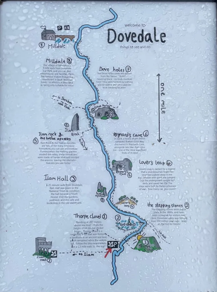
On this walk, as shown in the image above, there are several well-known landmarks, each at a different distance from the main car park:
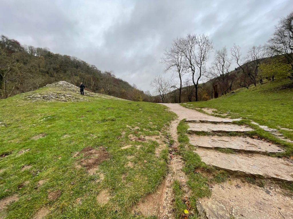
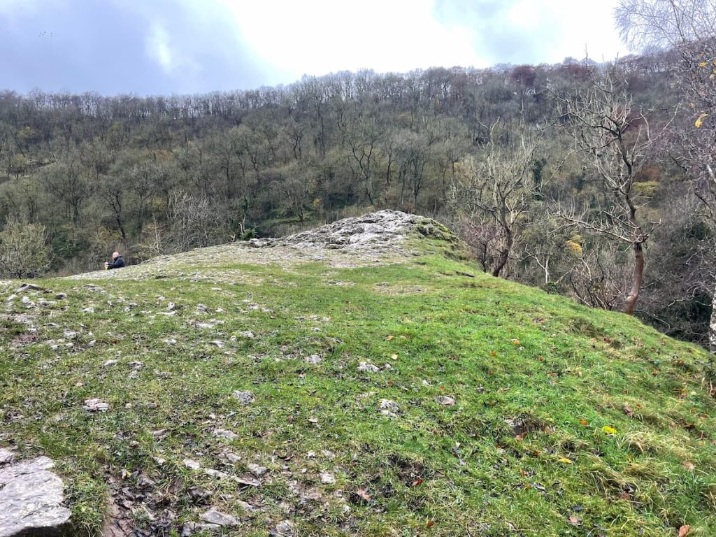
- Thorpe Cloud: A 287m high hill offering breathtaking views of the Dovedale Valley | ~30 mins – 1.4km (0.85mi)
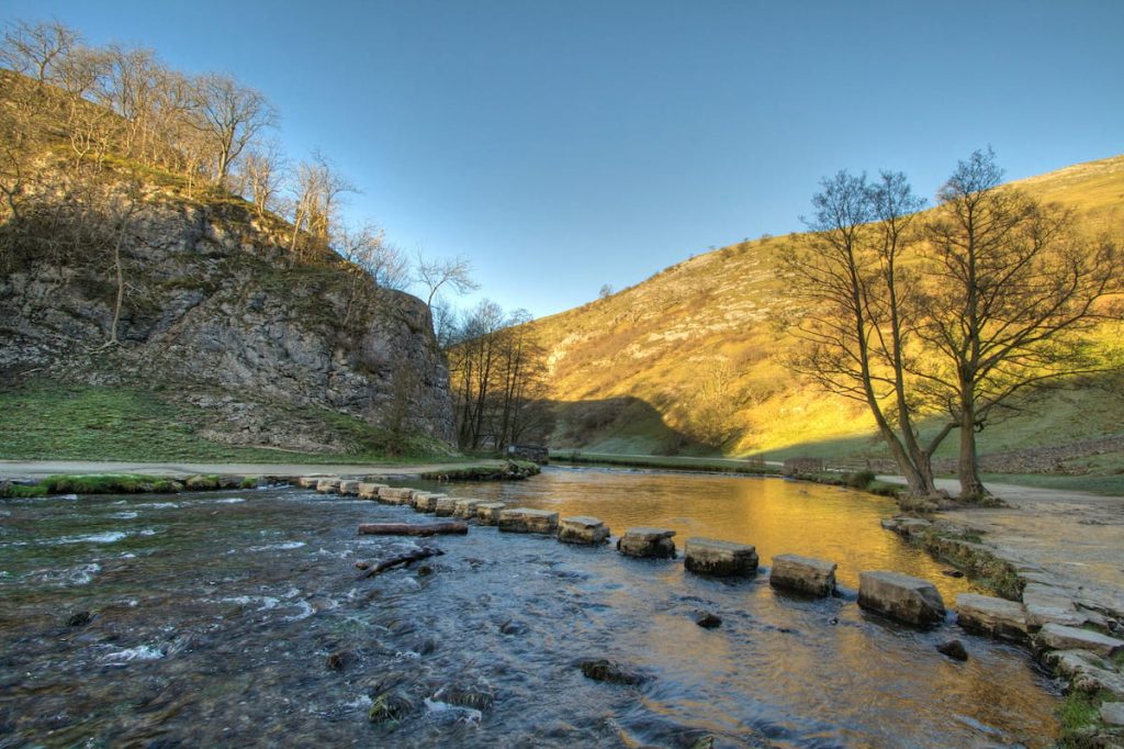
- The Stepping Stones: Manmade stones from the Victorian era, providing an exciting way to cross the River Dove | ~10 mins – 0.6km (0.40mi)
- Lovers Leap: A notable platform with a story of a woman who leapt in distress but was saved by the undergrowth below | ~25 mins – 1.5km (0.9mi)
- Reynard’s Cave: A striking cave entrance where ancient artefacts have been discovered | ~35 mins – 2.2km (1.37 mi)
- Ilam Rock & the Twelve Apostles: Impressive limestone formations along the river | ~50 mins – 2.9km (1.8mi)
- Dove Holes: Another smaller cave, named after the Saxon word “dubh” | ~1hr – 3.4km (2.1mi)
- Milldale: A charming village, perfect for refreshments before heading back | ~1.2hr – 4.8km (3mi)
*Remember, these distances and times are one-way, so double them for a round trip.
The terrain and paths make it hard to do a circular walk in this area, so you’ll have to retrace your steps unless you’re up for a big detour.
This also means you can choose how far you want to go, whether it’s a short 20-minute walk to the stepping stones or a longer few-hour journey.
Dovedale Stepping Stones Walk Step by Step – 9.7 km (6mi) ~ 2-3 hrs
1. From Dovedale Car Park, start your walk by passing the toilet block and following the tarmac road.
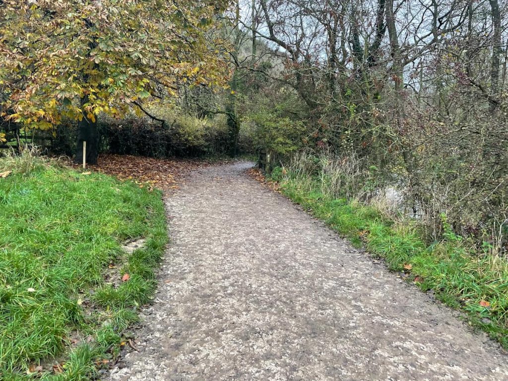
2. Soon, you’ll see a footbridge on your right. Ignore this and continue on the left-hand tarmac path, which runs next to the river.
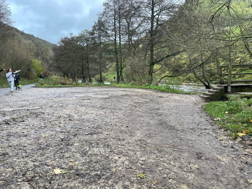
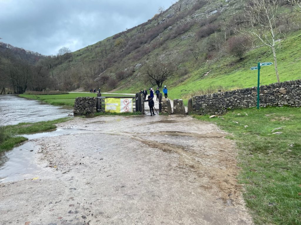
IF WATER LEVELS ARE HIGH: Before starting, check the River Dove from the car park. Heavy rainfall might flood the area, covering the stepping stones. Ask returning hikers about the path’s condition. If there’s flooding, use the footbridge and path on the right side of the river – if this path is also flooded, detour behind Thorpe Cloud to bypass the stepping stones. You can also check the Dovedale station on the government’s flood service dashboard, which is located near the stepping stones.
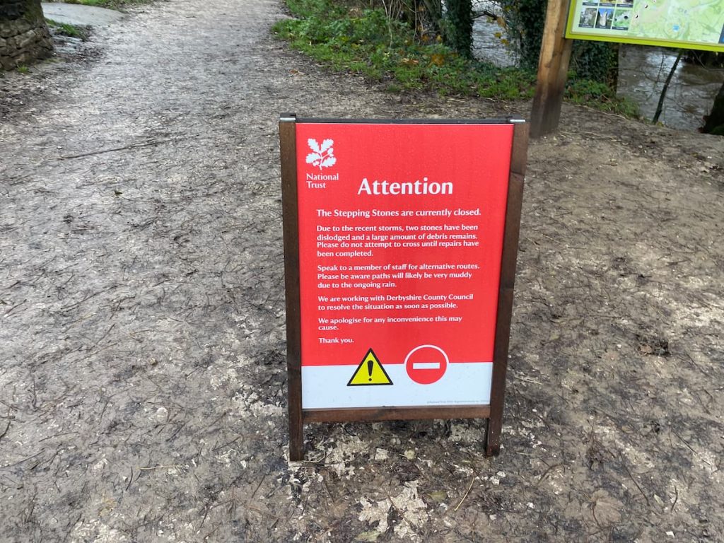
3. Reach the stepping stones and cross to the opposite side of the river.
4. After crossing, go through the gate and keep following the river.
5. Soon, you’ll come to a staircase leading up to Lover’s Leap.
Fact: Lover’s Leap is named after a story where a heartbroken woman jumped from the top but was saved by bushes below.
6. Go down the stairs on the other side and continue along the river.
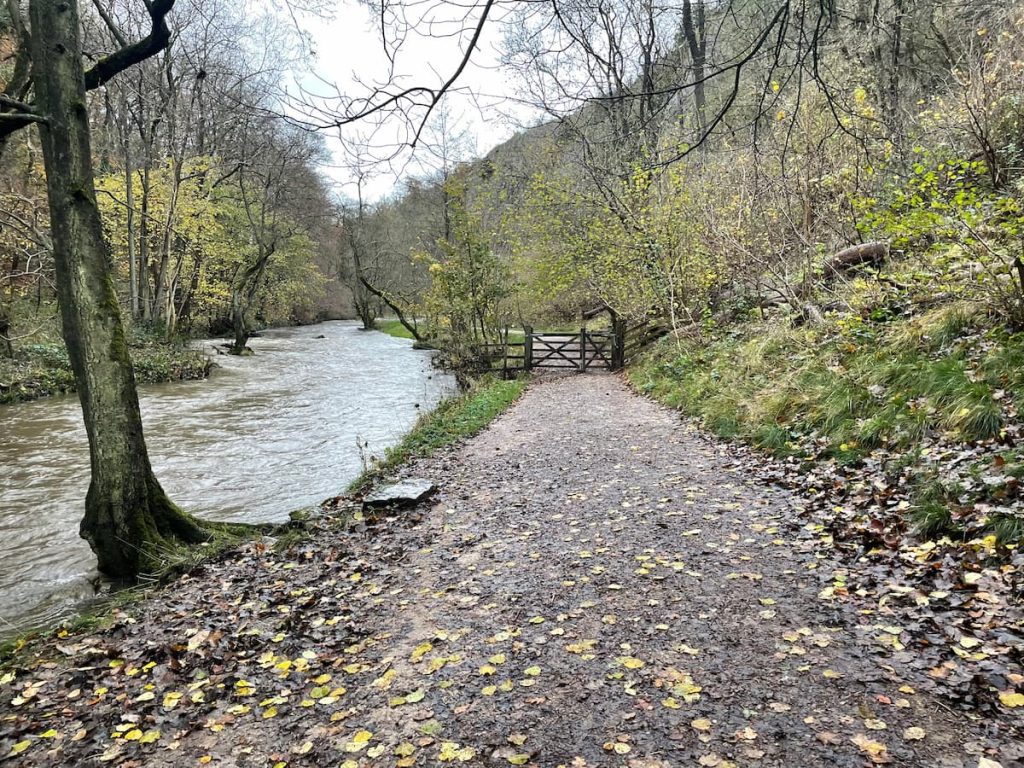
7. Pass through another gate, and keep going. You’ll eventually reach Reynard’s Cave. If you want to explore, take the path on the right.

Exact cave entrance location: ///spearhead.spent.table
Note: Be careful on this steep and possibly slippery path, especially when it’s wet. Don’t forget to stop and enjoy the view from the top.
8. Continue on the river path; you’ll soon come to a boardwalk section to follow.
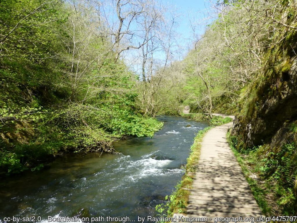
9. After the boardwalk, you’ll enter a clearing with a bridge crossing the river and Ilam Rock above.
10. Stay on the right-hand side of the river and pass through the gate. Soon, you’ll get to Dove Holes cave. Go inside to take a look if you’d like.

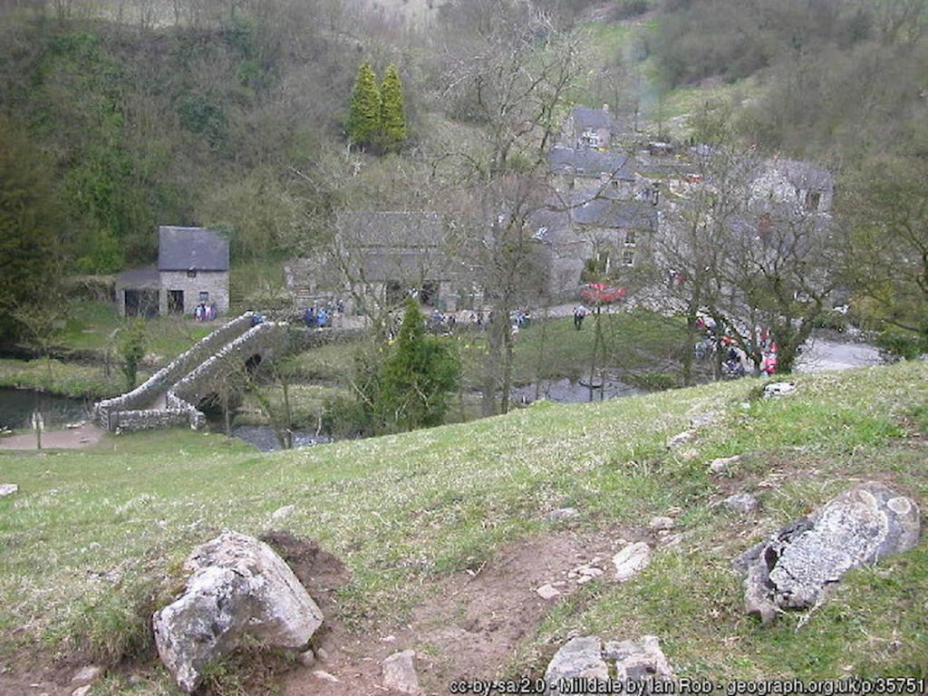
11. Now, you’re on the final stretch. Continue along the path by the river until you reach Milldale, where you’ll cross Viator Bridge into the village.
Enjoy Milldale and head back the same way to Dovedale National Trust car park.
For those wanting a longer walk, it’s possible to go all the way to Thor’s Cave!
- Daypack: Choose a 10-20L daypack to carry all your gear comfortably.
- Clothing: Wear layered, moisture-wicking clothing and pack a waterproof jacket and waterproof trousers for changing weather.
- Footwear: Sturdy walking boots or trail shoes are essential for the varied terrain.
- Water & Snacks: Carry enough water (at least 1L per hour) and bring energy-rich snacks.
- Navigation: Always have a map and compass, and optionally, bring a reliable GPS app to stay on track.
- First Aid Kit: Include essential items like blister treatments and painkillers. A compact First Aid Kit is ideal.
- Emergency Items: A headtorch, whistle, and multi-tool can be vital in unforeseen situations.
Please note some of these links may earn us a commission from qualified purchases at no additional cost to you, which helps fund the free content we provide.
Local Amenities & Facilities
Around the Dovedale stepping stones, the facilities are quite basic, so it’s wise to bring everything you might need.
The National Trust car park at Dovedale has picnic benches and often features an ice cream van or coffee truck on busy days. There’s also a public toilet, but it costs 20p to use.
For a nearby pub, The Old Dog in Thorpe is a fantastic choice. Open for food from noon, Wednesday to Sunday, it serves burgers, sandwiches, and classic pub fare. The pub has a lovely atmosphere and plenty of outdoor seating.
For more facilities, Ashbourne is the closest town, only a 10-minute drive away, with a broader selection of amenities.
History & Significance of Dovedale
Dovedale, in the Peak District National Park, is a beautiful valley known for its natural beauty and long history.
Owned by the National Trust, the valley stretches over 3 miles and attracts a million visitors each year.
The valley’s landscape is made of limestone from about 350 million years ago, during the Carboniferous period. Ice ages have shaped this limestone into unique forms, leading to striking landscapes and caves like Dove Holes and Reynard’s Kitchen Cave.
People have been in Dovedale since around 13,000 BCE. Early hunters used the caves for shelter, and later, around 4,500 years ago, farmers used them as tombs.

There’s evidence of Viking history in the area, seen in local place names. In medieval times, goods like silks and flax were transported across Viator’s Bridge. Tourism started in the 18th century, making Dovedale well-known.
In 2014, the discovery of Late Iron Age and Roman coins in Reynard’s Kitchen Cave highlighted the area’s historical importance. (These can be viewed in Buxton Museum).
In 2006, Dovedale was named a National Nature Reserve for its wildlife, plants, and rock formations.
At the south end of Dovedale, Thorpe Cloud, a striking limestone hill, provides fantastic views of the area. This hill and Bunster Hill opposite were bought by the National Trust in 1934.
Dovedale’s limestone landmarks also include Lover’s Leap, with steps made by Italian prisoners of war in World War II. There’s a story about Lover’s Leap where a woman’s skirt caught on branches, saving her when she jumped, thinking her lover had died in the Napoleonic Wars.
Ilam Hall & Park

Ilam Hall, just a short walk from Dovedale, is a historic Victorian building managed by the National Trust. Originally built in the 1820s with a Neo-Gothic design, it has been partly preserved and now hosts a youth hostel – rated one of the best in the Peak District.
Despite some modernization, its grand staircase and ornate ceilings reflect its past. Surrounded by the scenic Ilam Park, the hall is a blend of architectural charm and natural beauty.
Dovedale Stepping Stones – FAQs
How long does it take to walk Dovedale Stepping Stones?
The walk from the main car park to the Stepping Stones is less than 10 minutes.
If you’d like a longer walk, you can hike up Thorpe Cloud, adding about an hour, or continue along the River Dove for at least an hour, which would take you to Milldale Village.
What is Dovedale Stepping Stones?
Dovedale Stepping Stones are a series of stones crossing the River Dove at the base of Thorpe Cloud. They are believed to date back to the 1800s and have been attracting tourists since the Victorian era.
These stones allow walkers to hop from one to the other to cross the river. A few years ago, the council controversially flattened the rocks to make them safer, making the steps easier to cross.
Is Dovedale a circular walk?
While the walk described in this article isn’t circular, but it is possible to create a circular walk in Dovedale if you’re willing to go the extra distance.
This article keeps it simple, allowing visitors to walk as far as they like across the famous Dovedale landmarks and then back the same way on the well-maintained path.
How busy does Dovedale get?
Dovedale gets incredibly busy, especially in the summer and sunny months.
It is one of the most popular spots in the White Peaks, attracting visitors from all over.
To find a parking spot and enjoy a less crowded experience, consider arriving early or later in the afternoon. Avoiding school holidays and weekends can also help dodge the crowds.
Do you have to cross at the stepping stones?
If you prefer not to cross the stepping stones, there’s a footbridge about 5 minutes downstream from the crossing.
If you’re coming from the car park, you’ll see this footbridge on your right. Once you cross it, just follow the river on the same side to reach the other side of the stepping stones without having to cross them.
Just to double-check, are you looking for the right place? Dovedale is often mistaken with Dovestone (Reservoir)
NigelP
Wednesday 19th of June 2024
For those wondering, Dovedale has been a popular walking spot since the 18th century. The stepping stones themselves are an iconic symbol of the area, offering a unique way to cross the River Dove.
jimmie88
Thursday 23rd of May 2024
Imagine going all way to dovedale just to trip on a stepping stone lol
SarahC
Tuesday 16th of April 2024
Another overrated tourist spot. What's the big deal?
daz_k
Monday 25th of March 2024
anyone got tips for the best photo spots in dovedale? wanna get some epic shots of the stepping stones!
Becca-Louise
Thursday 8th of February 2024
I've lived near Dovedale for years, and it's such a treasure. The walking paths, the scenery, everything about it is just magnificent. If you're visiting, please make sure you leave it as beautiful as you found it. We're seeing a lot of litter lately, which is really sad. Also, the stepping stones are not to be missed!
Tom R.
Thursday 4th of July 2024
Couldn't agree more, Becca. Preserving our natural spaces is crucial. I hope everyone takes the reminder to heart.