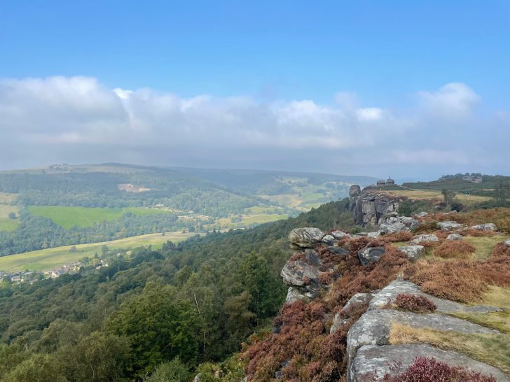

Explore the breathtaking Curbar Edge walk, a high cliff edge offering stunning views over Derwent Valley and wider Peak District National Park.
Lace up your walking boots—here’s everything you need to know before your visit.
Getting to Curbar Edge
Curbar Edge is easiest to access by car, with parking available close to the main viewpoints.
If public transport is needed, there are good options, including a nearby train station just a short distance away.
Parking at Curbar Edge
The main parking area is Curbar Gap Car Park, but there are also plenty of nearby laybys and other parking spots along the walk.
Curbar Gap Car Park (Paid)
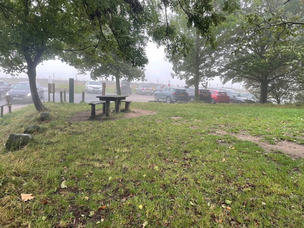
- Address: Clodhall Ln, Hope Valley S32 3YR
- Cost: 4 hrs £3.50 or All day £5.00
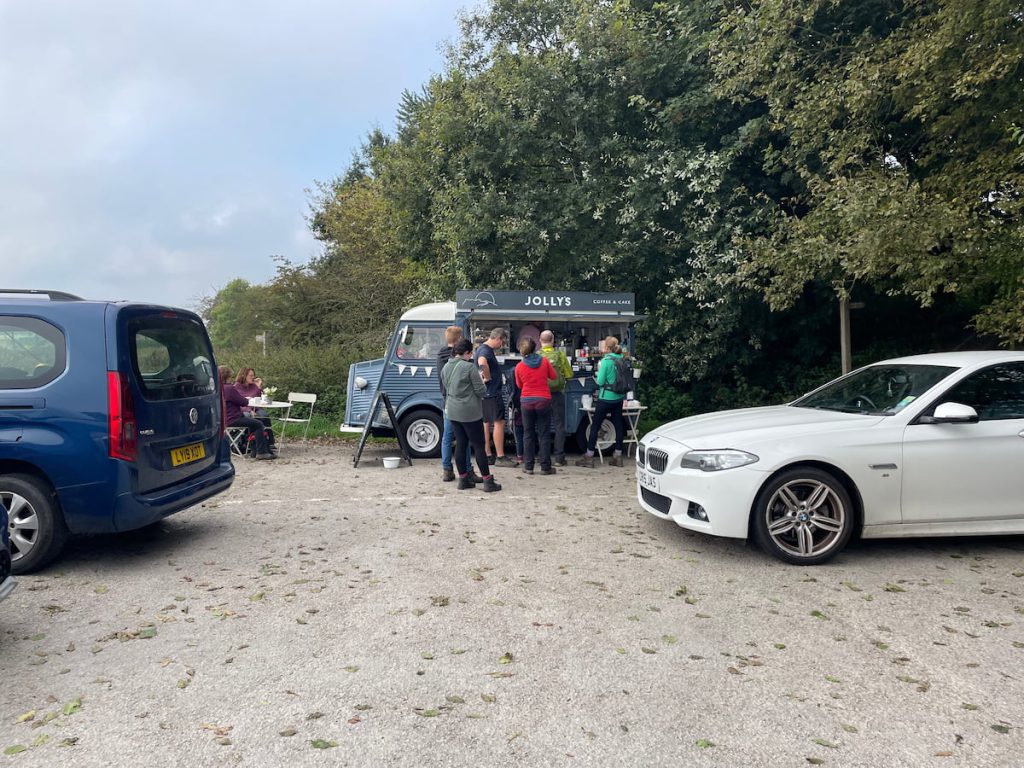
The car park is medium-sized, with picnic benches and a casual hot drinks vendor, offering easy access to the walk.
However, be sure to arrive early, as it can get busy, especially in the summer and on weekends with lots of walkers.
Laybys what3words:
Additionally, another official parking area is available at the National Trust Car Park – Haywood, located along the A625, along the same route.
The closest public transport connection is Grindleford station, with hourly train links between Manchester and Sheffield. From the station, it’s about a 20-minute walk to the route.
Curbar Edge Walking Map & Route
Download file for GPSThe circular walk heads out of the car park and up onto White Edge before coming back down through woodland and onto Froggatt Edge, then along Curbar Edge, offering stunning views of the valley until you rejoin the car park.
Just want to see the edge? -> Follow the route anticlockwise for as long as you’d like, then head back the same way.
Which hiking map app should I use? I recommend OS Maps Online for its unparalleled accuracy. However, if you’re a beginner, you might find AllTrails to be more user-friendly. For a detailed review of the best UK map apps, read my full review.
Curbar Edge Walk Step by Step – 9.5 km (5.9 mi) ~ 2-3.5 hrs
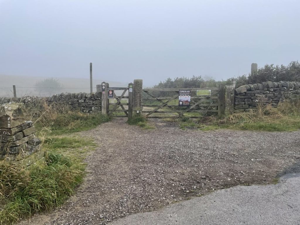
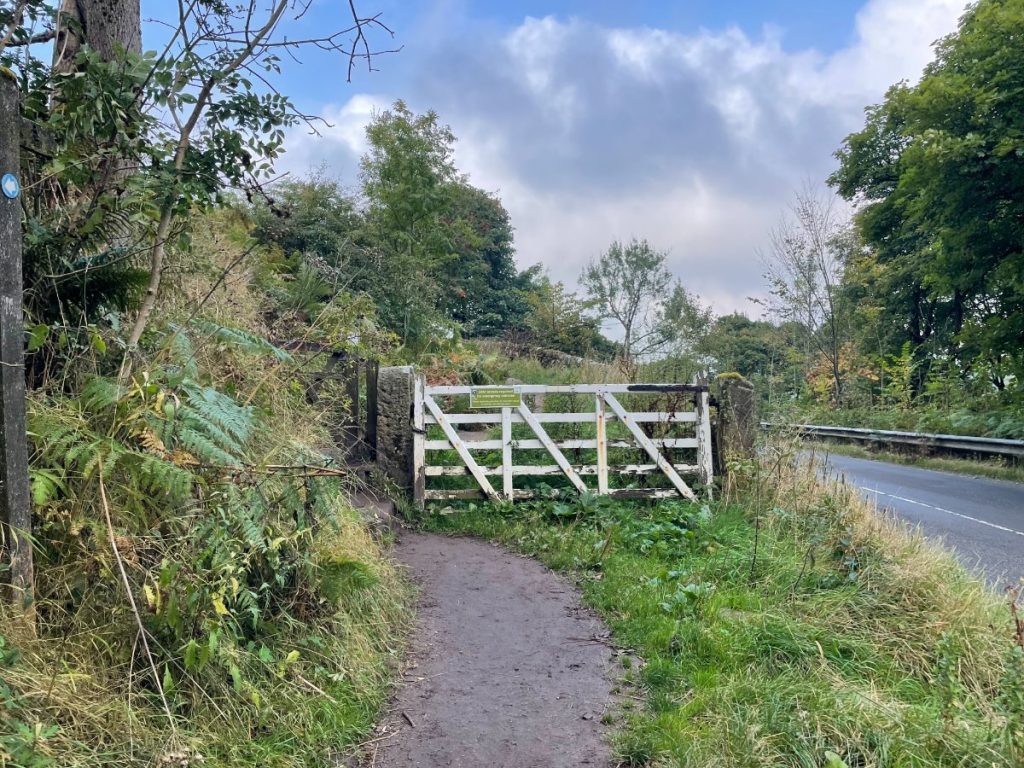
1. The walk begins by passing through the gate next to the entrance of the car park.
2. The footpath heads uphill, where you will turn left at the end of the wall.
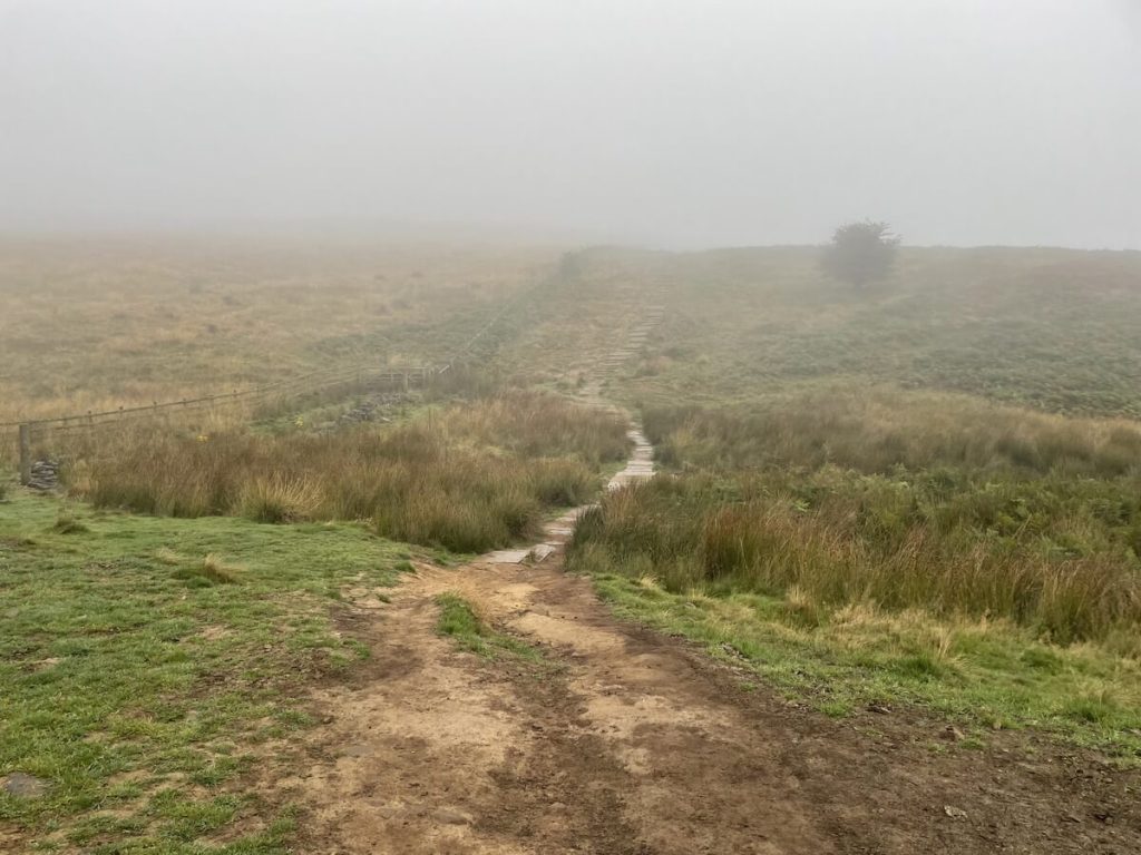
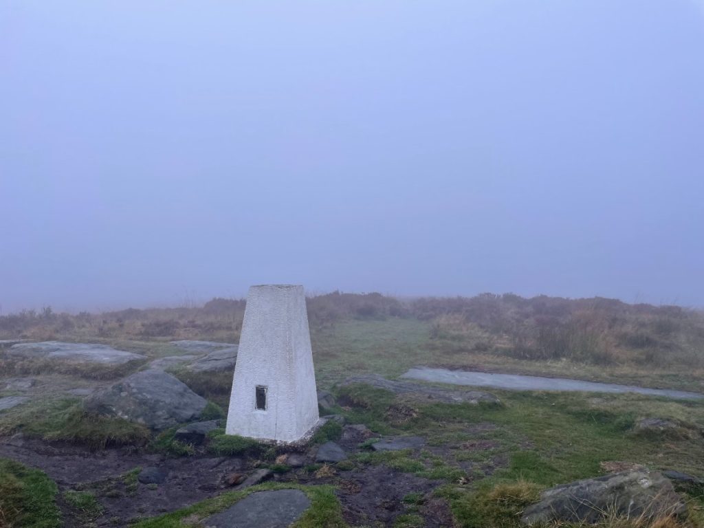
3. Eventually, the path leads to a trig point at 365m atop Big Moor offering views around the moor (though, at this time, it was unfortunately quite misty).
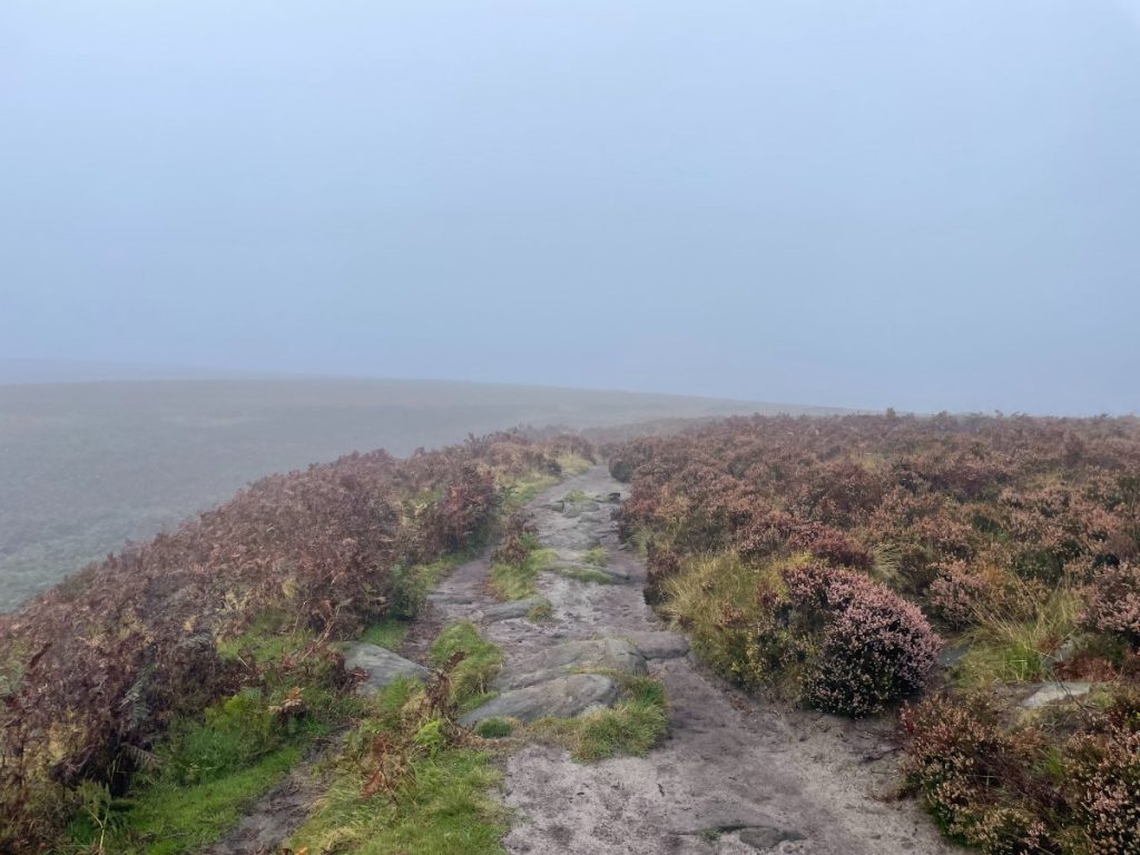
4. Continue along the path, following White Edge and passing the Hurkling Stone.
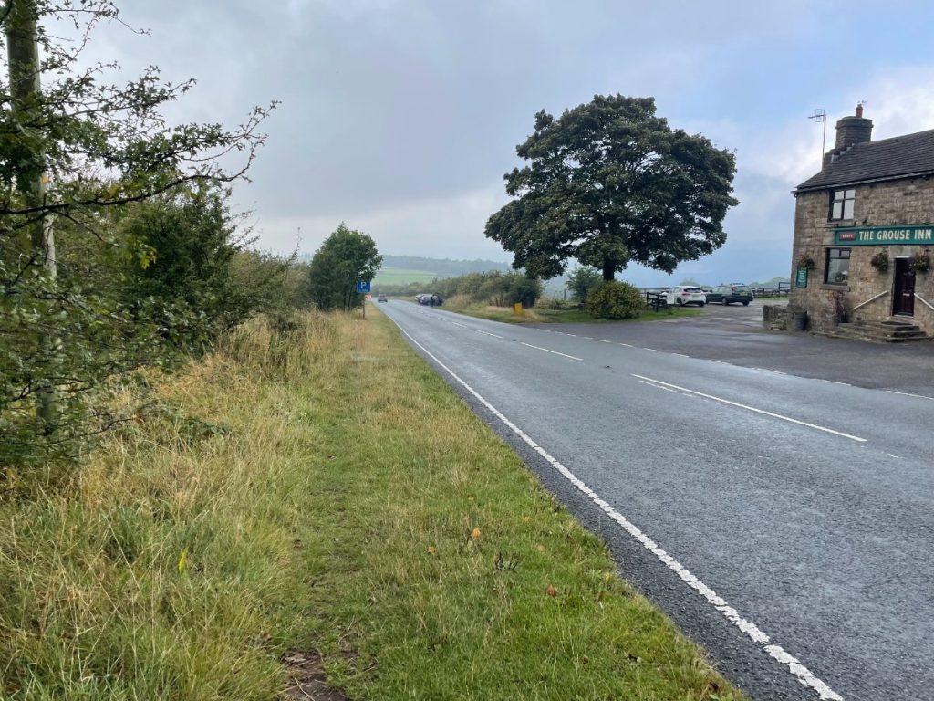
5. Take a left and follow the wall down into a small woodland until you reach a field that leads to the main road (A625).

6. Cross the road and take the path just past The Grouse Inn, which goes downhill through a field.
7. Go through several gates, passing the National Trust Haywood car park, and cross the A625 again a short distance down the path. (Be cautious, as this is on a tight bend.)
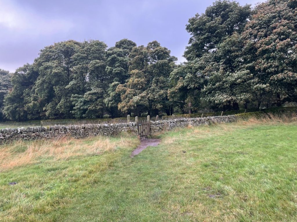
8. Head through the gate on the other side of the road, where the path begins to curve uphill as you enter the woodland of Froggatt Edge.
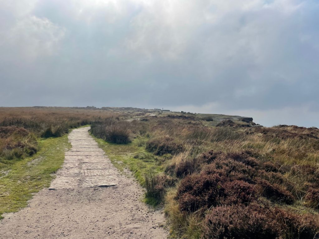
9. Keep following the path until it opens out from the woodland, offering great views of the Derwent Valley and rocky gritstone outcrops ahead, as well as historic stone circles.

10. As the path starts to gain elevation, you’ll move onto Curbar Edge.

Optional: You can either follow the designated path marked on the Ordnance Survey map or carefully use the path closer to the edge.
11. From the top of Curbar Edge, you’ll get panoramic views of both sides of the valley—one of the best spots for photos.
12. From here, follow the path down and through the gate, leading back to the car park.

Bonus Landmark: If you’d like to visit another popular viewpoint, head up the footpath on the other side of the car park to Baslow Edge.
- Daypack: Choose a 10-20L daypack to carry all your gear comfortably.
- Clothing: Wear layered, moisture-wicking clothing and pack a waterproof jacket and waterproof trousers for changing weather.
- Footwear: Sturdy walking boots or trail shoes are essential for the varied terrain.
- Water & Snacks: Carry enough water (at least 1L per hour) and bring energy-rich snacks.
- Navigation: Always have a map and compass, and optionally, bring a reliable GPS app to stay on track.
- First Aid Kit: Include essential items like blister treatments and painkillers. A compact First Aid Kit is ideal.
- Emergency Items: A headtorch, whistle, and multi-tool can be vital in unforeseen situations.
Please note some of these links may earn us a commission from qualified purchases at no additional cost to you, which helps fund the free content we provide.
Local Amenities & Facilities
There are limited amenities and facilities along the route, so be sure to bring everything you need and be prepared to take it back with you.
On weekends (Friday-Sunday), Jolly’s Coffee and Cake box is available, offering hot and cold drinks, as well as a small selection of cakes right from the car park. About halfway along the route is also The Grouse Inn, which makes for a great place to stop.
A little further afield:
Curbar & Calver (5 min drive): These neighbouring villages offer a peaceful, scenic atmosphere with stunning views of the surrounding Peak District. They have a quaint village feel with local shops and cafes.
Baslow (5 min drive): A charming village near Chatsworth House, Baslow features a mix of traditional cottages and modern amenities. It’s a popular starting point for walks, especially along the River Derwent (stretching from Ladybower Reservoir through Matlock Bath), and has several cosy pubs and restaurants.
Highly rated local businesses:
- Derwentwater Arms: A traditional, family-run pub dating back to 1708, serving comfort food and real ales.
- The Eating House: A small independent cafe offering great breakfasts and lunches.
- Toll Bar Fish & Chips: A classic, highly-rated fish and chip shop in Stoney Middleton.
The closest larger towns with more amenities are Bakewell (15 mins away), Chesterfield (20 mins away), and Sheffield (30 mins away).
History of Curbar & Froggatt Edge

Curbar and Froggatt Edge are iconic gritstone escarpments. These natural formations have a rich history that stretches back thousands of years, offering not only scenic views but also a window into both human activity and geological processes.
Historical Importance
The edges have been significant since prehistoric times. Archaeological finds, including cairns and burial mounds from the Bronze Age. These burial sites, found particularly around Froggatt Edge, indicate that the land was used for ceremonial purposes, adding historical depth to the region.
Curbar Edge, in particular, became important during the Roman period, when the natural gritstone was quarried for millstone production. This quarrying activity continued through the centuries, and remnants of this industry, including unfinished millstones, can still be found along the edges.
Rock Climbing Legacy

Both Curbar and Froggatt Edge have become renowned in the world of rock climbing. In the early 1900s, Curbar Edge was one of the pioneering locations for the sport in the UK.
Climbers have developed a variety of routes, ranging from beginner-friendly paths to some of the most challenging climbs in the country. Froggatt Edge, known for its famous routes like “Three Pebble Slab” and “Downhill Racer,” is celebrated for its technical climbs that test even the most experienced climbers.
Natural Beauty and Wildlife
Curbar and Froggatt Edge are part of the protected Eastern Moors of Derbyshire, home to a diverse range of flora and fauna. The moorland is covered in heather, which blooms in late summer, painting the landscape in shades of purple.
Birdwatchers can spot a variety of species, including buzzards, kestrels, and grouse, while the surrounding woodlands are home to deer, which can be seen during their rutting season in autumn, as well as highland cattle in the surrounding fields.
Curbar Edge – FAQs
How was the Curbar Edge formed?
Curbar Edge was formed through millions of years of erosion.
The gritstone cliffs are the result of ancient riverbed deposits that have been gradually shaped by wind, water, and ice, leaving behind the dramatic escarpment we see today.
Can you cycle along curbar edge?
Yes, you can cycle along certain paths near Curbar Edge, but cycling on the edge itself is restricted in some areas due to the rough terrain and conservation rules.
Some nearby routes are also suitable for mountain biking.
How high is the Froggatt Edge?
Froggatt Edge stands at an elevation of approximately 263 metres (862 feet).
The highest point of Curbar edge stands at 339 metres (1112 feet).
What is the postcode for Curbar Edge?
The postcode for Curbar Edge is S32 3YR.
The exact address of the main car park is Clodhall Ln, Hope Valley S32 3YR.
If you enjoyed this walk, be sure to explore other edge walks nearby, like Bamford Edge or Stanage Edge, both just a short distance away.
Jackie
Tuesday 26th of August 2025
Did this edgy walk today - lovely walk really enjoyed it, thank you for the details