
When you think of things to do in Castleton, it’s hard not to envision its sweeping landscapes and inviting walks. Castleton is not just a picturesque village but a gateway to some of the region’s most iconic walks.
From the dramatic ridges of Mam Tor to the secluded pathways of Cave Dale and the swirling breezes of Winnats Pass, Castleton offers walking experiences for every adventurer.
Whether you’re a seasoned hiker or someone just looking to soak in the natural beauty, here’s a quick guide to help you set foot on the right path.
Top Castleton Walks
In a hurry? Here’s my quick list:
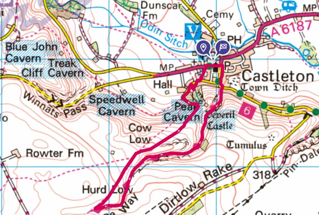
- ⛰️ Mam Tor Walk: 11.5km (7.13mi) ~ 3.5-4hrs
- 🌳 Cave Dale Walk: 4.3km (2.7mi) ~ 1-2 hours
- 🌲 Winnats Pass: 4.5km (2.8mi) ~ 1.5-2hrs
Red: Mam tor | Blue: Cave Dale | Green: Winnats Pass
Which hiking map app should I use? I recommend OS Maps Online for its unparalleled accuracy. However, if you’re a beginner, you might find AllTrails to be more user-friendly. For a detailed review of the best UK map apps, read my full review.
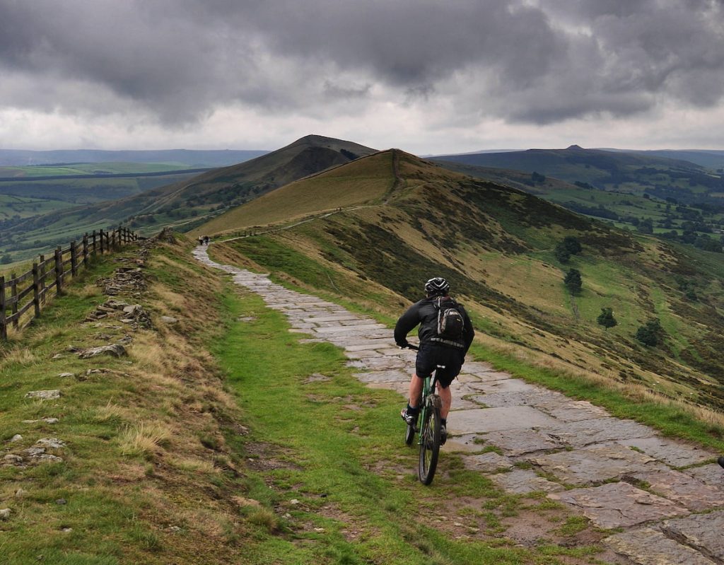
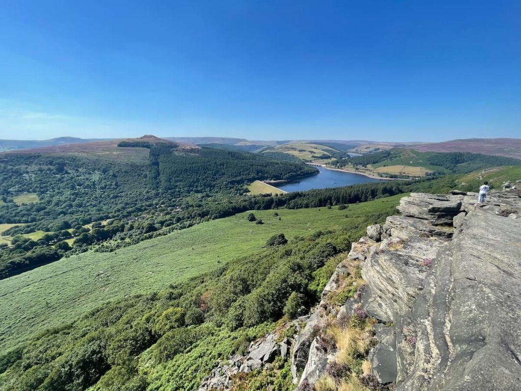
1. Mam Tor
🟡 Medium | 🚶♂️ 11.36 km (7.06 mi) | ⛰️ Total ascent: 473 m (1,552 ft) | ⏱️ 3-4 Hrs
- Difficulty: Moderate (Overall, the walk follows well-maintained paths. However, it traverses a long distance and covers over 500m of elevation, which could be challenging for those not regular walkers.)
Mam Tor is one of the most popular and highly rated walks in the Peak District, and it’s not hard to tell why.
Known to many as the “Shivering Mountain”, it’s a staple for walkers and outdoor enthusiasts across the UK.
You’re treated to broad, sweeping views of the Hope Valley and Edale on one side and the charming village of Castleton down below on the other. The ridge walk, while a bit of a climb in parts, provides uninterrupted views to make up for it.
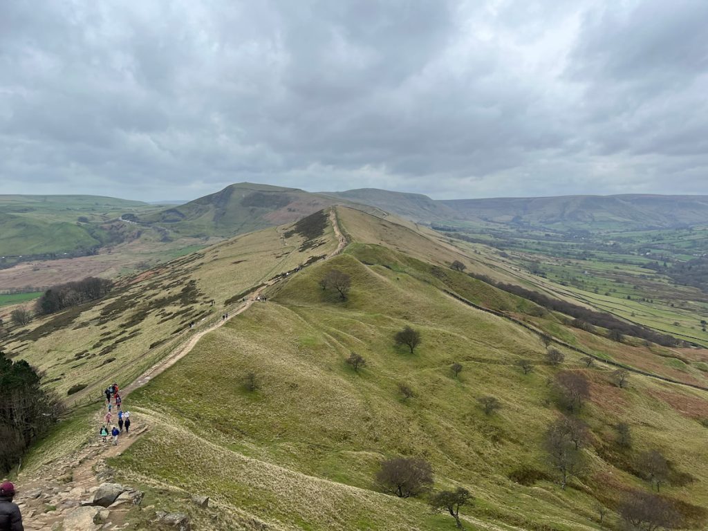
And it’s not just about the views. Mam Tor holds a slice of history with the remains of an Iron Age hillfort at its summit.
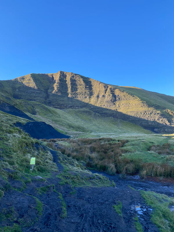
What’s more, the mountain’s unique eastern face, known for its historic landslides, has become a point of interest for both walkers and geologists. You’ll get to see for yourself the “road that slid away”.
You might even spot paragliders taking to the skies, making the most of the mountain’s favourable air currents.
IMPORTANT: The mapped version of this route and the guide, starts from the National Trust Mam Nick Car Park. As you’ll be starting from Castleton, which the route passes through anyway, change the start location.

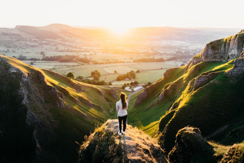
2. Cave Dale
🟡 Medium | 🚶♂️ 4.3 km (2.7 mi) | ⛰️ Total Ascent: 221 m (725 ft) | ⏱️ 1.5-2 Hrs
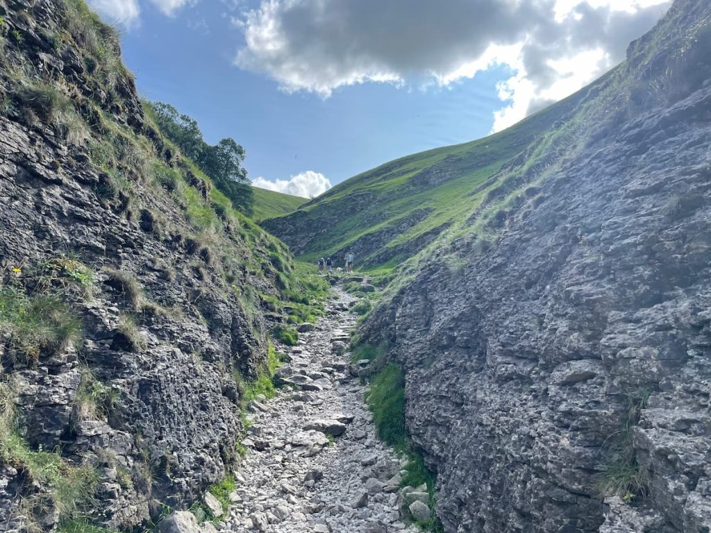
- Difficulty: Easy-Moderate (The starting Cave Dale Valley itself is fairly steep; however, after the initial climb, the walk is fairly manageable.)
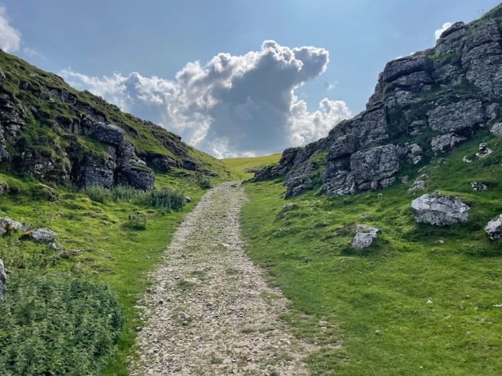
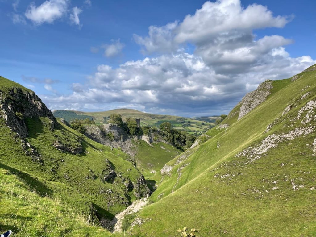
Cave Dale, a stone’s throw from Castleton’s village centre, is a favoured walking route. From the village, a narrow alleyway ushers you towards the dramatic, rock-lined valley.
This unique valley was formed when the cave roof above gave way, resulting in the now-exposed “cave dale”. As you explore this distinct landscape, you might glimpse gated entrances leading to the deeper recesses of the Peak Cavern below.
Upon ascending the valley’s peak, breathtaking views unfold. You’re presented with the expanse of the valley, the remnants of Peveril Castle, and the distant hills.
As you circle the top, the left reveals the iconic Winnats Pass and Mam Tor. Subsequently, the path gently slopes back to Castleton.
Catering to a spectrum of walkers, whether you’re keen on completing the full circuit or merely savouring the Cave Dale Valley, there’s always a fresh sight awaiting.
3. Winnats pass
🟡 Medium-Hard | 🚶♂️ 4.5 km (2.8 mi) | ⛰️ Total Ascent: 229 m (751 ft) | ⏱️ 1.5-2 Hrs
- Difficulty: Moderate (Section of the walk can be steep and slippery, which could be challenging for some)
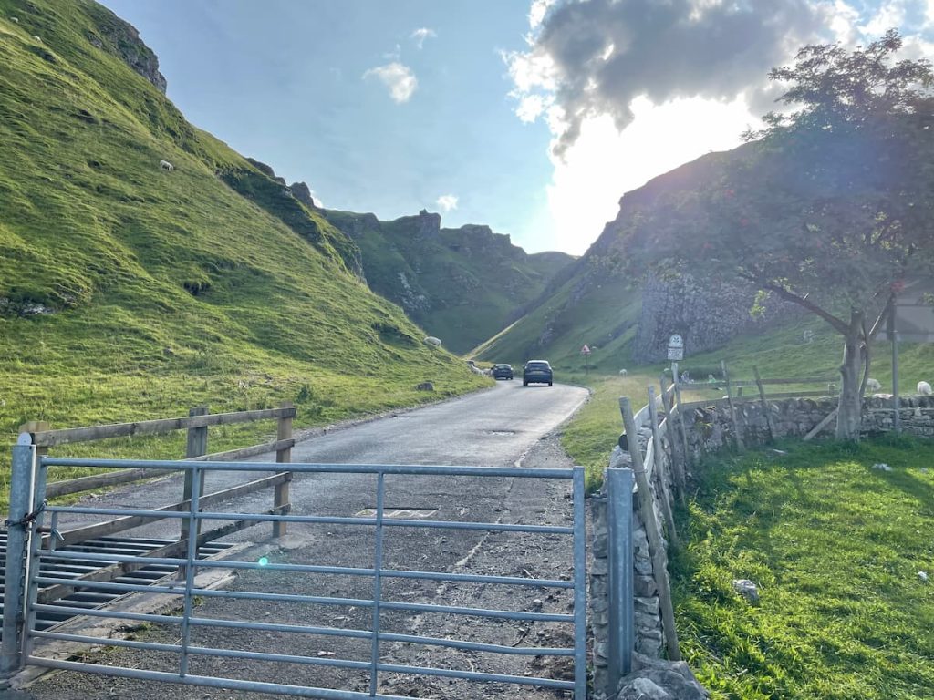
Winnats Pass, often simply dubbed “Winnats”, is a striking limestone gorge and hilly passage at the core of the Peak District.
Its name, a twist on ‘wind gates’, speaks to the swirling breezes that characterise the area.
Beginning your walk in Castleton, you’ll head along the road until Speedwell Cavern. Here, the grandeur of the pass stretches out beneath you.
From this vantage point, a steep road and subsequent track lead you upwards, offering unparalleled valley views and numerous chances for photography enthusiasts. Your journey winds down as you stroll through the fields, returning to the village.
Embarking on the Winnats Pass adventure offers a rich tapestry of nature, heritage, and exploration. Those wary of steep inclines might hesitate, but the views at the top are truly rewarding.

- Daypack: Choose a 10-20L daypack to carry all your gear comfortably.
- Clothing: Wear layered, moisture-wicking clothing and pack a waterproof jacket and waterproof trousers for changing weather.
- Footwear: Sturdy walking boots or trail shoes are essential for the varied terrain.
- Water & Snacks: Carry enough water (at least 1L per hour) and bring energy-rich snacks.
- Navigation: Always have a map and compass, and optionally, bring a reliable GPS app to stay on track.
- First Aid Kit: Include essential items like blister treatments and painkillers. A compact First Aid Kit is ideal.
- Emergency Items: A headtorch, whistle, and multi-tool can be vital in unforeseen situations.
Please note some of these links may earn us a commission from qualified purchases at no additional cost to you, which helps fund the free content we provide.
Other Walks Around Castleton
If you are willing to drive a little further from Castleton, you’ll have many more options for breathtaking walks in the surrounding area.
Some popular peak district walks, just 10-15 minutes away by car, include:
See the full list of the Best walks in the Peak District, Edale walks, or walks in Derbyshire.