
The Peak District, is renowned for its rolling hills, serene dales, and muddy moors.
While it might not house the highest mountains in the country, the region’s hills and three mountains each carry geological and historical importance.
In this article, we provide an in-depth overview of the top 10 peaks within the Peak District National Park, detailing their significance and outlining the over 100 other hills in the local area!
Top 10 Mountains & Hills in the Peak District
Scroll down to see a table of the Peak District’s complete list of mountains and hills.
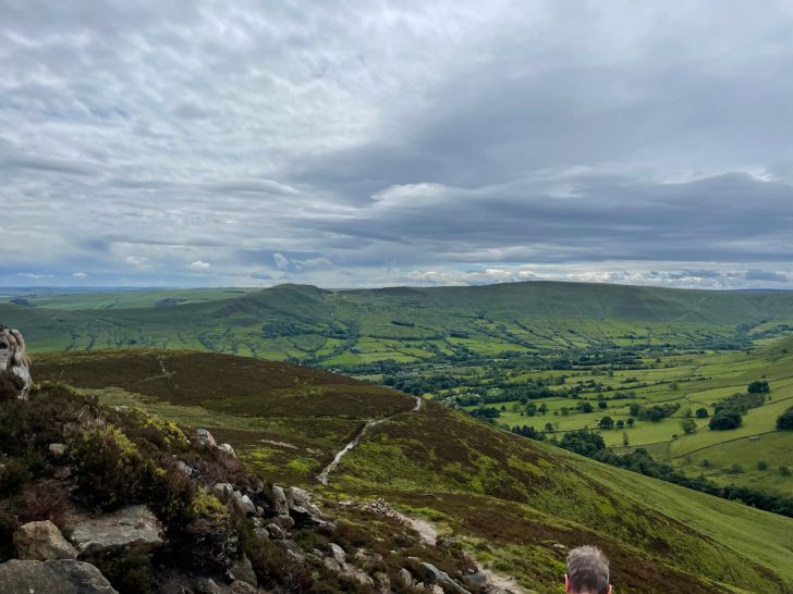
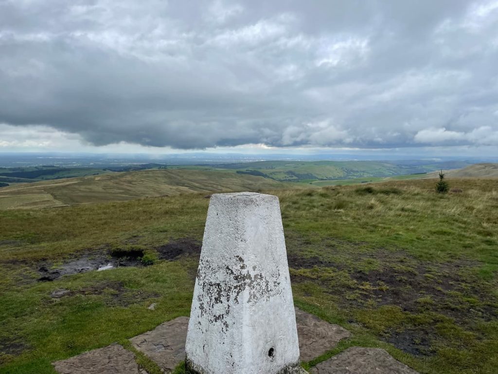
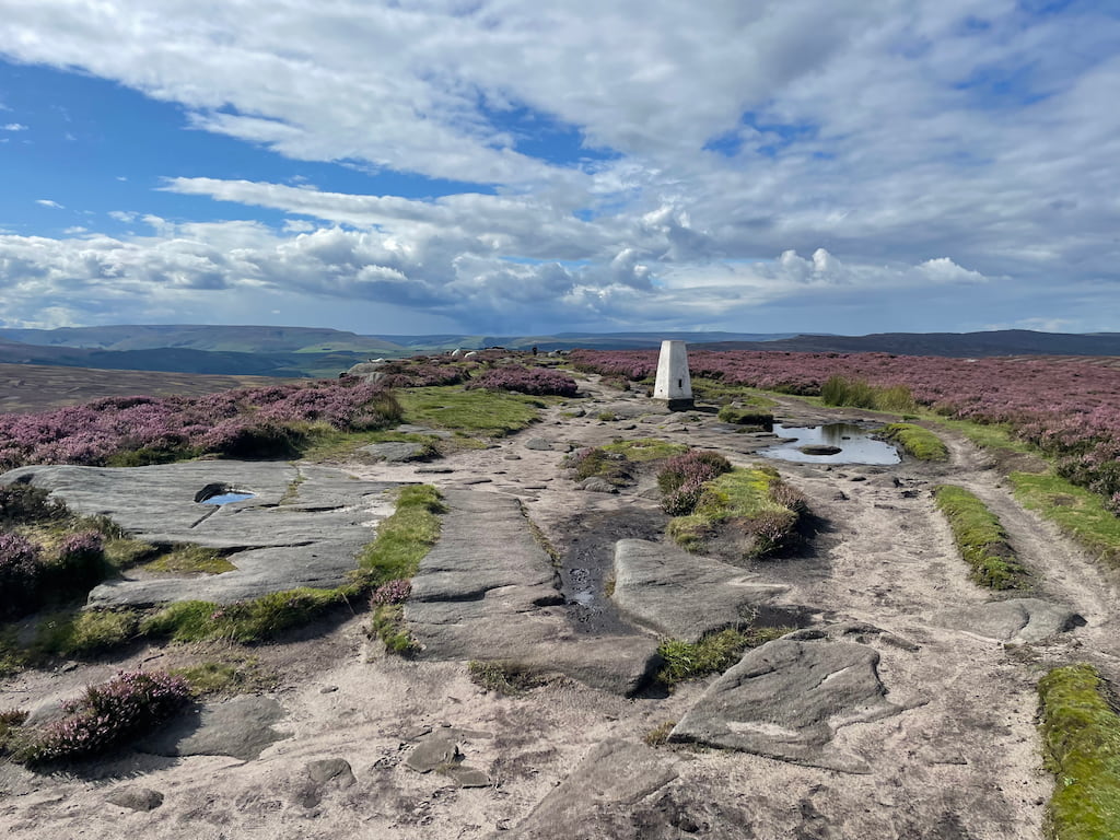
1. Kinder Scout – 636m (2087ft)
For reference, the image above is of Kinder Low, which is 633m tall and the main trig point.
Kinder Scout is the highest peak in the peak district, measuring 636m above sea level. Kinder Scout is also the highest hill in terms of relative height at 496.6m, meaning essentially the prominence of the peak.
The Kinder Scout area is also a popular walking spot offering stunning views of Manchester and even as far as Snowdonia on a clear day.
Nearby is also Kinder Downfall, the tallest waterfall in the Peak District, with a 30-metre fall, and the equally famous Mermaid’s Pool below.
Or Kinder Scout Walk via Jacobs Ladder
2. Bleaklow 633m – (2077ft)
Bleaklow stands as the second-highest peak in the Peak District, reaching an elevation of 633m above sea level. This gritstone moorland is only slightly overshadowed by its southern neighbour, Kinder Scout.
Not only is Bleaklow known for its challenging terrain, seamed by ‘groughs’ – water-eroded channels in the peat, but it also holds historical significance with several aircraft crash sites. The most notable is the 1948 crash of the USAF Boeing RB-29A Superfortress, with remnants still visible and a memorial erected in 1988.
View B29 crash site walk via Bleaklow Trig Point
3. Higher Shelf Stones – 621m (2037ft)

Higher Shelf Stones is located near Bleaklow and is the third-highest mountain in the Peak District.
Like Bleaklow, it offers stunning views over Manchester and features a historic path that connects to other crash sites nearby.
View B29 crash site walk near Higher Shelf Stones
4. Grindslow Knoll – 601m (1972ft)
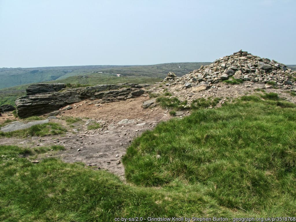
Grindslow Knoll, the fourth highest peak, emerges distinct, often appearing separate despite its connection to Kinder Scout. Dominating the western side of Grindsbrook Clough, it offers unparalleled views of the southern Peak District and the Vale of Edale.
While Grindslow Knoll is renowned for its panoramic views, especially with the Nab to the east, is also a gateway to iconic landmarks. Notable sites like Jacob’s Ladder, Edale Cross, and the Woolpacks make it a central point.
From here on out, the rest are officially hills (Shh, we can call them Peaks)!
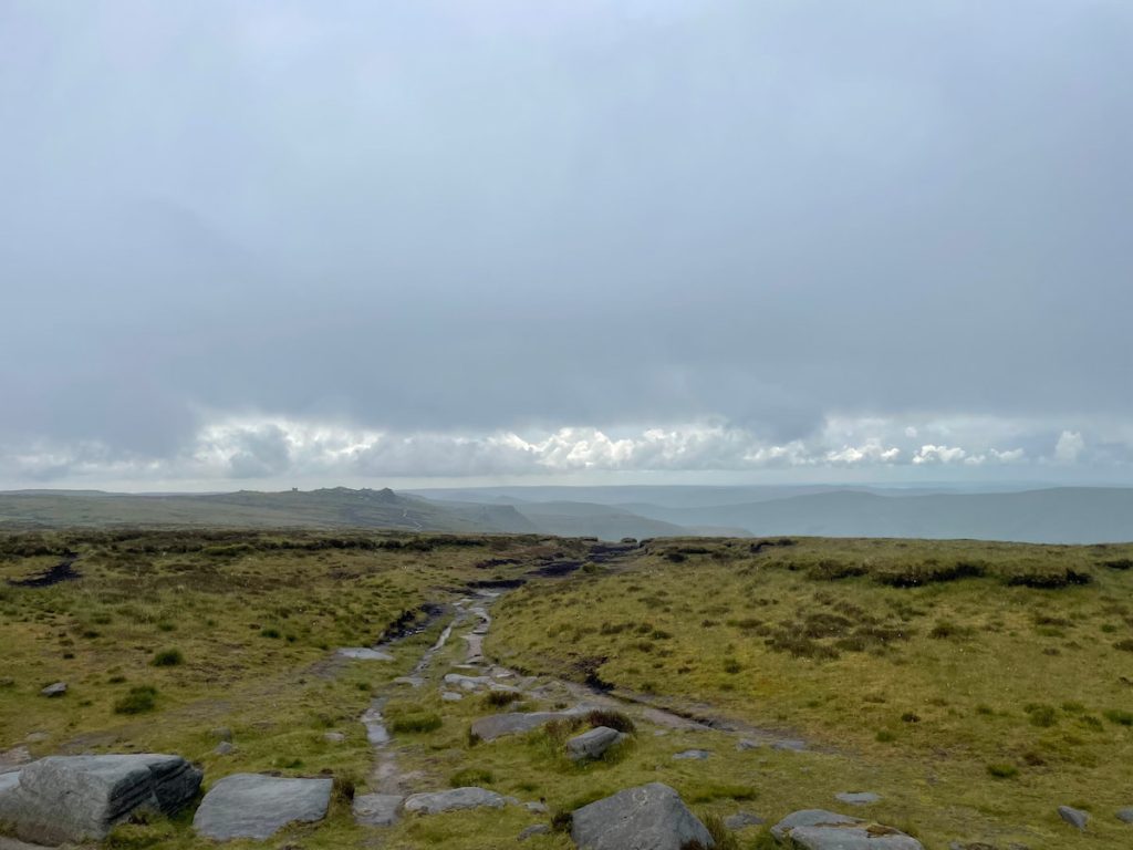
5. Black Hill – 582m (1909ft)

Black Hill, the fifth-highest peak in the Peak District and the highest in West Yorkshire, reaches an elevation of 582m above sea level. This Pennine moorland hill boasts a extensive plateau with steeper sides.
Historically, its peak was dark and almost devoid of vegetation, lending the hill its name. However, recent restoration has rejuvenated the landscape, and the Pennine Way, now paved, crosses Black Hill, allowing walkers to navigate even in wet conditions.
Walkers can approach via the Pennine Way from Crowden, passing the Laddow Rocks cliffs, or from the ‘Isle of Skye’ junction, leading to a paved section towards Black Hill. The hill’s highest point, Soldiers’ Lump, holds significance as it once used in the original Ordnance Survey.
6. Brown Knoll – 569m (1867ft)
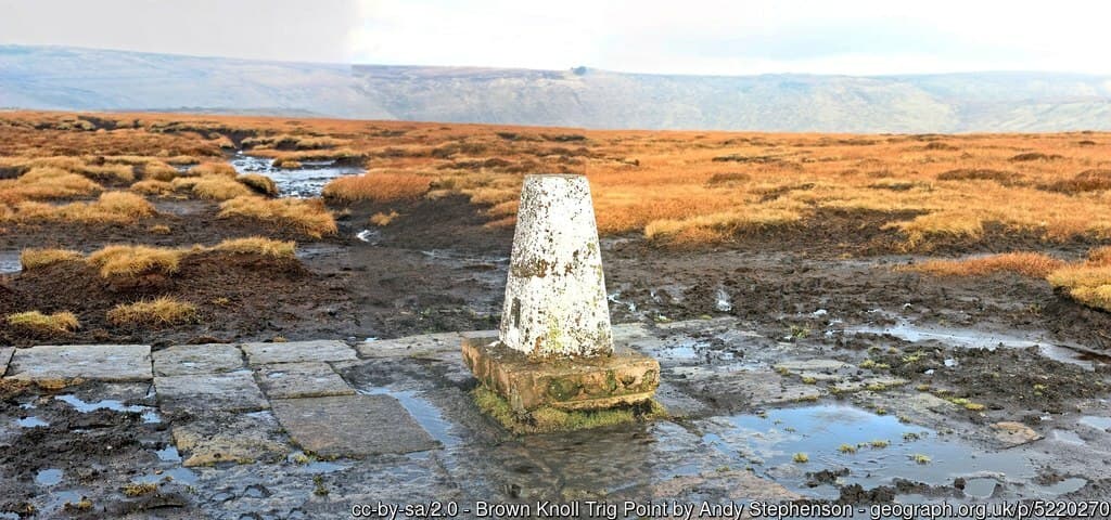
The Brown Knoll, coming in at the 6th highest in the Peak District is a large plateau and paved path leading to a trig point.
The summit is less impressive than some of the other hills and mountains on this list.
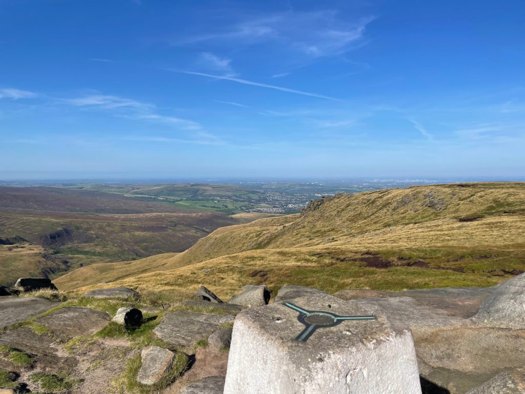
7. Shining Tor – 559m (1834ft)
Shining Tor, with its peak at 559m above sea level, holds the title of the highest hill in Cheshire, England. Located in the Peak District, it stands between Macclesfield in Cheshire and Buxton in Derbyshire, marking the boundary between Derbyshire and Cheshire East.
The ascent to Shining Tor offers various routes, with many walkers starting from the Upper Goyt Valley near Errwood Reservoir.
Once at the summit, the views are captivating. Due to its elevation, it offers sights of the peak of Shutlingsloe, the city of Manchester, and the Cheshire Plain.
8. Axe Edge Moor – 551m (1808ft)

Axe Edge Moor, located southwest of Buxton in the Peak District, is a vast expanse of moorland. With its peak reaching 551 metres above sea level, it stands slightly lower than the nearby Shining Tor, which is situated across the Goyt Valley.
This moorland is notably the source of several rivers, including the River Dove, River Manifold, River Dane, River Wye, and River Goyt.
The moor once housed England’s second-highest public house, the Cat and Fiddle Inn, which, after closing in 2015, has been reborn as a distillery.
Interestingly, Axe Edge Moor also serves as a convergence point for three counties: Derbyshire, Staffordshire, and Cheshire, which all meet at Three Shire Heads on the River Dane.
9. Lord’s Seat (Rushup Edge) – 550m (1804ft)
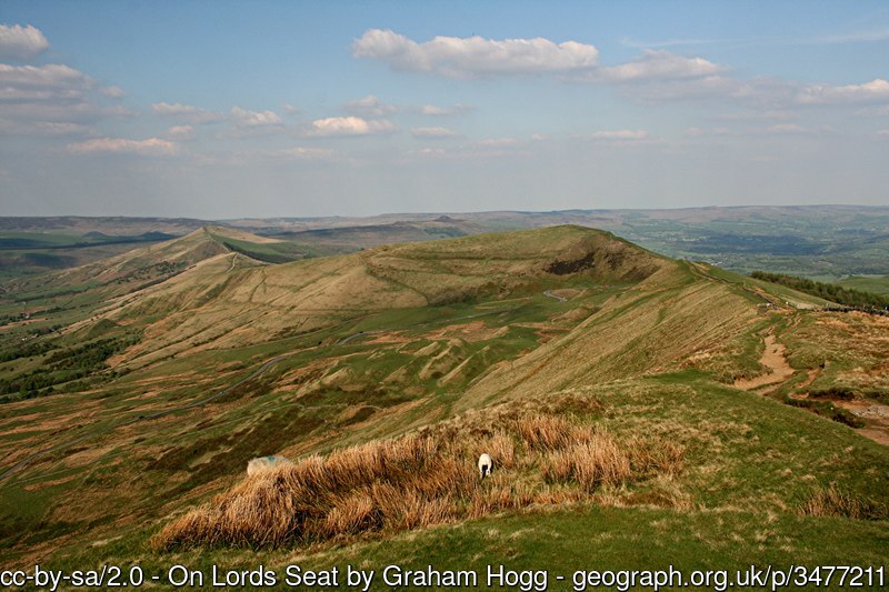
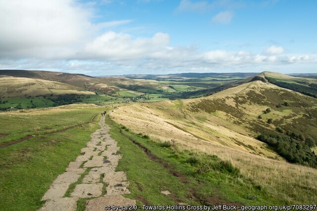
Rushup Edge, a prominent hill in the Derbyshire Peak District, boasts its highest point at Lord’s Seat, reaching an elevation of 550 metres. Adjacent to this ridge is the famous Mam Tor, situated at its eastern end and marking the commencement of the Great Ridge.
Lord’s Seat isn’t just known for its height; it’s also the site of a historical round barrow. Geologically, Rushup Edge is an extension of the ridge that stretches eastward to landmarks like Mam Tor, Hollins Cross, Back Tor, and Lose Hill, delineating the Edale and Hope valleys.
This ridge is primarily composed of Namurian age Mam Tor Beds, a mix of sandstone and siltstone, with landslides on its northern side contributing to the formation of colluvium.
10. Whetstone Ridge – 547m (1795ft)

Whetstone Ridge, the highest point near Shutlingsloe, sits at 547m tall, making it the 10th highest peak in the Peak District.
FACT: The Government defines a mountain as having an elevation above 600 meters (1,969 ft). (Countryside and Rights of Way Act 2000)
Full list of Peak District Mountains in Order
Other Notable Peak District Mountains You Can Hike
There are, of course, many more notable hills in the Peak District, but here’s a good overview of many honourable mentions which could be your next uphill challenge!
Mam Tor
Mam Tor, often referred to as the “Shivering Mountain”, stands tall in the Peak District near Castleton, Derbyshire. With a peak at 517 meters above sea level, it’s a renowned destination for hikers, offering panoramic views of the suhillnding valleys and peaks.
While Mam Tor is celebrated for its views and iconic paved pathway, it’s also steeped in history and geology. The mountain’s eastern face is known for frequent landslides, giving it its unique name. Moreover, the summit houses the remnants of an Iron Age hillfort, showcasing its historical significance.
Win Hill

Win Hill situated northwest of Bamford Edge, rises to a height of 462 meters above sea level. This prominent hill is surrounded by the River Derwent to the east, the River Noe to the southwehilland the Ladybower Reservoir to the north. A ridge extends northwest from Win Hill, connecting it to the famed Kinder Scout. Historical markers like the Hope Cross, dating back to 1737, can be found along the old Roman road that crosses this ridge.
A notable feature of the area is the hill’s counterpart, Lose Hill, located to the west across the River Noe. Local lore tells a tale of a battle between the forces of Edwin of Northumbria and Cynegils of Wessex, with each hill representing one side. A more plausible origin for Win Hill’s name traces back to “Wythinehull”, meaning “Withy Hill” or “Willow Hill”, a nod to the fragments of willow found in the region.
The Roaches

The Roaches, deriving its name from the French “les roches” meaning “the rocks,” is a striking rocky ridge located above Leek and Tittesworth Reservoir in the Staffordshire side of the Peak District. Rising steeply to an elevation of 505 meters, this ridge is part of a larger escarpment that includes Ramshaw Rocks and Hen Cloud.
This gritstone escarpment is a magnet for outdoor enthusiasts, drawing hikers, rock climbers, and free runners. The Roaches Estate, which encompasses this area, was acquired by the Peak District National Park Authority in the 1980s to protect it from unsuitable development.
On days with clear skies, the views from The Roaches are breathtaking, spanning across Cheshire and even reaching landmarks like Snowdon in Wales and Winter Hill in Lancashire.
The Roaches have a rich biodiversity. In the 1930s, Bennett’s wallabies from Australia were introduced to the wild here, and their descendants survived well into the 21st century. Additionally, peregrine falcons have successfully bred on The Roaches, leading to temporary climbing restrictions to protect the nesting sites.
Or extend your Roaches Walk via Lud’s Church
Stanage Edge (High Neb)
Stanage Edge, commonly known as Stanage, is a prominent gritstone ridge in the heart of the Peak District. Situated near Hathersage, it marks the boundary between Derbyshire’s High Peak and South Yorkshire’s Sheffield. Its highest point, High Neb, rises to an impressive 458 meters.
Historically, Stanage was a quarry site for grindstones, and today, traces of these carved stones remain scattered on its slopes.
A climber’s paradise, Stanage boasts the UK’s longest rock route, the 5000m Girdle Traverse, pioneered by Ron Fawcett in 1992.
Beyond its natural allure, Stanage has graced the silver screen. Its most iconic cinematic moment is in the 2005 film “Pride and Prejudice,” where Keira Knightley’s Elizabeth Bennet is seen lost in its expansive views.
Peak District Mountains FAQs
Is there any mountains in the Peak District?
The Peak District houses two mountains: Kinder Scout and Bleaklow.
While there are more trig points above 600m, which the UK class as mountains, these are technically part of the same mountain top.
What are the 3 peaks in the Peak District?
The three primary peaks in the Peak District are Kinder Scout, Bleaklow, and Black Hill.
What is the easiest mountain to climb in the Peak District?
While not one of the three main mountains, Mam Tor is among the more accessible and popular walks in the Peak District, offering a well-paved ridge and managed inclines.
What is the most famous peak in the Peak District?
Kinder Scout holds the title as the most renowned peak in the Peak District due to its elevation and historical role in the Right to Roam movement.
Does Derbyshire have any mountains?
Derbyshire encompasses parts of the Peak District and includes mountains such as Kinder Scout and Bleaklow.