Thrope Cloud, nestled in the tranquil Derbyshire Dovedale valley, stands as a striking and prominent hill, attracting numerous visitors to the Peak District National Park.
In this guide, you’ll find essential information to enhance your visit, ensuring a memorable experience.
Let’s explore Thorpe Cloud together, where a journey along its path rewards you with breathtaking views!
Getting to Thorpe Cloud
Thorpe Cloud is most easily reached by car. There’s a main car park close to the hill, just a short walk away.
To the best of my knowledge, there aren’t any public transport options to the Dovedale area and Thorpe Cloud at the moment.
Parking around Thorpe Cloud
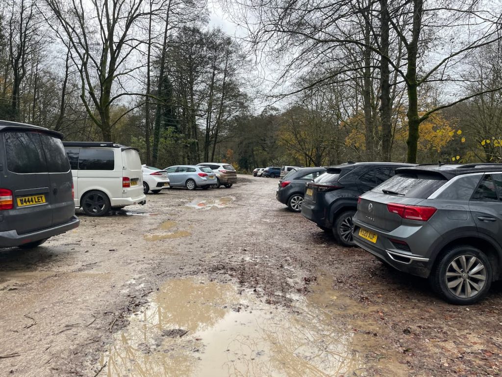
The Dovedale National Trust Car Park is the top choice and nearest parking spot for Thorpe Cloud.
However, there are also free parking options in the nearby village of Thorpe (at Narlow Lane Car Park) and in Ilam. Keep in mind that parking here means a longer walk.
Dovedale Valley is a favourite spot in the Peak District, so securing a parking space can be challenging. It’s wise to get there early or later in the afternoon to avoid missing out, particularly during the summer holidays.
Dovedale National Trust Car Park (Paid)
- Address: Dovedale Ave, Ashbourne DE6
- Cost: £5 for 4 Hours, £7 for all day, Free for NT Members
For those primarily visiting Thrope Cloud and nearby areas, a 4-hour stay is typically sufficient.
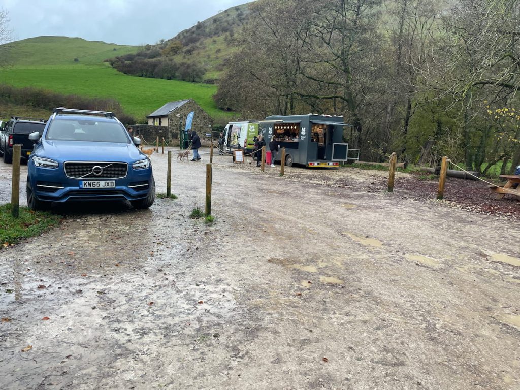
The car park boasts a large number of spaces and even an overflow area, which is staffed during busy months.
While the car park offers limited amenities, an ice cream and coffee truck is often available on busier days. Public toilets are present but do note there’s a 20p charge per use, which is accessible via a turnstile.
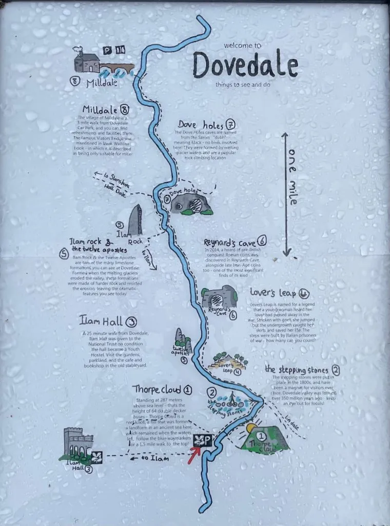
Thorpe Cloud Walking Map & Route
🟡 Medium | 🚶♂️ 2.8 km (1.77 mi) | ⛰️ Total ascent: 171 m (561 ft) | ⏱️ Around 1 Hr
Download file for GPSFrom the car park, the walk takes you along the River Dove and over the stepping stones. You’ll then circle around the back of Thorpe Cloud, encountering a steep climb to the summit. After reaching the top, you’ll head down, circling the hill, and cross a footbridge to return to the car park.
Which hiking map app should I use? I recommend OS Maps Online for its unparalleled accuracy. However, if you’re a beginner, you might find AllTrails to be more user-friendly. For a detailed review of the best UK map apps, read my full review.
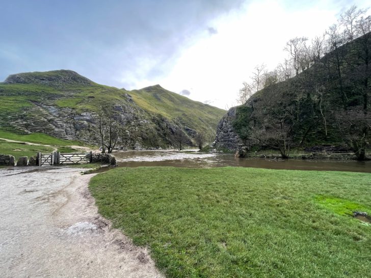
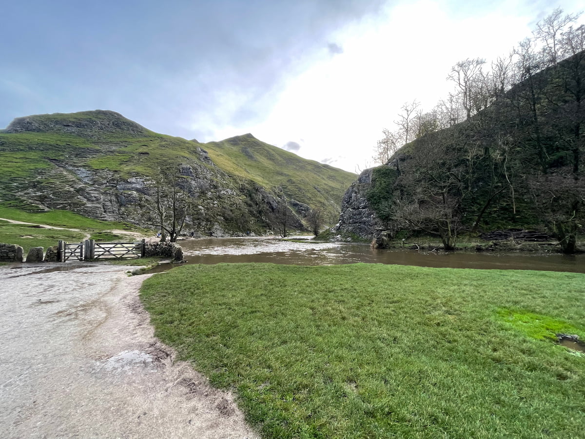
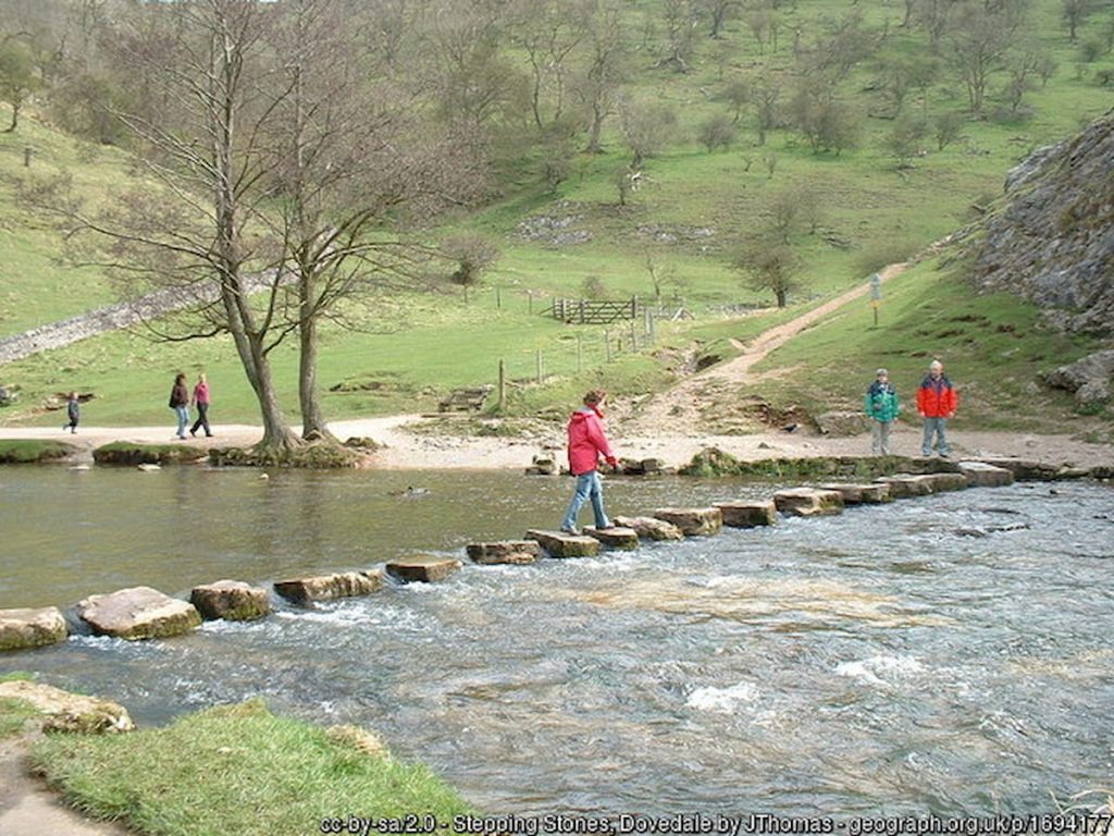
If Water levels are High
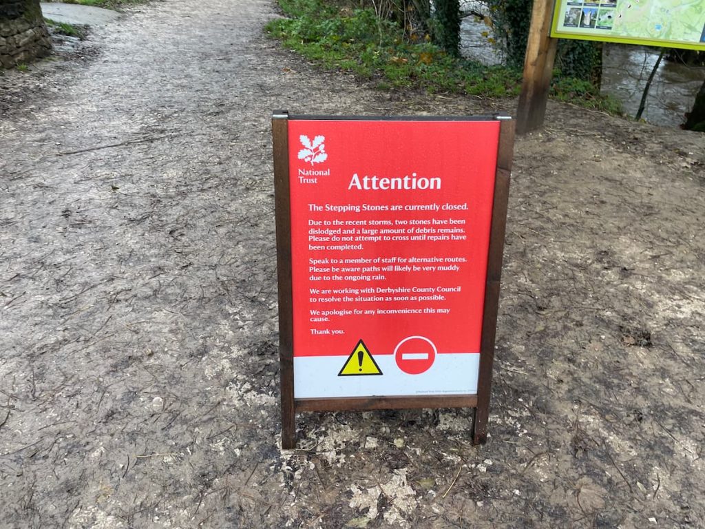
When the River Dove’s water levels are high, the stepping stones might be submerged, making crossing difficult.
It’s important to look out for any signs or ask other walkers coming back to gauge the situation. If the stepping stones are covered, you can cross using the footbridge near the car park and take the path on the right-hand side of the river, which bypasses the stepping stones entirely.
Path Erosion
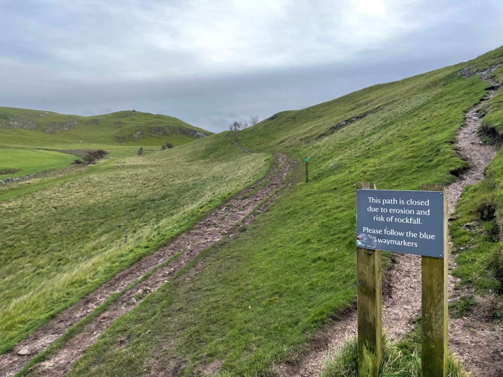
Thorpe Cloud is walked by many people each day, leading to erosion control measures being in place. As a result, the paths shown on Ordnance Survey maps don’t always match the permitted routes.
However, the National Trust has clearly marked the main path around the hill with wooden blue stakes to guide you. Be aware of numerous unofficial paths. These are not recommended and are marked with signs warning against their use.
Thorpe Cloud Walk Step by Step – 2.8km (1.8mi) ~ 1hr
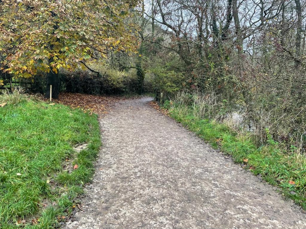
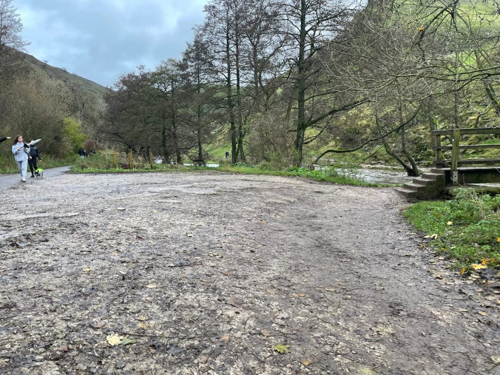
1. Start from Dovedale car park, following the tarmac footpath alongside the River Dove.
2. You’ll come across a footbridge on the right. Cross here for an anti-clockwise route or if the river is high. Otherwise, stay left and continue.
3. Soon, you’ll reach the famous Dovedale stepping stones. Cross them to the other side of the river.
4. Follow the path straight ahead (not through the gate), which curves around the hill and gradually ascends as it skirts the side of the hill.

Note: From here, the route is marked with blue wooden stakes indicating the designated path. Avoid unofficial paths.
5. You’ll arrive at a plateau offering a nice view of the valley you’ve just hiked through.
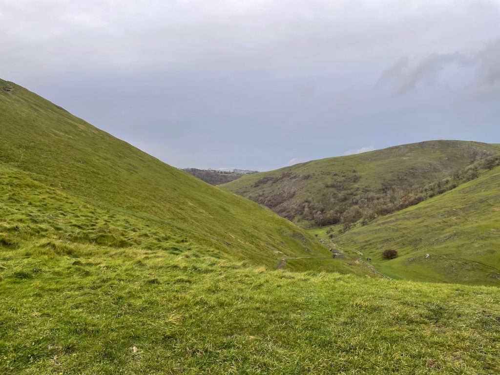
6. Continue following the blue stakes. A path leads up the limestone hill, marking the final ascent to Thorpe Cloud’s summit as you approach from the rear.
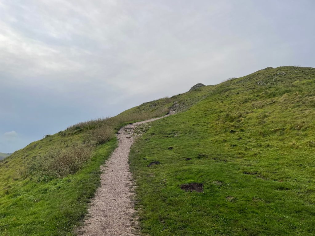
7. At a large boulder where the path forks, go right. Soon, you’ll reach the ridge and the summit, with views of the River Dove, Dovedale Valley, Bunster Hill, and Ilam Park.

8. After enjoying the view, before heading back down the same way until you reach the bottom section by the stone wall.

9. Follow the path along the wall, passing a derelict stone barn, still following the blue stakes.

10. You’ll return to the River Dove, where a footbridge takes you back to the footpath you started on.

11. Turn left and head back to the car park.
If you have extra time, consider extending your walk to Reynard’s Cave or Milldale. For more details, see my full Dovedale walk article.

Also, think about visiting Ilam Hall, which is managed by the National Trust and run by the YHA. It’s a beautiful hall popular with hikers, families, and school groups and one of the best hostels in the Peak District.
- Daypack: Choose a 10-20L daypack to carry all your gear comfortably.
- Clothing: Wear layered, moisture-wicking clothing and pack a waterproof jacket and waterproof trousers for changing weather.
- Footwear: Sturdy walking boots or trail shoes are essential for the varied terrain.
- Water & Snacks: Carry enough water (at least 1L per hour) and bring energy-rich snacks.
- Navigation: Always have a map and compass, and optionally, bring a reliable GPS app to stay on track.
- First Aid Kit: Include essential items like blister treatments and painkillers. A compact First Aid Kit is ideal.
- Emergency Items: A headtorch, whistle, and multi-tool can be vital in unforeseen situations.
Please note some of these links may earn us a commission from qualified purchases at no additional cost to you, which helps fund the free content we provide.
Thorpe Cloud Amenities & Facilities
In the immediate area around Thorpe Cloud, facilities are quite limited, so it’s a good idea to bring everything you might need.
The National Trust car park at Dovedale is equipped with picnic benches and often has an ice cream van or coffee truck on busy days. There’s also a public toilet available, but there’s a 20p charge for using it.
For a local pub, The Old Dog in Thorpe is a great choice. It’s open for food from 12 noon, Wednesday to Sunday, offering burgers, sandwiches, and classic pub grub. The pub boasts a charming atmosphere and plenty of outdoor seating.
If you need more amenities, Ashbourne is the nearest town, just a 10-minute drive away, offering a wider range of facilities.
Thorpe Cloud – FAQs
Is Thorpe Cloud hard to climb?
Thorpe Cloud is relatively easy to climb, with the entire walk from the main car park taking around an hour.
The path mostly ascends gradually, but the final ascent to the summit is steeper and may pose a small challenge, especially for those not accustomed to steep gradients.
Additionally, the path can become slippery and more difficult to navigate when muddy.
Why is it called Thorpe Cloud?
The name ‘Cloud’ is believed to derive from the Anglo-Saxon word “clud”, which means a mass of rock or hill. ‘Thorpe’ is an Old Norse term meaning village or farmstead. Given that the village of Thorpe is nearby, the hill was named ‘Thorpe Cloud’.
Can you take dogs up Thorpe Cloud?
Yes, dogs are allowed on Thorpe Cloud and in the surrounding Dovedale Valley. However, dogs may need assistance when crossing the peak district stepping stones at the base of the hill.
Dog owners should adhere to all advice and signage about managing their pets in the area.
Is Thorpe Cloud a mountain or hill?
Thorpe Cloud is classified as a hill, standing at a height of 287m (942ft), ranking it as the 123rd highest point in the Peak District.
It is quite isolated in the landscape, with its prominent shape standing out.
Karla W
Friday 7th of June 2024
Absolutely love Thorpe Cloud. It's such a gem for nature lovers. The variety of wildlife and the breathtaking scenery make it a must-visit for anyone. Don't forget your camera, and please keep it clean for everyone to enjoy!
JoeyM
Tuesday 30th of April 2024
yeah cause what we all wanna do is pay to park our car before a walk, proper bargain that
Si123
Monday 1st of April 2024
walked thorpe cloud last year, views are top. Would defo recommend.
Liz G
Thursday 4th of July 2024
is it hard to climb?
fred_b
Sunday 18th of February 2024
Fascinated by the name 'Thorpe Cloud'. I've read it might be named after the Old English word for 'hill'. Really brings the landscape's history to life, doesn't it?
Tilly J
Saturday 13th of January 2024
is it alright to let dogs off the lead on thorpe cloud? worried bout the sheep an stuff, cheers.