Discover the beauty of Lathkill Dale, a remarkable limestone valley featuring a river and waterfall, all rich with mining history.
Our guide is here to tell you everything you need to know before visiting this famous white peak spot.
We’ll answer the questions you’re likely to have, making sure you’re all set. Just tie up your boots and prepare for your adventure!
Getting to Lathkill Dale
The best way to reach Lathkill Dale is by car.
However, if you’re using public transport, it can be possible to take the 58 bus from Buxton, which stops at Monyash, just outside The Bulls Head. However, the bus frequency is limited – be sure to check the timetable here.
Parking at Lathkill Dale
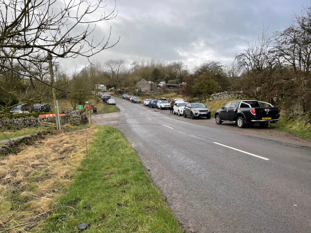
Parking is limited at Lathkill Dale, unlike other well-known walks in the Peak District. You have a couple of options: park at the beginning of the footpath or in Monyash village, a short distance up the road.
If you’re interested in exploring Lathkill Dale from a different angle, you can park in Over Haddon, although this walk doesn’t start from there.
Lathkill Dale Footpath & Toilets (Free)
- Address: Church St, Monyash, Bakewell DE45 1JH
- Cost: Free (Leave a donation to the local parish in the box if you can)
Right outside Monyash village, there’s a small car park with a toilet block, fitting about 3 or 4 cars. Along the road, you’ll find a large layby for parking, as well as plenty of grassy areas. Just remember to park sensibly and not block anything.
Closer to Monyash, there’s another large layby that can accommodate a few more cars.
Given the popularity of this walk, parking spaces are limited. It’s a good idea to arrive early or later in the afternoon to make sure you get a spot.
Monyash Roadside Parking (Free)
- Address: Monyash, Bakewell DE45 1HE
- Cost: Free
In the village, there’s also quite a bit of roadside parking available. Just make sure it’s not specifically reserved for businesses or residents. Parking in the village gets very congested, especially at weekends when conditions are good for walking, so be considerate to local residents.
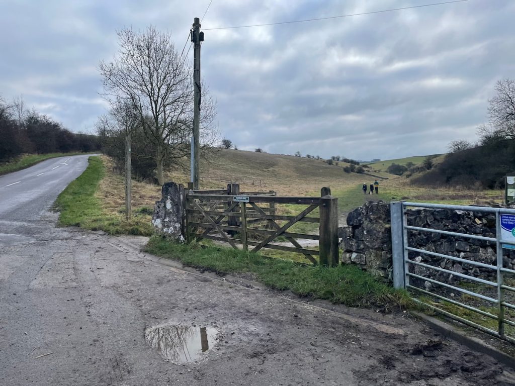
From the village, it’s only a short walk down the road to reach the start of the Lathkill Dale walk. Be careful on the way down, as it’s a tricky bend that is not very wide, making visibility quite poor for drivers.
Lathkill Dale Circular Walk Map
🔵 Easy-Medium | 🚶♂️ 6.6 km (4.1 mi) | ⛰️ Total Ascent: 139 m (455 ft) | ⏱️ 1.5-2 Hours
Download file for GPSThe walk begins near Monyash, leading down into the Lathkill Valley. Here, you’ll join a path along the river, passing several weirs and waterfalls. The route then leaves the valley, crossing open fields, before looping back to the starting car park.
Which hiking map app should I use? I recommend OS Maps Online for its unparalleled accuracy. However, if you’re a beginner, you might find AllTrails to be more user-friendly. For a detailed review of the best UK map apps, read my full review.
Lathkill Dale Walk Step by Step – 6.6km (4.1 mi) ~ 1.5-2hrs
WARNING: Visiting Lathkill Dale after heavy rain is not advised. The waterfall may be impressive, but the path along the river often floods.
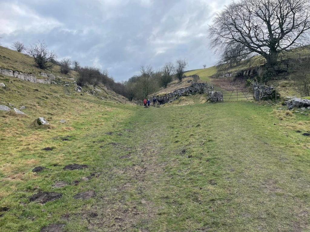
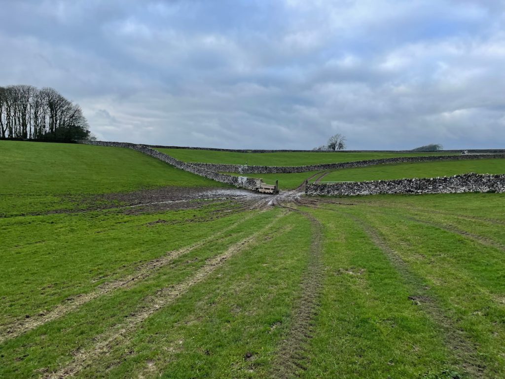
1. Leave the car park, cross the field leading down into the limestone valley, and go through the gate at the far end.
2. The path will descend into the valley. Follow it through a gate, avoiding the path going up on the right.
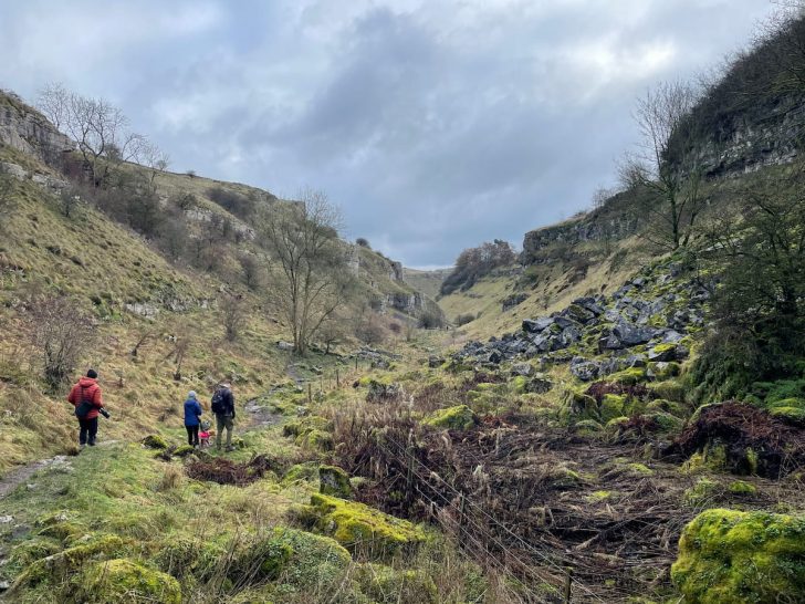
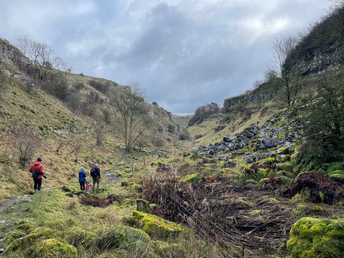
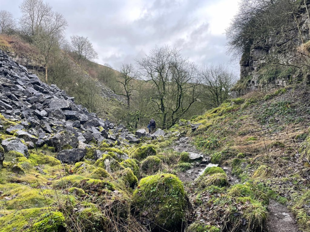
3. The path narrows and descends, revealing the area’s mining heritage. It’s rocky, so watch your step.
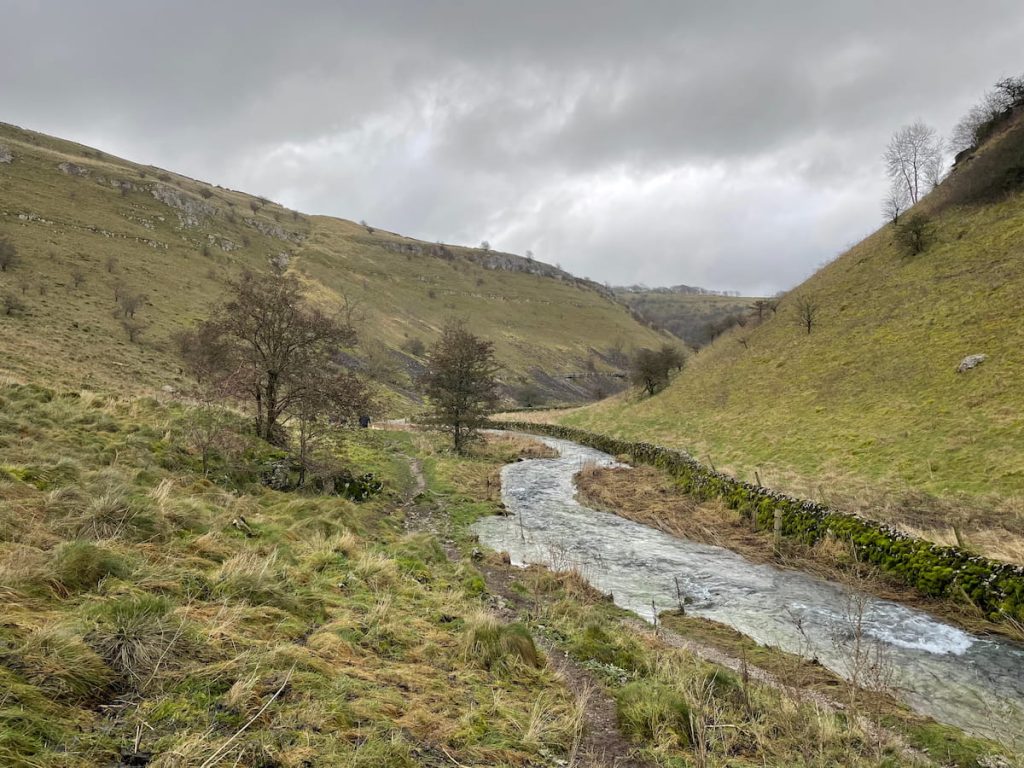
4. The path reaches a stone wall, and the valley opens up, showing the curving limestone cliffs.
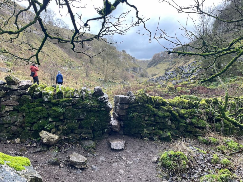
5. Continue to the River Lathkill, where water emerges from the cave. If water levels are high, the left-hand path may be submerged and impassable. Be ready to turn back if needed.
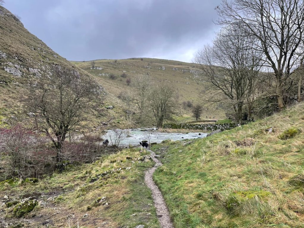
6. Follow the river, passing a footbridge on the right leading to the Limestone Way.
7. After a short while, you’ll reach the Lathkill Dale Waterfall. It’s not the most impressive waterfall in the Peak District, but it’s popular for wild swimming.
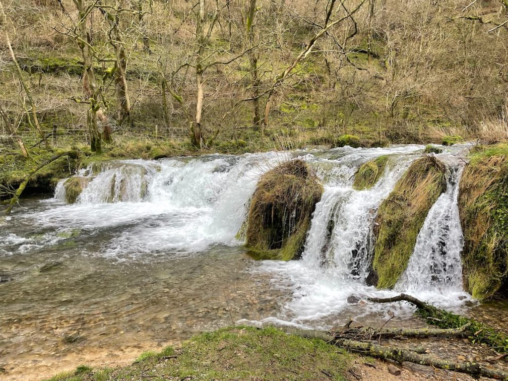
8. Continue along the river to a second weir. Here, a path leads uphill to the left in a sub-valley. Follow it as it winds up through a gate at the top. This is the only significant elevation on the walk.

Alternative: For a simpler route, continue along the river and return the same way.
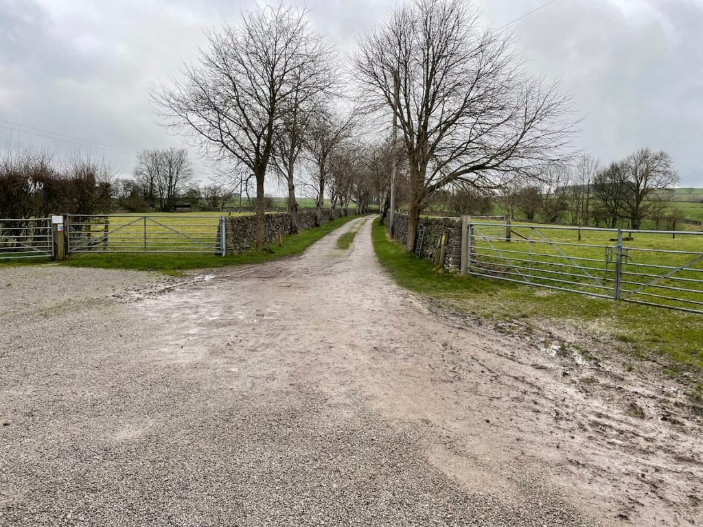
9. At the top, follow the public footpath through Mill Farm campsite to the road, then turn left.
10. Follow the road, which inclines slightly, around a right-hand bend. After about 100 metres, find a stile and gate to rejoin the footpath.
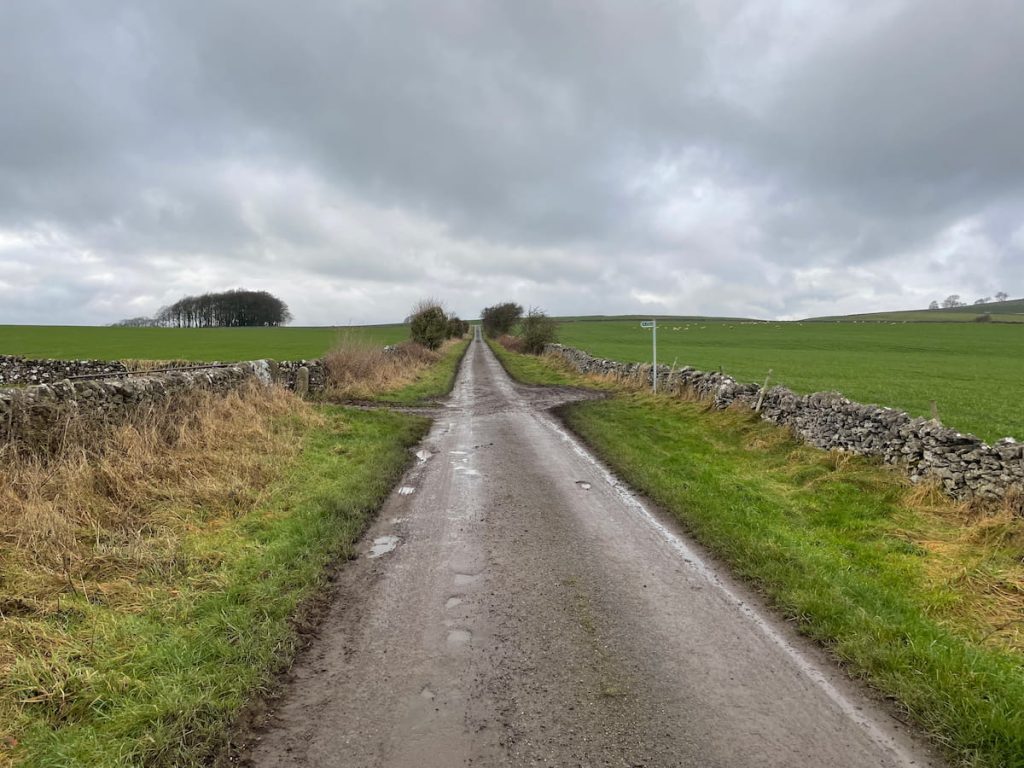
11. Follow the path along the wall through various fields. Use the map to locate stiles over walls, but there are also yellow-tipped footpath signs and silver-painted stone walls for guidance.
12. After crossing nine fields, you’ll return to the main road. Turn left and follow it back to the start of the route.
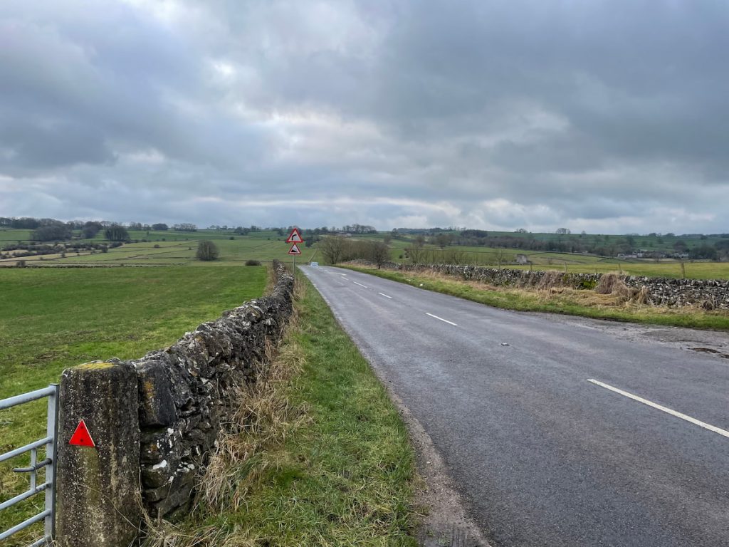
Note: The final stretch is on a busy main road with no footpath. Be cautious, especially with pets and children.
- Daypack: Choose a 10-20L daypack to carry all your gear comfortably.
- Clothing: Wear layered, moisture-wicking clothing and pack a waterproof jacket and waterproof trousers for changing weather.
- Footwear: Sturdy walking boots or trail shoes are essential for the varied terrain.
- Water & Snacks: Carry enough water (at least 1L per hour) and bring energy-rich snacks.
- Navigation: Always have a map and compass, and optionally, bring a reliable GPS app to stay on track.
- First Aid Kit: Include essential items like blister treatments and painkillers. A compact First Aid Kit is ideal.
- Emergency Items: A headtorch, whistle, and multi-tool can be vital in unforeseen situations.
Please note some of these links may earn us a commission from qualified purchases at no additional cost to you, which helps fund the free content we provide.
Amenities & Facilities

On the Lathkill Dale walk itself, facilities are quite limited. So, it’s important to bring everything you need and be ready to take all your rubbish back with you.
At the car park, there’s a free toilet maintained by the local community. If you can, they would appreciate any spare change as a donation. Keep in mind, that these toilets are closed during winter to prevent pipe damage.
Other nearby amenities include:
- The Bulls Head in Monyash (1 Minute Drive Away): This welcoming local pub serves real ales and has a pool table. It boasts a large garden and offers a menu full of classic pub dishes.
- The Old Smithy Tearooms & Restaurant (1 Minute Drive Away): A family-run cafe in the former village blacksmith shop that serves homemade and locally sourced meals, snacks, drinks and ice creams.
- Tagg Lane Dairy & Ice Cream Farm (3 Minutes Drive Away): A delightful farm shop and gelateria, providing authentic dairy products. It’s a great stop on a warm summer day.
- Bakewell (9 Minutes Drive Away or Walk from Bakewell): A traditional Peak District town famous for the “Bakewell Tart”. Here, you’ll find a variety of pubs, chip shops, and bakeries. See the full list of things to do in Bakewell.
- Buxton (15 Minutes Drive Away): As one of the largest towns in the Peak District, this spa town has all the amenities you might need, along with many more attractions and activities.
Lathkill Dale FAQs
What is the history of Lathkill Dale?
Lathkill Dale in Derbyshire is celebrated for its striking natural beauty and rich lead mining history dating back to the 13th century. The area is dotted with historical remnants like engine houses and aqueducts.
Notably, the medieval Conksbury Bridge is nearby, close to a village mentioned in the Domesday Book of 1086. Now, it’s a serene nature reserve, a stark contrast to its bustling mining past.
What river runs through Lathkill Dale?
The River Lathkill flows through the valley of Lathkill Dale. This river is famous for its crystal-clear waters, beginning at springs below Lathkill Head Cave and weaving through the dale.
It’s a central part of the area’s charm, supporting a rich variety of wildlife. The River Lathkill’s appearance varies with the seasons, often going underground in drier times due to its limestone base and the area’s mining history.
Can you swim in River Lathkill?
Yes, you can swim or paddle in the River Lathkill at certain spots, especially during high water levels.
There are small weirs along the river that create suitable places for swimming. The Lathkill Waterfall area is particularly popular for this.
What is the postcode for Lathkill Dale?
Lathkill Dale covers a broad area, with a short walk required to reach it. The nearest postcode is DE45 1JH, which brings you close to the start of the Lathkill Dale footpath and the public toilets.
If you enjoyed this walk, you might also love the Cave Dale walk in Castleton. It’s another stunning limestone valley, but this time, the path leads uphill, offering incredible peak district views of the Hope Valley!
Ron Jeffries
Thursday 4th of July 2024
Regarding the query about the history of Lathkill Dale, it's fascinating indeed. The dale has been a site of historical significance dating back centuries, with evidence of lead mining activities from as early as Roman times. Its natural beauty combined with its rich history makes it an intriguing place for both naturalists and historians alike.
Bella_swift_03
Wednesday 19th of June 2024
Just did the Lathkill Dale walk and OMG the views are to die for! Perfect for my Insta, def recommend!!!
Simon Peel
Monday 13th of May 2024
Okay, I've heard lots about Lathkill Dale, especially the circular walk. But what's the deal with facilities there? Last time I heard, the place was lacking. Has it got any better, or are we still expected to fend for ourselves out there?
John D
Tuesday 6th of August 2024
@Simon Peel,
Phil D
Monday 1st of July 2024
I agree with Jenny, improvements have been made but still room for much more. Don't keep your hopes too high though.
Jenny K
Monday 17th of June 2024
Simon, they have improved lately! There are now decent toilets and the footpath is much better maintained. Worth giving it another shot.
lil_tea_pot
Monday 22nd of April 2024
if Lathkill Dale got toilets, does it mean the trees get a lil privacy now? lol
Gary Fisher
Thursday 14th of March 2024
I've visited Lathkill Dale multiple times and it never disappoints. The free parking on Monyash Road is quite handy, but do get there early as it fills up quick!