
The oldest national park in the UK offers a range of walks and landscapes to enjoy, including rolling hills, open moors, reservoirs, and trails. It’s tough to choose, but in this guide, we’ve narrowed down the list to some of the best and most well-rounded walks and hikes that you’re sure to remember!
Below is a list to quickly help you pick a walk for any occasion or setting, based on personal opinion and first-hand experiences.
Here’s the best list:
- 🏆 Best overall Peak District Walk: Mam Tor & the Great Ridge
- 💧 Best Reservoir Walk: Dovestone Reservoir
- ⛰️ Best Hill Walk: Stanage Edge
- 🛣️ Best Trail / Easy Walk: Monsal Trail
- 🌇 Close to Manchester: Errwood Reservoir
- 🌃 Close to Sheffield: Ladybower Reservoir or Derwent Dam
- 🚶♂️Short Walk: Solomons Temple
- 👨👩👧 Best Family Walk: Padley Gorge
- 🪨 Best Stepping Stone Walk: Chee Dale Stepping Stones
- 🛩️ Crash Site Walk: B29 “Overexposed” Crash Site
- 🏞️ Best Cave Walk: Thor’s Cave
- 🧗♂️ Best Scrambling Walk: The Dragon’s Back (Chrome & Parkhouse Hill)
- 🏊♀️ Best Waterfall & Wild Swim Walk: Three Shires Head or the Trinnacle Trail
Below is a map of some of the best and most popular walks across the peak district:
Almost all of these walks are circular, with some iconic spots or point of interest, which the walk is usually named after.
Best walks in the Peak District National Park
Below is my personal order of the top walks in the Peak District National Park if I had to do them over again.
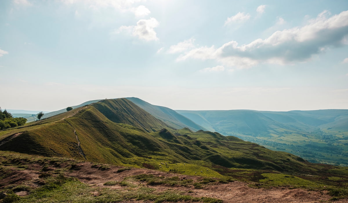
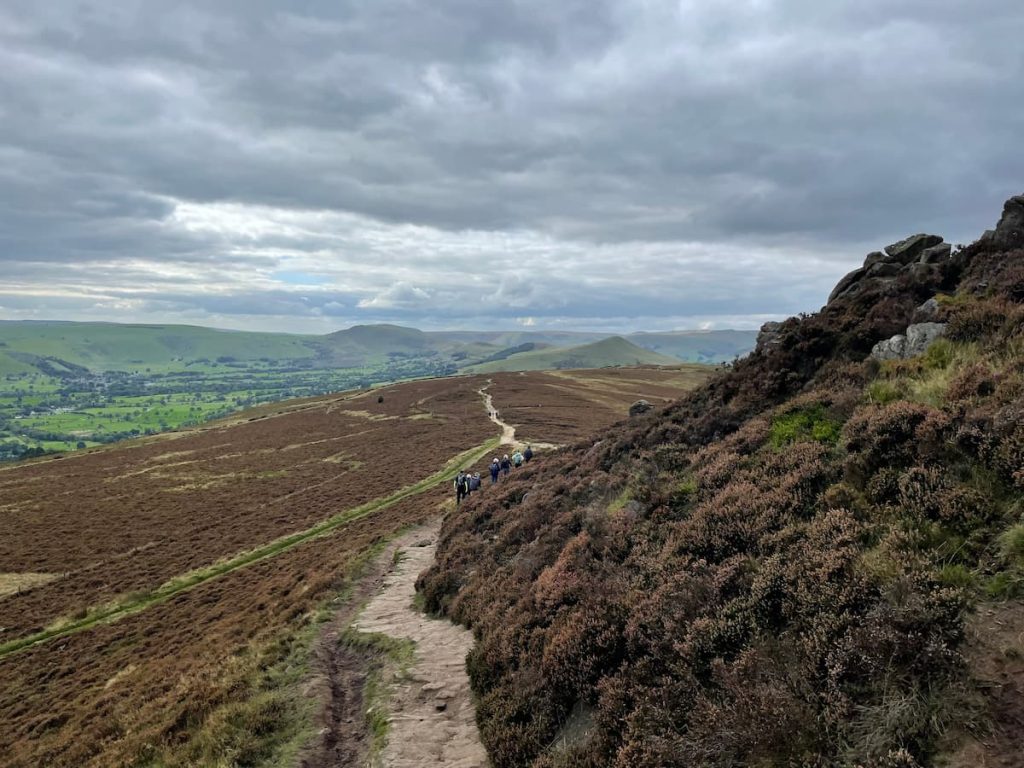
1. Mam Tor & the Great Ridge
🟡 Medium | 🚶♂️ 11.36 km (7.06 mi) | ⛰️ Total ascent: 473 m (1,552 ft) | ⏱️ 3-4 Hrs
Starting Point: National Trust Mam Nick Car Park (Paid)
One of the best-loved walks in the Peak District is the Mam Tor and Great Ridge trail. It gives you amazing 360-degree views from the top, which extends for miles as you cross the ridge.
Large sections of the Mam tor path are well paved and easy to follow, making it a great walk for anyone new to exploring the Peak District National Park.
This particular route goes over Hollins Cross, Back Tor, Lose Hill, and into Castleton, covering a distance of 7.13 miles (11.5km). However, should you wish, it can be shortened significantly for those with less ability or appetite for a long walk.
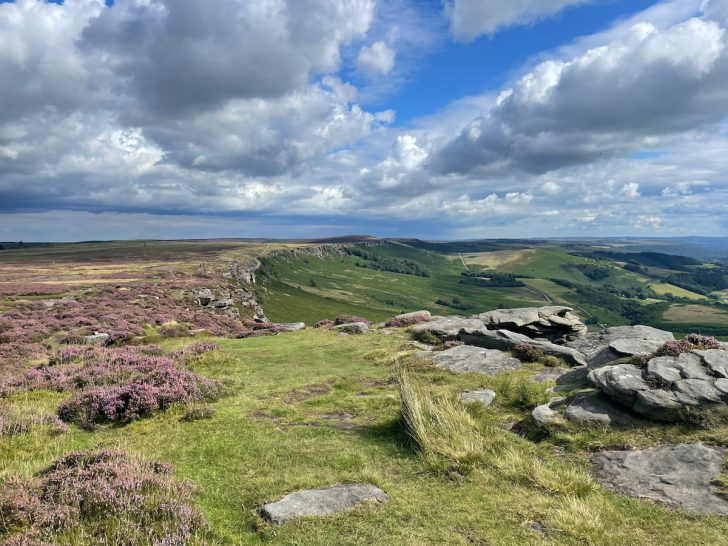
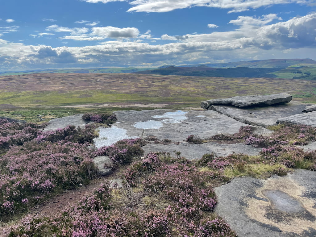
2. Stanage Edge
🟡 Easy-Medium | 🚶♂️ 7 km (4.35 mi) | ⛰️ Total ascent: 219 m (719 ft) | ⏱️ 2-3 Hrs
Starting Point: Hollin Bank Car Park (Paid)
Stanage Edge is renowned for its striking cliffs. This area offers circular walking routes with spectacular views of the surrounding hills and moors, especially from its highest point, High Neb.
The route is adaptable, allowing walkers to lengthen or shorten their journey. Once you get on the Edge, the walk flattens as you cross the “long causeway”.
Stanage Edge is not only a walker’s delight but also a popular spot for climbers, boasting over 2,000 climbing routes across diverse terrains. Look out for the famous Robin Hood cave, which is said to be steeped in legend. The area is also known for recent celebrities, with Keira Knightly filmed here for Pride & Prejudice.
Download file for GPS3. Bamford Edge
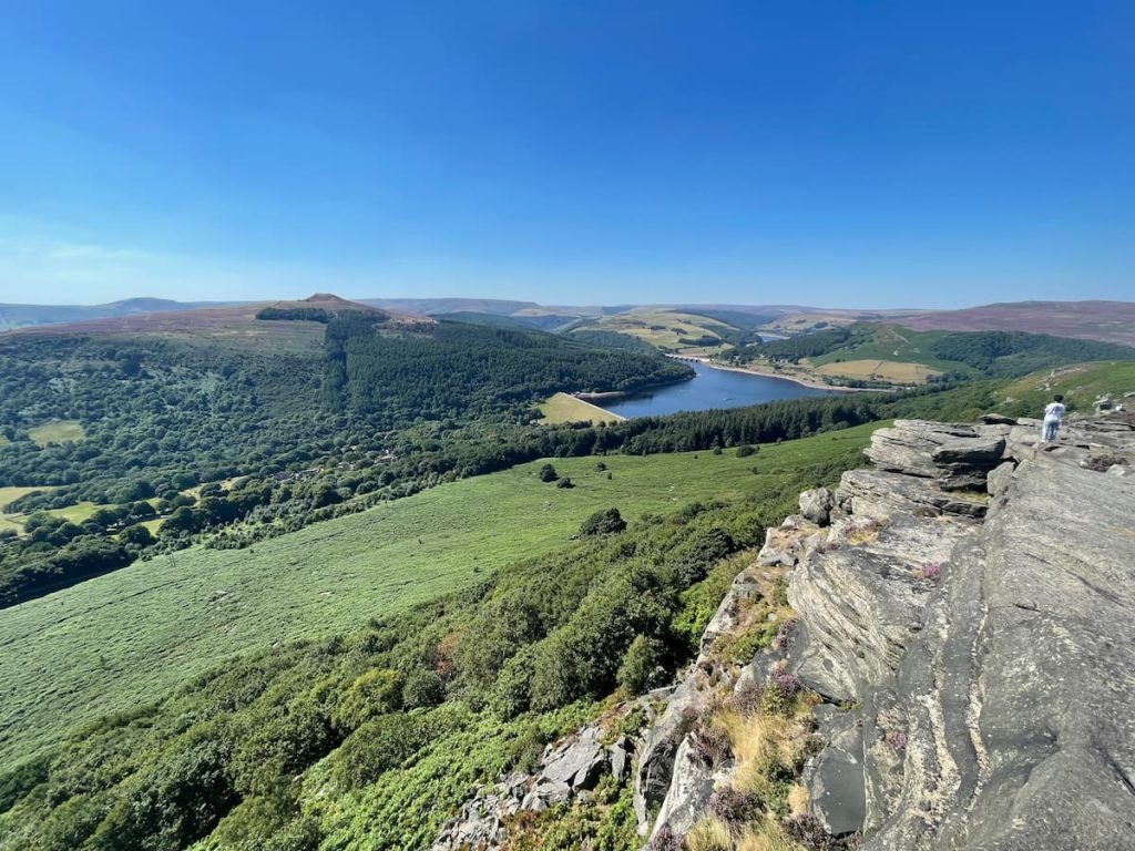
🔵 Medium | 🚶♂️ 5-9 km (3-6 mi) | ⛰️ Total Ascent: 210-320 m (690-1050 ft) | ⏱️ 1.5-3 Hrs
Starting point: Heatherdene Car Park
Bamford Edge is a popular spot for photography in the Peak District. It’s famous for its Peak District views from an overhanging rock. From here, you can see the stunning Ladybower Reservoir, Derwent, and other noticeable hills around.
There’s a straightforward 5km (about 3.3 miles) walk you can take. It starts with a quick climb from Heatherdene car park. Alternatively, you can choose a path that goes around in a loop. This way takes you through the village of Bamford and then back, passing over the reservoir.
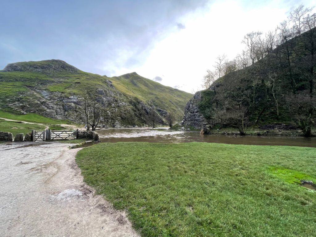
Download file for GPS4. Dovedale & Thorpe Cloud
🟢 Easy | Various Distances & Routes
Starting Point: Dovedale National Trust Car Park
Dovedale, in the southern part of the Peak District, has been a favourite spot for visitors since Victorian times. This area is loved for its long valley, Ilam Hall, quaint villages, and famous stepping stones.
There are a few walks to enjoy around Dovedale. A top choice is to walk along the river to Milldale, passing by Lover’s Leap and Reynard’s Cave. You might also like to take a short side trip to the top of Thorpe Cloud, where you’ll be rewarded with fantastic views of the surrounding area.
See OS Map Online – River Walk
See OS Map Online – Thrope Cloud
Download file for GPS- Daypack: Choose a 10-20L daypack to carry all your gear comfortably.
- Clothing: Wear layered, moisture-wicking clothing and pack a waterproof jacket and waterproof trousers for changing weather.
- Footwear: Sturdy walking boots or trail shoes are essential for the varied terrain.
- Water & Snacks: Carry enough water (at least 1L per hour) and bring energy-rich snacks.
- Navigation: Always have a map and compass, and optionally, bring a reliable GPS app to stay on track.
- First Aid Kit: Include essential items like blister treatments and painkillers. A compact First Aid Kit is ideal.
- Emergency Items: A headtorch, whistle, and multi-tool can be vital in unforeseen situations.
Please note some of these links may earn us a commission from qualified purchases at no additional cost to you, which helps fund the free content we provide.
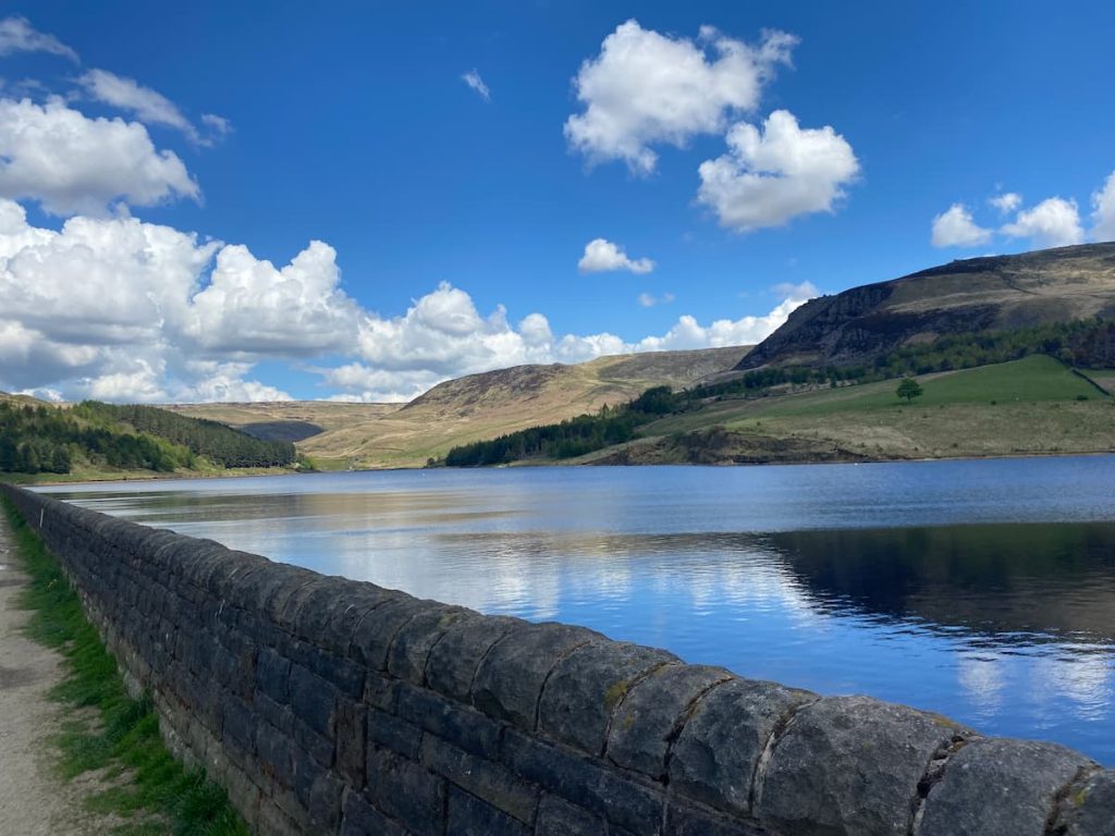
5. Dovestone Reservoir
🟢 Easy | 🚶♂️ 4.3 km (2.67 mi) | ⛰️ Total Ascent: 45 m (149 ft) | ⏱️ 1-2 Hrs
Starting Point: Dovestone Reservoir Car Park
On the western edge of the Peak District National Park, just a short journey from Greater Manchester, you’ll find Dovestone Reservoir. This is a well-liked walk that’s mostly flat and suitable for a range of abilities.
You have the option of a 4.3km (2.7 miles) circular route around the reservoir, which usually takes about 1-2 hours. Alternatively, you can venture into the hills around Dovestone, like heading up to the Trinnacle. You can then loop back through the surrounding moors before returning to your starting point.
Whichever path you choose, the variety of landscapes at Dovestones promises to make your visit a memorable one.
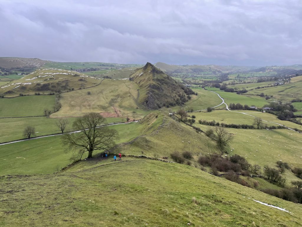
Download file for GPS6. Parkhouse & Chrome Hill Walk (The Dragon’s Back)
🔴 Hard (+Scramble) | 🚶♂️ 6-7 km (4-4.5 mi) | ⛰️ Total Ascent: 283-389m (929-1275 ft) | ⏱️ 2-3 Hrs
Starting Point: Village of Hollinsclough or Earl Sterndale.
Parkhouse and Chrome Hill, famously known as the “Dragon’s Back,” resemble a dinosaur in the Peak District with their spiky, towering hills.
The journey guides you across stunning fields and up the steep hills, including some scrambling – ideal for those seeking a bit of an adventure.
For those eager for a challenge, climbing both hills is an option. Alternatively, focusing on Chrome Hill alone is also an option. This walk can be demanding, so it’s best undertaken by those with some hiking experience under their belt.
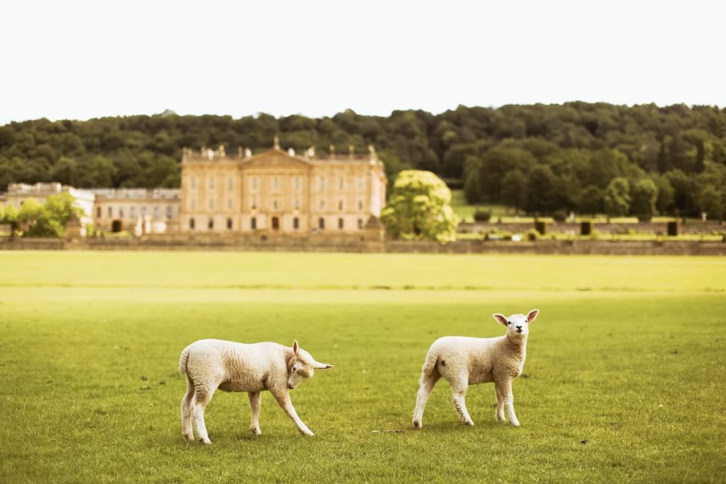
Download file for GPS7. Chatsworth & Estate
🟢 Easy | Various Distances & Routes
Starting Point: Chatsworth House Car Park
Chatsworth House estate, nestled in the Peak District, is renowned for its splendid house, gorgeous gardens, and rich history.
A visit to Chatsworth allows you to explore the grand house brimming with art and historical gems. The gardens are a treat as well, showcasing detailed designs and lovely water features. For younger guests, the farmyard and adventure playground are also perfect for fun and exploration.
Chatsworth House offers something for everyone, whether you’re a fan of history or art or just enjoying a day in a beautiful setting. The estate also features walks that loop around to the viaduct, Hunting Tower, Birchen Edge, or even over to Bakewell, making it an ideal destination for a memorable day out.
Full Routes – Still a work in Progress
8. Padley Gorge
🟢 Easy-Medium | 🚶♂️ 5-6 km (3-3.8 mi) | ⛰️ Total Ascent: 150-202 m (500-663 ft) | ⏱️ 1-2.5 Hrs
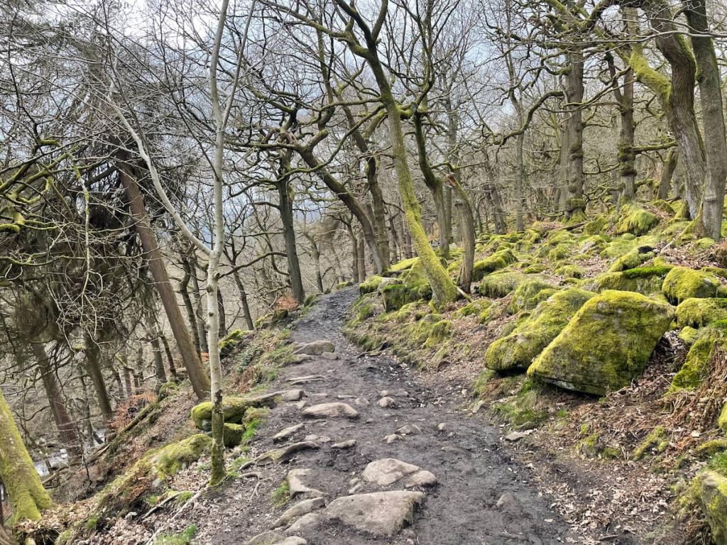
Padley Gorge is a perfect choice for family walks, featuring gently flowing streams, tumbling waterfalls, and ancient woods, along with the nearby Longshaw Estate.
For those seeking a bit more of a challenge, the longer walk, you can include Longshaw Estate and keep an eye out for Deer. This route offers more of the stunning scenery that the Peak District is known for.
Whether it’s paddling in the stream, playing around, or simply soaking in the natural beauty, Padley Gorge is an excellent spot for a family day out in the Peak District.
Download file for GPS9. The Roaches
🟡 Medium | 🚶♂️ 6.7 km (4.2 mi) | ⛰️ Total Ascent: 277 m (908 ft) | ⏱️ 2-2.5 Hrs
Starting Point: Roach Ln, Leek
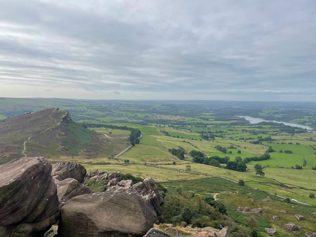
Just outside of Leek in the Staffordshire south-west edge of the Peak District, The Roaches offers a spectacular circular walk. Known for its craggy landscape, derived from the French word “roches”, it’s a popular spot for climbers, bolderers and hikers.
The Roaches walk spans about 6.7 km (4.2 miles) and can be completed in around 2 to 2.5 hours. It includes major landmarks like Hen Cloud, offering a gentle ascent towards The Roaches’ trig point. Along the route, you’ll be treated to breathtaking views of Staffordshire and the shimmering Tittesworth Reservoir.
For those seeking a longer journey, you can extend your walk to Lud’s Church, adding about 2 hours and covering an additional 5.2km (3.24 miles).
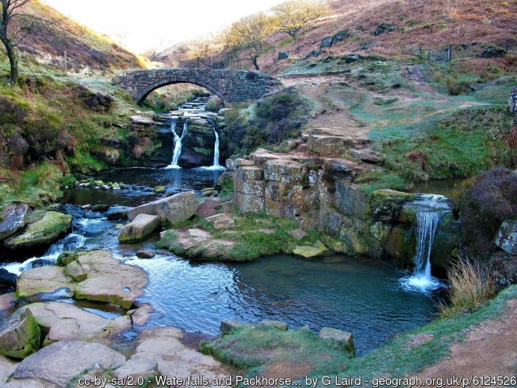
Download file for GPS10. Kinder Scout & Kinder Plateau
🟡 Medium | 🚶♂️ 15 km (9.3 mi) | ⛰️ Total ascent: 616 m (2,020 ft) | ⏱️ 4-5 Hrs
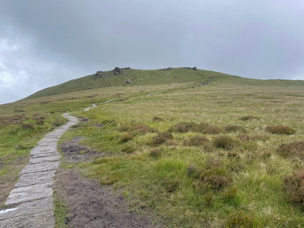
Kinder Scout is the highest mountain in the Peak District, offering a rewarding yet challenging hike.
Routes generally start from Edale and take several hours to complete a circular path. On the Kinder Plateau, you’ll find Kinder Downfall, a well-known waterfall. It’s located on the River Kinder, and during high winds, the water blows back on itself, creating a steam cloud visible from afar.
If you’re looking for one of the best hikes in the Peak District, Kinder Scout is one to tick off your list and claim the highest point in the Peaks while your at it.
Download file for GPS11. Lud’s Church
🟡 Medium | 🚶♂️ 11.4 km (7 mi) | ⛰️ Total ascent: 439 m (1,440 ft) | ⏱️ 3-5 Hrs

Starting Point: The Roaches
Lud’s Church, is a striking natural chasm created by a massive landslip in the Millstone Grit bedrock above Gradbach, Staffordshire. This 100-metre long and 18-metre deep chasm, covered in lush moss and maintaining a cool atmosphere even on the warmest days, offers an enchanting walk through history and legend.
The walk to Lud’s Church is an adventure into another world. Its deep green hue starkly contrasts the open landscape of the Roaches a short distance away.
Accessible via the Roaches, Back Forest, or Gradbach, the walk to Lud’s Church can be circular, winding through rocky paths and forested areas. It’s a route that takes you back in time, inviting you to explore the deep, mossy chasm that has captivated visitors with its unique blend of natural beauty and historical mystique.
Whether you’re interested in the rich tapestry of English history, folklore, or simply in search of a unique walking experience, Lud’s Church in the Peak District offers a journey unlike any other.
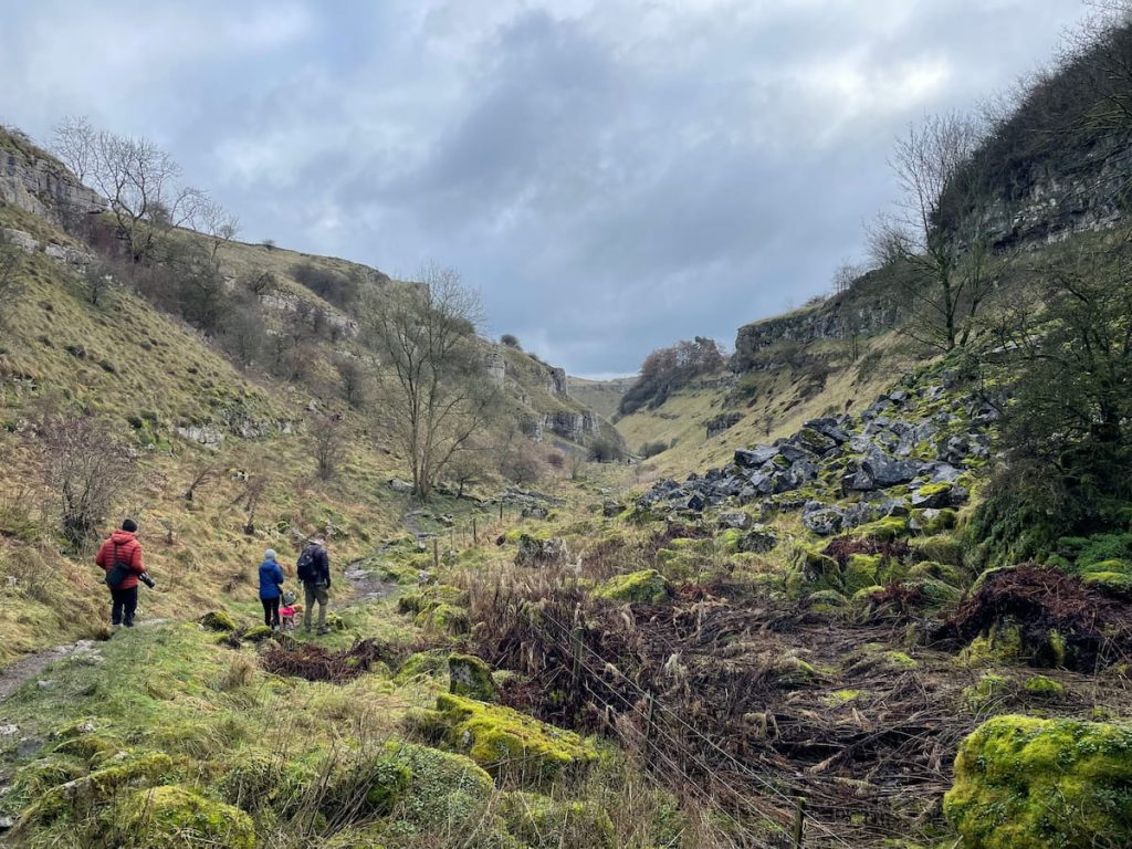
Download file for GPS12. Cave Dale
🟡 Medium | 🚶♂️ 4.3 km (2.7 mi) | ⛰️ Total Ascent: 221 m (725 ft) | ⏱️ 1.5-2 Hrs
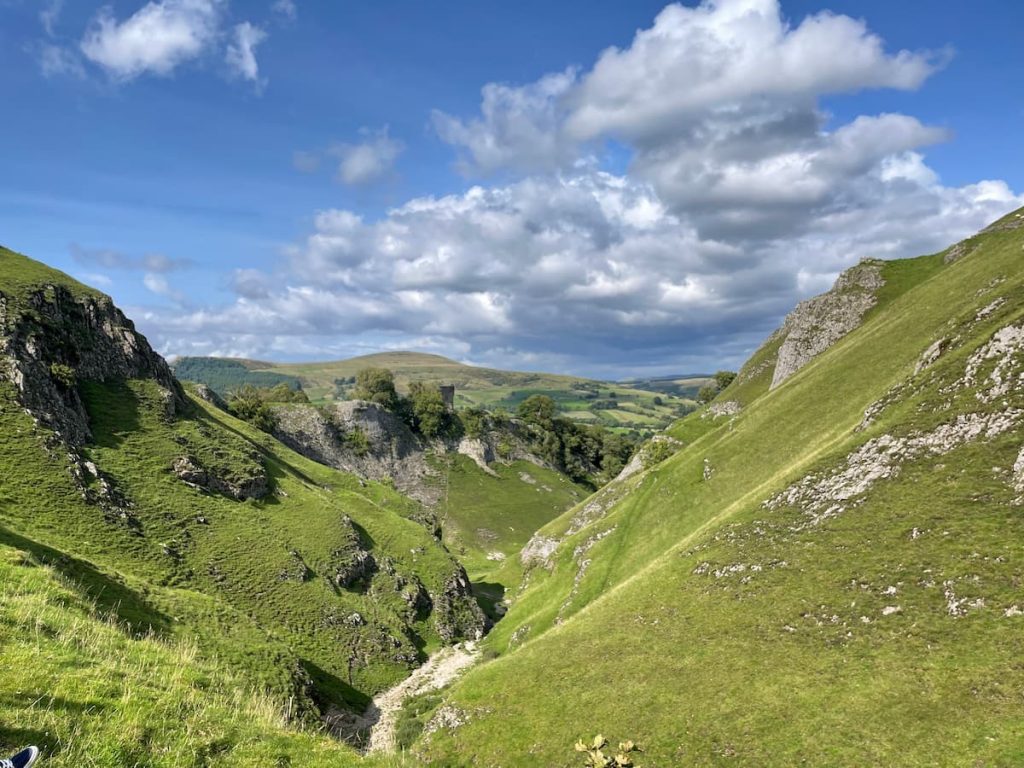
Starting Point: Castleton Car Park – HPBC or Peak Cavern Car Park
Cave Dale, a captivating limestone valley just outside the picturesque village of Castleton, offers an enchanting walk through the ancient naturally formed landscape.
The path through Cave Dale ascends, flanked by almost vertical valley sides. Along the way, you’ll discover small caves and enjoy increasingly spectacular views, culminating in a stunning perspective of Peveril Castle and the valley.
Cave Dale is a must-visit for anyone exploring the Hope Valley area. This short circular route, approximately 4.3 km (2.7 miles) long, can be comfortably completed in 1-2 hours. Alternatively, you can create a much longer circular route over to Winnats Pass or Mam Tor.
Whether you’re an avid hiker or simply looking for a peaceful walk around Castleton, this route promises a memorable experience.
Download file for GPS13. Chee Dale Stepping Stones
🟡 Medium | 🚶♂️ 5.2 km (3.2 mi) | ⛰️ Total Ascent: 143 m (469 ft) | ⏱️ 1.5-2.5 Hrs
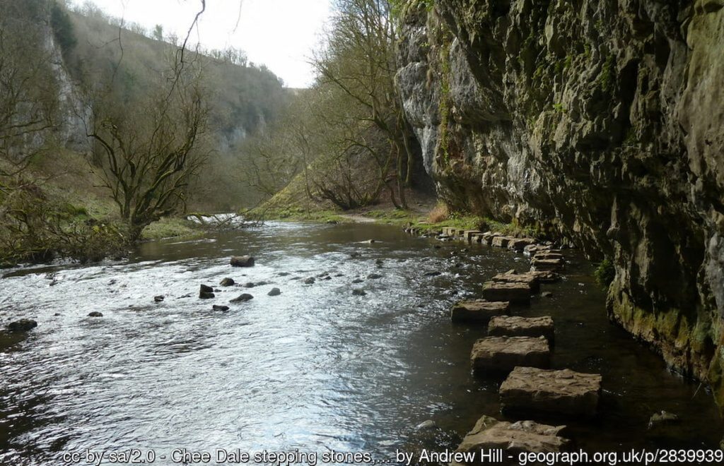
Starting Point: Millers Dales Car Park
Chee Dale Stepping Stones offers a unique and enchanting experience for visitors. It is renowned for its stepping stones, which pave a path along the River Wye.
The shorter trail is about 3.2km (2 miles) long and offers a more direct, faster journey via the Monsal Trail. For those seeking a longer adventure, the circular route covers approximately 5km (3.2 miles), following the river first. Both paths promise breathtaking scenery and an immersive nature experience.
Summer is the best time to visit the stepping stones, as the path can be muddy and the river levels high at other times, submerging the route.
View the other Peak District stepping stone walks.
Download file for GPS14. Win Hill
🔴 Medium-Hard | 🚶♂️ 5.2 km (3.2 mi) | ⛰️ Total Ascent: 143 m (469 ft) | ⏱️ 1.5-2.5 Hrs
Starting Point: Heatherdene Car Park
Win Hill is known for its steep ascents, panoramic views, and historical significance.
This Win Hill walk is about 6km (3.7 mi) long and typically takes around 2 hours. The route starts at Heatherdene car park (The same starting point as Bamford Edge), crossing the Ladybower dam before ascending a steep hill to the summit of Win Hill, where you’ll be rewarded with stunning 360-degree views. The descent is gentler, leading you through a forest and back over the dam to the car park.
Due to its steepness, the climb can be challenging, but the effort is well worth it for the breathtaking views at the top. An anti-clockwise approach is recommended for those preferring a gentler ascent.
Download file for GPS15. Thor’s Cave
🟢 Easy-Medium | Various Distances & Routes

Thor’s Cave, located near Wetton in the Staffordshire Peak District, is a natural limestone cavern that offers a unique hiking experience.
The hike to Thor’s Cave involves a steep ascent leading to the cave’s entrance, which sits about 80 metres above the ground in the Manifold Valley. Inside the cave, visitors can enjoy a cool atmosphere, with natural light streaming through the various openings and tunnels that offer a glimpse into its deeper recesses.
The cave is historically significant, with evidence of human occupation dating back to the late Stone Age, around 11,000 years ago, and continuing through the Iron Age and Roman period. Excavations have unearthed stone tools, pottery, amber beads, bronze items, and the burial sites of at least seven people.
Full Routes – Work in Progress
16. B29 ‘Overexposed’ Crash Site (Bleaklow)
🟡 Medium | 🚶♂️ 6.5 km (4 mi) | ⛰️ Total ascent: 219 m (142 ft) | ⏱️ 1.5-3 Hrs
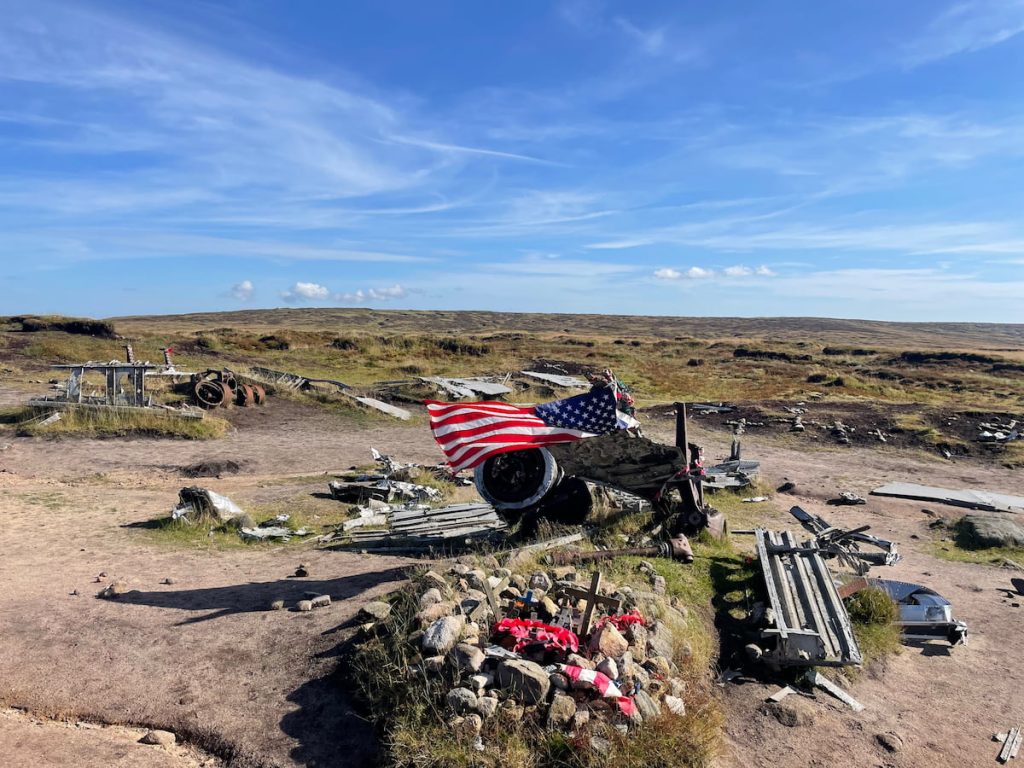
The B29 ‘Overexposed’ crash site walk in Bleaklow Moor is a poignant and atmospheric hike that leads to the remains of a Boeing B-29 Superfortress, which tragically crashed in November 1948 due to bad weather.
Visitors are urged to be respectful, not to climb or play on the wreckage, and to leave the site as they found it. A memorial plaque at the site pays tribute to the 13 crew members who lost their lives in the crash.
This walk offers a moment of reflection amidst the natural beauty and stunning views over Manchester and the surrounding Peak District National Park.
Download file for GPS17. Solomon’s Temple
🟢 Easy | 🚶♂️ 5 km (3.1 mi) | ⛰️ Total Ascent: 145m (476 ft) | ⏱️ 1-2 Hours
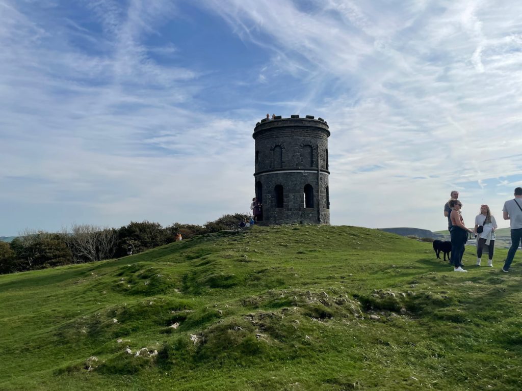
Starting Point: Poole’s Cavern Car Park (Next to GoApe)
Solomon’s Temple atop Grin Low Hill is a great short and family-friendly walk, which includes a woodland trail and an old Victorian folly.
From the top, you can see panoramic views of Buxton and the stunning surrounding peaks. For this Buxton walk, you can either opt to walk from the town centre or park outside Buxton Country Park for a shorter route.
Download file for GPS18. Monsal Trail
🟢 Easy | 🚶♂️ 1-15 km (1-9 mi) | ⛰️ Total ascent: 100-200 m (30-60 ft) | ⏱️ 0.5-4.5 Hours
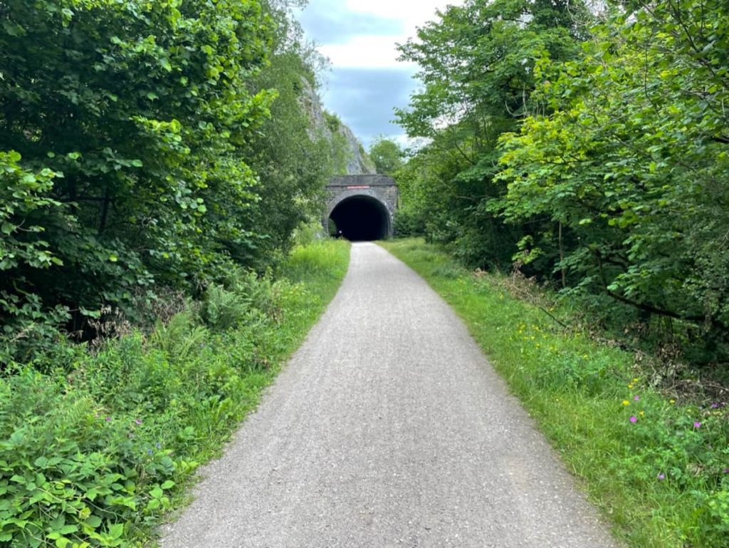
Starting Point: Bakewell, Miller’s Dale, or Wyedale
The Monsal Trail is perfect for walkers, cyclists, horse riders, and wheelchair users who can enjoy a peaceful journey through the beautiful limestone dales of the Peak District National Park.
Spanning approximately 8.5 miles, the trail connects Blackwell Mill (Just outside of Buxton) in Chee Dale to Coombs Road in Bakewell.
The trail was once a former midland railway line connecting Manchester to London, which closed in 1968, with many tunnels reopened in 2011 by the national park authority.
The railway line now creates a wide, flat path that cuts through the hills with tunnels and crosses gouges with stunning bridges.
19. Birchen Edge
🟢 Easy-Medium | Various Distances & Routes

The Birchen Edge walk is a delightful circular hike. The walk is not only fun but also educational. It features Nelson’s Monument, a gritstone column erected in 1810 in honour of Lord Nelson. Near this monument, you’ll find the ‘Three Ships’ rocks, each carved with the names of three of Nelson’s ships: Victory, Defiance, and Royal Sovereign.
Birchen Edge offers a blend of natural beauty, historical interest, and fun climbing opportunities, making it an ideal choice for a hike in the Peak District.
Full Routes – Work in Progress
20. Shinning Tor
🔵 Medium | 🚶♂️ 6.7-11.5km (7-4 mi) | ⛰️ Total Ascent: 169-441m (554-1446 ft) | ⏱️ 2-4 Hours

Starting Point: The Street Car Park (Errwood) or Pym Chair car park
Shining Tor is the highest point in Cheshire and is nestled in the Goyt Valley above Errwood Reservoir.
There are several options for reaching the trig point. You can either take a shorter and direct route along the moor or a longer walk that circles the Reservoir and the ruin of Errwood Hall.
Whichever you decide, on a clear day, you’ll be able to see the skyline of Manchester as well as a Jodrell bank in the Cheshire Plain.
21. Lathkill Dale
🔵 Easy-Medium | 🚶♂️ 6.6 km (4.1 mi) | ⛰️ Total Ascent: 139 m (455 ft) | ⏱️ 2-3 Hours
Lathkill Dale is a charming limestone valley featuring a river and waterfalls, surrounded by an area steeped in mining heritage.
The journey begins near Monyash village, close to Bakewell, and descends into the valley, following the river’s path. It then loops back, crossing the open fields above.
In Lathkill Dale Valley, you’ll find a delightful combination of craggy limestone cliffs, woods, caves, and babbling streams.
Download file for GPS22. Three shires Head
🔵 Medium | 🚶♂️ 7 km (4.5 mi) | ⛰️ Total Ascent: 264 m (866 ft) | ⏱️ 2 Hours
Starting Point: Clough House Car Park
The Three Shires Head is a picturesque waterfall where the three counties of Staffordshire, Cheshire, and Derbyshire meet. It is renowned for wild swimming in the Peak District, thanks to its natural pools and cascading waterfalls.
Discover the charm of this circular route, starting and finishing at the Clough House Car Park. As you journey, you’ll pass through varied landscapes of rolling hills, babbling streams, and the iconic Three Shires Head.
So, whether you’re a keen walker or a lover of a cold plunge, this could be the perfect walk for you.
Download file for GPSThis is just a short overview of the most iconic and best Peak District walks. While there are many more and far too many to detail, here’s a continuation of the ordered list:
24. Winnats Pass
25. Derwent Dam or Via Slippery Stones
26. Reynards Cave
27. Jacob’s Ladder
28. Hen Cloud
The remaining walks are also popular in the Peak District, but they have yet to be ranked:
- Curbar Edge
- Derwent Edge
- Alport Castles
- Wolfscote Dale
- The Trinnacle (Above Dovestone)
- Carsington Water
- Darwin Forest
- Tittesworth Reservoir – A great circular walk
- Shutlingsloe
- Langsett Reservoir
- Crook Hill
- Torside Reservoir
- Rudyard Lake
If you’re looking for a hike over a few days, The Limestone Way offers a remarkable multi-day walking experience, stretching 46 miles from Rocester to Castleton. This scenic path takes you through rolling hills and charming villages, perfect for enjoying England’s oldest national park at a leisurely pace.
Main Types of Walks in the Peak District
Whether you choose the White or Dark Peaks, there are a variety of walks and settings to enjoy. While the Peak District may not have the towering fells found in the Lake District or other parts of England and the UK, it offers plenty of rolling hills, open moors, reservoirs, caverns, and trails to explore across the counties of Derbyshire, Cheshire and Staffordshire.
The reservoir walks, like those around Ladybower Reservoir or Dovestone, are generally the flattest and easiest for most people. There are also trails, such as the Monsal Trail or Tissington Trail, which follow flat, disused railway lines.
Alternatively, those seeking a more adventurous walk can choose from many edge and ridge walks, such as Stanage Edge, Bamford Edge, or Mam Tor. Lastly, there are river and cave walks, which often follow a river for a long stretch and typically include a cave. Examples include Thor’s Cave, Reynard’s Cave, and even Lathkill Dale.
Lastly, opt for a walk based from one of the many towns and villages that dot the National Park:
SP
Thursday 6th of March 2025
Wow! This is pretty much what anyone needs to know before planning. Very informative!
Vic K.
Monday 17th of June 2024
The geology of the Peak District is absolutely fascinating, especially areas like the Roaches and Lud's Church. The geological formations are a testament to the earth’s history and make for an incredible hiking experience.
MartyMc
Wednesday 12th of June 2024
Interesting read! However, I noticed a slight mistake. The B29 'Overexposed' Crash Site is actually located on Higher Shelf Stones, which is on Bleaklow and not directly in the list above. It’s a minor detail but thought it worth mentioning for accuracy.
SaraLoo123
Tuesday 4th of June 2024
Lathkill Dale looks like something out of a fairy tale, can’t wait to visit. Great list btw, really helpful.
Mikey J
Saturday 1st of June 2024
imagine stumbling on a b29 crash site, cool history lesson or horror movie start.