Immerse yourself in the alluring charm of the Peak District with my guide to the Three Shires Head Walk and Waterfall.
This picturesque hike leads you to the popular Three Shires Head—a stunning waterfall where three counties meet—but you’ll also discover opportunities for wild swimming in natural pools and cascading waterfalls.
So whether you’re a keen walker, an outdoor enthusiast, or simply longing for a little escape, this walk through the heart of the Peak District promises a unique experience!
Getting to the Three Shires Head Waterfall
To get to the Three Shires Head Waterfall, you’ll need to park or get dropped off on the A54 and walk in.
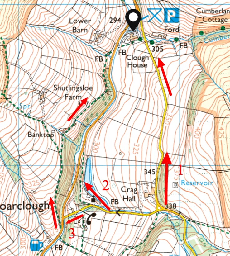
Alternatively, you can park at the nearby Clough House Car Park, where this mapped route starts.
Three Shires Head Parking
Clough House Car Park (Free)

- Address: Wildboarclough, Macclesfield SK11 0BD or ///blast.sweetly.introduce
- Cost: Free
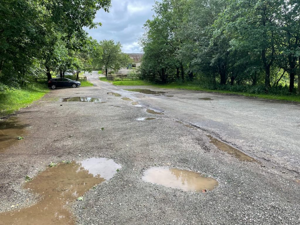
Clough House is the main car park in the area, offering a good amount of parking space. While there are no toilets or water fountains, several picnic benches by the stream make for a pleasant spot on a warm day.
Layby along the A54
If you want to get closer to the Three Shires Head waterfall, there are a couple of laybys along the A54 where people often park, although spaces are limited.
The locations are:
You’ll then have to walk up the road or cut across to rejoin the path this article discusses.
Public Transport
To my knowledge, there are no public transport options to get close to the three Shires’ head waterfalls.
The closest towns with major train stations are Macclesfield (18-minute drive), and Buxton (11-minute drive), so it may be possible to get a taxi there and back from those stations.
Get dropped off at ///snack.appealing.metals. This is the closest place, just a 10-15 minute walk.
Three Shires Head Walking Map & Route
Download file for GPSThis route starts off at clough house car park, with a gradual ascent, towards the steepest point of the walk (get it over early!), and leads down to the Three Shires Head waterfall just before the halfway mark. You then head over to the charming village of Wildboarclough, where you have options to extend or shorten the walk.
Which hiking map app should I use? I recommend OS Maps Online for its unparalleled accuracy. However, if you’re a beginner, you might find AllTrails to be more user-friendly. For a detailed review of the best UK map apps, read my full review.
Three Shires Head Step by Step – 7.5KM (4.7mi) Route
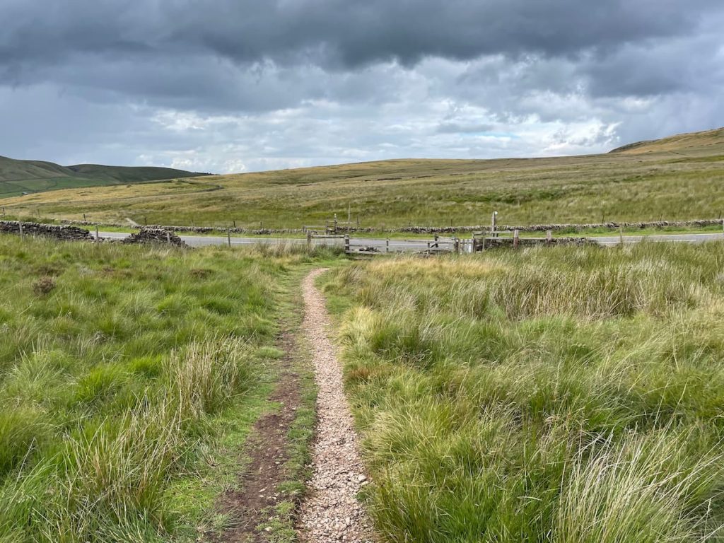
- Head out of the car park, past the farm yard, across the road and through a gate.
- Start the ascent, where you’ll cross over a small footbridge, followed by a gate.

- Keep heading up the hill, past the abandoned cottage, until you reach a small waterfall and gate.

- Turn RIGHT, and keep meandering uphill, where you’ll start to level out and see a main road (Don’t worry, this is the highest point of the route!).

- You’ll need to cross the road, take a left and climb down the large metal staircase.
Note: This is a fast, busy road, and the path is quite steep and narrow to cross, so it’s best to be mindful here.

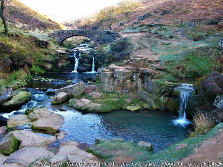
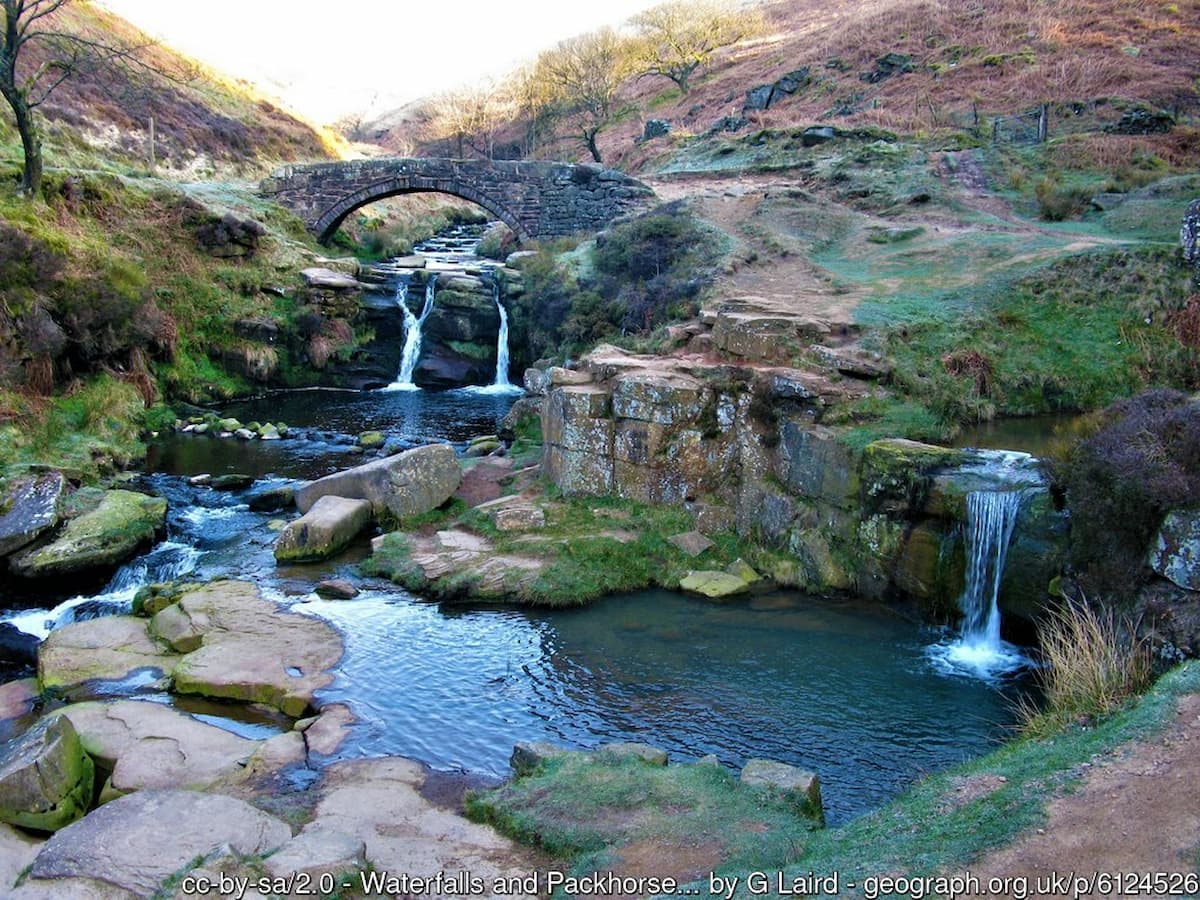
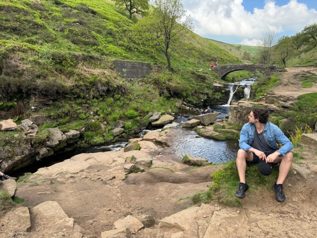
- Head through the farmer’s fields, following the stream in sections until it joins the River Dane. You’ll come to a gate and bridge, and the path will become clearer. Follow it until you reach the arched bridge and the iconic Three Shires Head, one of the most popular waterfalls in the Peak District!

You may wish to spend some time here and even try some popular Three shires head swimming!
- After you finish here, continue on the same path as it follows high above the river and winds up and around the hill until you reach a road.

- Cross the road and go over the stile until you reach the A54 again at another point.
- Keep following the path, crossing the walkways and going through the gate. You will then enter a wooded area that connects with the road.

- A little further down the road, you can choose to shorten or extend the route:
- Take the next right turn, which leads straight back to the car park.
- Follow the road a bit further until you reach the church, then follow the track around and back to the car park.
- Extend the route by continuing past the church, rejoining the footpath, and following it back around to the car park.
- Daypack: Choose a 10-20L daypack to carry all your gear comfortably.
- Clothing: Wear layered, moisture-wicking clothing and pack a waterproof jacket and waterproof trousers for changing weather.
- Footwear: Sturdy walking boots or trail shoes are essential for the varied terrain.
- Water & Snacks: Carry enough water (at least 1L per hour) and bring energy-rich snacks.
- Navigation: Always have a map and compass, and optionally, bring a reliable GPS app to stay on track.
- First Aid Kit: Include essential items like blister treatments and painkillers. A compact First Aid Kit is ideal.
- Emergency Items: A headtorch, whistle, and multi-tool can be vital in unforeseen situations.
Please note some of these links may earn us a commission from qualified purchases at no additional cost to you, which helps fund the free content we provide.
Three Shires Head Amenities & Facilities
There are no amenities or facilities at the Three Shires Head waterfall or its car park, as it’s a remote Peak District National Park walk.
Make sure you bring everything you need and be prepared to take it all back with you.
Clough House Car Park is basic but has some picnic benches.
I didn’t see any nearby pubs that were open, but Buxton is a 10-15 minute drive away, offering everything you need, including a large Morrisons and many food and drink options. Alternatively, Macclesfield, a much larger town, is about 15 minutes in the other direction.
Three Shires Head Walk & Waterfall – FAQs
How do you get the Three Shires Head?
To get to the Three Shires Head Waterfall, you can park or get dropped off on the A54 and then walk in. Another option is to park at the Clough House Car Park, which is where the mapped 7km circular route starts.
Please note that there are no public transport options that take you directly to the waterfall.
The closest towns with major train stations are Macclesfield and Buxton, from where you could possibly take a taxi.
Where do you park to walk to Three Shires Head?
The main parking option for those visiting Three Shires Head is the Clough House Car Park. It’s free to use, and there are picnic benches, but no other amenities.
There are a few laybys along the A54 that can be used for parking as well, although spaces are limited. The exact locations for these laybys are ///snack.appealing.metals and ///fidelity.adjust.fairway.
Is the Three Shires Head walk dog friendly?
Yes, the Three Shires Head walk is dog friendly. It offers an excellent opportunity for dogs to explore the beautiful countryside, enjoy the fresh air, and cool off in the water.
Just be careful around the busy roads.
If you’re looking to stay over, view our article on the best Peak District dog-friendly hotels.
Can you swim in the Three Shires Head?
Yes, you can swim at Three Shires Head.
Many visitors take advantage of the opportunity to take a dip in the three small pools and under the waterfalls. However, wild swimming here will depend on the water level, and you should always consider your ability before getting in the water.
How long does it take to walk Three Shires Head?
The circular route at Three Shires Head is approximately 7.5km in length or about 4.7 miles. The time it takes to complete this walk can vary greatly depending on your pace, the weather conditions, and how often you stop to rest or appreciate the waterfalls.
Generally, it should take around 2-3 hours.
How hard is the Three Shires Head walk?
The walk at Three Shires Head involves a gradual ascent towards the steepest point of the walk at the beginning and then descends towards the waterfall.
The trail can be a bit challenging because of the elevation gain and uneven surfaces, but it’s manageable for people with a moderate level of fitness.
In wet conditions, the paths can also be muddy and slippy, so bring your walking boots!
If you want to watch a video about the area, I’d recommend checking out this one by Owen Jackson:

LeoP
Saturday 22nd of June 2024
this place aint what it used to be, too many people coming through now. miss the old days when it was quiet
DaveR
Tuesday 28th of May 2024
I've been hiking around Three Shires Head for years, and it never gets old. The waterfall is a gem, especially early in the morning. For those asking about parking, there's a small spot not too far from the path that leads you straight to the falls. Just make sure to arrive early as it can get quite busy during the weekends. Always remember to leave no trace and enjoy the natural beauty!
SarahG
Thursday 4th of July 2024
thanks DaveR, good shout on the parking. Is it kid-friendly though? Thinking of bringing the fam.
Monday 29th of April 2024
Is this walk safe for smaller dogs too?
Gazza
Saturday 13th of April 2024
Oh great, another spot to be ruined by crowds. Hope there's plenty of parking for everyone’s ego.
Tommo94
Monday 18th of March 2024
man, tried to find the starting point for ages last time. finally got it but wish i knew where to park proper before.