
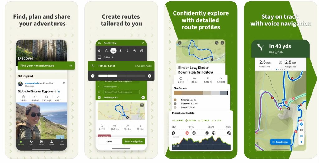
Finding the right hiking app can transform your experience by offering detailed maps, route suggestions, and community insights before you even reach the trail.
Having planned hundreds (if not thousands) of Peak District walks and other national parks throughout the UK, discovering the best and most useful apps has been a game-changer for me. As a fan of technology, I have delved deep!
This guide explores the specifics of these leading hiking apps, along with other notable mentions, to help you navigate the best paths and maximise your outdoor adventures across the UK’s varied terrains.
Whether you’re a seasoned hiker or new to the trails, I’ll ensure that you are well-equipped with the right app for your next outdoor adventure.
In a hurry? Best hiking app for whom:
- 🏆Best Overall: OS Maps App (The Gold Standard for UK Hiking)
- 👨👩👦👦 Best Community & Crowdsourced Hiking App: AllTrails
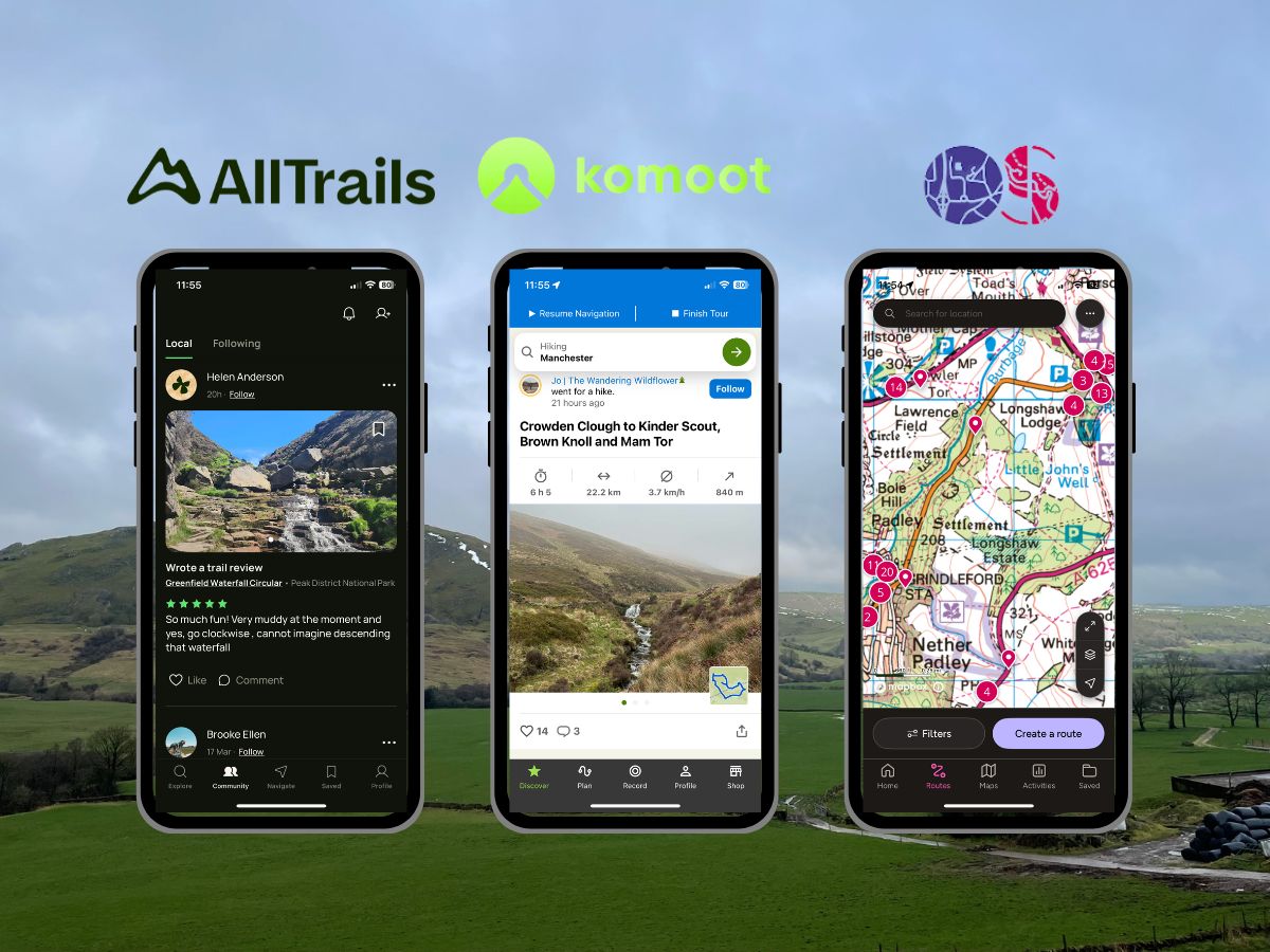
When it comes to the “best hiking apps” in the UK, there are only two real contenders: the OS Maps App and AllTrails. Dating back to 1791, OS Maps have been the de facto paper map used by most major British organisations and government bodies, with the App bringing these highly detailed maps into the digital age with GPS capabilities. AllTrails, on the other hand, is the newer kid on the block, packed with crowd-sourced data, making it as easy as possible to plan your next hike based on community advice, albeit with the caveat of less detailed maps.
While there are many more niche options, for the vast majority of users, these suggestions will be perfect. If you’re looking for non-navigation apps, such as distance tracking, weather, and other useful apps, jump to the supplementary hiking apps section.
Top Hiking Apps in the UK for 2026
Based on my personal opinion, using the apps and website for planning and using while in the Peak District National Park.
Outline is one of the top three contenders; while there are many more apps on the market, not all are best suited to the UK market and are overall less good of a product. However, I’ll still briefly mention them below.
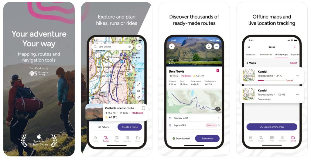
1. OS Maps
Apple: 4.7/5 (97K Reviews) | Google: 4.7/5 (37.1K Reviews)
£34.99 per year (£2.92/month) – 14-Day Free Trail Available
🟢 Pros
- Simple Route Management: You can easily create, track, and follow routes.
- Ready-to-Use Routes: Offers a selection of premade routes for various levels.
- Unlimited Map Printing: Print as many maps as you need from the web platform.
- Comprehensive Map Coverage: Access all 607 OS Leisure maps covering Great Britain and Northern Ireland, widely recognized and used by hikers and professionals alike, including the DofE, Scouts, the British Mountaineering Council, Armed Forces, Mountain Rescue teams, and many more.
- Offline Map Downloads: Carry your maps with you without needing an internet connection while keeping live GPS capabilities.
- Cross-Platform Compatibility: Use it on web browsers, mobile devices, tablets, and smartwatches.
- Complimentary Access: Free access to the digital version of any paper map you own.
🔴 Cons
- Limited Social Features: Offers fewer options for community engagement compared to some other options.
- Geographic Limitations Outside UK: Its main functionality is restricted outside Great Britain and Northern Ireland, making it less useful for international trekers.
- Learning Curve for Beginners: While OS Leisure maps are packed with detail, they might initially overwhelm new hikers. However, mastering these maps can significantly enhance your navigation skills.
- Platform-Specific Complaints: There have been reports of bugs and issues, particularly in Android devices. Although this cannot be universally verified, it appears that the developers are actively working on updates and improvements to address these concerns.
OS Maps stands out as a highly recommended hiking app for those exploring the UK’s diverse landscapes, with the company dating back to 1791, backed by detailed OS Leisure maps, favoured by a range of British outdoor professionals and enthusiasts.
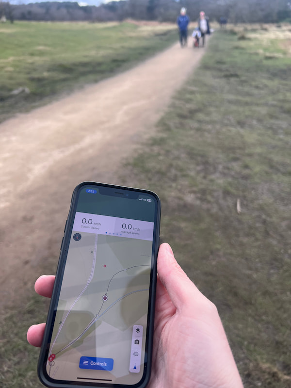
Its capability to plot, record, and follow routes with ease, alongside the convenience of unlimited map printing and cross-platform compatibility, makes it a top pick. The app also shines with features like real-time GPS tracking and offline map accessibility, ensuring you remain on track even in the most remote locations.
Recognized as an Apple App Store Editor’s Choice and ranked 4th among UK navigation apps, as of March 11th, 2024 OS Maps app has recently undergone a significant update, enhancing its usability and modern aesthetics. This addresses previous criticisms and aligns it closer to competitors.
Additionally, purchasing a paper map grants free access to its digital counterpart, adding value.
However, for avid international hikers, its utility might be limited due to geographic restrictions.
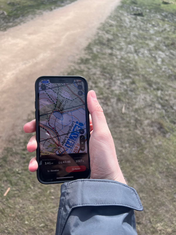
From personal experience, the app’s reliability in conditions of poor visibility has proven invaluable, underscoring its importance for safety and navigation in challenging environments.
View my full OS Maps app review.

| Feature | Free | Premium |
|---|---|---|
| OS Standard Mapping worldwide | ✓ | ✓ |
| Plot, record and follow routes | ✓ | ✓ |
| OS Explorer and Landranger Mapping | X | ✓ |
| Global snap-to-path | X | ✓ |
| View purchased maps offline | ✓ | ✓ |
| Import and export routes | X | ✓ |
| Aerial 3D | X | ✓ |
| Save maps offline | X | ✓ |
| Print A4/A3 maps | X | ✓ |
2. AllTrails
Apple: 4.8/5 (32K Reviews) | Google: 4.8/5 (383K Reviews)
Plus: £35.99 a year (£2.99/month). Peak: £79.99 a year. 7-day free trial available.

🟢 Pros
- Extensive Database of Trails: AllTrails offers routes for hikers, with over 400k trails globally. This comprehensive global database is coupled with user-generated content, such as trail reviews and photos, to help users know what to expect.
- Community Engagement: Users can share their experiences, offer advice, and connect with other members, enhancing the app’s value through a collective knowledge base.
- User-Friendly Interface: Both the app and website are easy to navigate, with numerous filters to help users find trails that meet their specific needs, such as difficulty level, length, and suitability for dogs or children.
- Pro Membership Benefits: For those opting for AllTrails Pro, benefits include offline map access, no ads, customizable maps, and features like the Lifeline safety tool, off-route alerts, and more.
🔴 Cons
- Variation in Trail Details: The amount of information can vary, with popular trails having more details than lesser-known paths. This discrepancy might make it harder to assess the suitability of certain trails.
- The global mapping focus is outside of the UK
- Occasional App Issues: Some users have reported bugs and crashes, although these seem to be infrequent.
AllTrails is a leading app for hikers, featuring an extensive database with over 400k trails globally, supported by user-generated content like reviews and extensive route photos for informed planning.
Its community engagement is arguably it’s best feature allowing for sharing experiences and advice, detailed route planning. If this is what you want, this IS the app for you.
The app and website are very user-friendly, with filters for finding trails by difficulty, length, and more. AllTrails Pro offers additional benefits like offline maps, no ads, more customizable maps, and safety features such as Lifeline and off-route alerts.
However, it is criticized for inconsistent trail details and occasional app issues. With the app not being UK-focused, there can be a drawback to this. Despite these, AllTrails remains a valuable tool for outdoor enthusiasts worldwide.
View the full AllTrails App Review.
| Features | Free | AllTrails+ |
| Navigate on the trail | ✓ | ✓ |
| Favourite trails and create lists | ✓ | ✓ |
| Download offline maps | X | ✓ |
| Get alerts for wrong turns | X | ✓ |
| Live share your activities | X | ✓ |
| Access 200+ Guides | X | ✓ |
| Know conditions before you go | X | ✓ |
| Preview 3D flyovers | X | ✓ |
| Find trails by distance from you | X | ✓ |
| Unlock more map details | X | ✓ |
| Print maps for backup | X | ✓ |
| Give back with 1% for the Planet | X | ✓ |
AllTrails added a third tier, Peak (£79.99 a year), in 2026. It bundles AI features like plant and insect ID (Outdoor Lens), a community heatmap showing how busy trails are, and in-app custom route building. For most UK walkers, Plus is still the tier that matters. Note that the detailed trail-conditions feature moved from Plus up to Peak.
3. Komoot
Apple: 4.7/5 (8.3K Reviews) | Google: 4.4/5 (392K Reviews)
£59.99 per year (£4.99/month)
🟢 Pros
- Komoot Interactive Route Planning: Plan your hikes and multi-day walks using the drag-and-drop feature to customize your route.
- Community-Driven Recommendations: Discover hidden gems through tips and photos shared by the Komoot community.
- Diverse Route Options: Whether you’re into hiking, biking, or mountain biking, Komoot has a route for you.
- Offline Maps & Navigation: Download your planned routes and navigate without an internet connection, ensuring you’re always on the right path (Premium only).
- One free region to try: New users get one free regional map to test the planner. [Note: the old buy-once region packs and lifetime World Pack were withdrawn for new users in 2025. If you signed up before March 2025, your purchased regions still work.]
🔴 Cons
- Now subscription-only for new users: Komoot used to let you buy a region once and keep it forever. Since 2025 that option has gone for new sign-ups, so to sync routes to a Garmin or watch, or to navigate offline, you now need Premium. At £59.99 a year it’s the priciest of the main UK hiking subscriptions.
- Complex Features for New Users: The wealth of features and customization options might overwhelm beginners initially.
- Limited Social Interaction: While it offers community-driven recommendations, its social features are not as developed as some competitors.
- No as Hiking Focused: Unlike some of the other apps mentioned, Komoot has a bigger community and emphasis on cycling and other outdoor sports.
Komoot is renowned for its comprehensive route, outdoor navigation planning, and exploration capabilities. It merges a detailed route planner with community insights, making it an invaluable tool for hikers, bikers, and outdoor enthusiasts alike.
The app, along with the popular web app, offers customised, interactive route planning and offline navigation, ensuring you can explore with confidence, armed with all the necessary information at your fingertips.
With a rating of 4.7 on Apple and 4.4 on Google, it’s evident that users appreciate Komoot’s fusion of functionality and community-driven content. The ability to discover and share personal highlights enhances the experience, enabling you to find and recommend those special, off-the-beaten-path spots.
The free version still lets you browse and plan routes, but following them offline or syncing to a device now needs Premium. This is a big change: Komoot was acquired by Bending Spoons in 2025, and the buy-once region packs that made it stand out were withdrawn for new users. If keeping costs down matters to you, it’s worth looking at Hiiker (below), which kept free offline maps.
In essence, Komoot is a versatile, reliable companion for anyone looking to explore the great outdoors. However, the premium subscription options might better suit UK walkers.
| Feature | Free | Maps | Premium |
|---|---|---|---|
| Turn-by-turn voice navigation | Available for the first region | Available in purchased region(s) | Unlimited worldwide |
| Offline functionality | Limited to first region | Available in purchased region(s) | Unlimited worldwide |
| Weekly updates | Yes | Yes | Yes |
| Available on all devices | Yes | Yes | Yes |
| Multi-day planner | No | No | Yes |
| Sport-specific maps | No | No | Yes |
| On-Tour weather | No | No | Yes |
| Live Tracking | No | No | Yes |
| Personal Collections | No | No | Yes |
| 3D Maps | No | No | Yes |
| Komoot map on Garmin | No | No | Yes |
| Price | Free for first region | Region packs no longer sold to new users | £6.99/month (Billed annually at £59.99/year) |
Other Hiking Apps
Here are some other options that are often discussed in relation to hiking apps but are far less well-known, and I wouldn’t necessarily recommend them to the vast majority of people. This is because they are either inferior or not as effective in UK hiking areas:
- 4. Gaia GPS: Specializes in off-the-grid navigation, offering detailed topographic maps and trail info for hiking, biking, and camping enthusiasts. Its strength lies in its comprehensive map layers and offline capabilities.
- 5. Outdooractive: Combines a wide array of outdoor activities with a strong community aspect, allowing users to plan, track, and share their adventures. It stands out for its extensive database of trails and routes across the globe.
- 6. Hiiker: Free offline maps for everyone. PRO+ from around £49.99 a year. Hiiker is the app to watch in 2026, especially now Komoot has dropped its one-off region packs. It’s built purely for hikers, with no cycling or fitness clutter, and unusually it has never charged for offline maps and says it never will. You can download trails and navigate without signal for free, which is a big deal for somewhere like the Peak District where signal drops fast once you leave the car park.Pay for PRO+ and you unlock premium topographic layers, including Ordnance Survey and Harvey maps, plus a genuinely strong multi-day route planner. It’s cheaper than Komoot and used by mountain rescue teams worldwide. The catch: reviewers note the OS map layer can look a little grainy compared to the official OS app, and route planning needs a signal.
- 7. OsmAnd: Free offline maps. OsmAnd+ is a one-off ~£34.99, no subscription. If your priority is a genuinely free, offline-first app and good battery life, OsmAnd is hard to beat. It’s open source, lets you download regions and plot routes completely offline, and the free tier covers most needs (seven map downloads). It’s not the prettiest or simplest app, and the maps lack OS-level detail, but for following your own GPX track on a long day out while saving battery, it’s excellent.
- FATMAP: Was a popular alternative but is now owned by Strava.
- ViewRanger: Another popular alternative that is now owned by Outdooractive.
What is the best free hiking app?
While all of the mentioned apps offer a free option with very basic maps, I’d advise paying the nominally small yearly fee for a premium plan, such as OS Maps (£34.99 per year).
This will enable you to keep the maps offline—a critical feature if you’re venturing anywhere outside of the city—as well as access more detailed maps, allowing you to pinpoint exactly where you are and what’s around you.
How to Choose the Best Hiking App for You
Selecting the right app for hiking can enhance your outdoor experiences significantly, tailoring adventures to match your individual needs.
Whether you’re a casual walker or a serious trekker, consider these key factors to find your perfect digital companion:
- Type of Hiking: Are you into serene walks, challenging mountain hikes, or varied activities like biking and running? Different apps cater to specific outdoor activities with tailored features.
- Region Coverage: Ensure the app supports detailed maps of your preferred hiking regions. Some apps specialize in local areas, while others offer global coverage.
- Detail Level: If you’re a navigation newbie or prefer detailed guidance, look for apps with comprehensive path information, turn-by-turn directions, and user-generated insights.
- Field Testing: An app might seem perfect online, but testing its real-world performance is crucial. Check how it fares in terms of accuracy, battery usage, and offline functionality.
- Comparison: Don’t settle for the first app you try. Experiment with a few options to see which one suits your hiking style and preferences best.
Remember, technology can fail. Always carry a paper map and compass as backups, and consider the battery drain of using GPS functions—investing in a power bank might be a wise choice. I would recommend an Anker power bank.
While these apps don’t require data to navigate, having a charged cellphone is vital for emergencies. This multi-layered approach ensures you’re prepared for a rewarding and safe hiking experience, blending the best of digital innovation with traditional navigation wisdom.
Other Hiking Technology Apps
Beyond the well-known names, a plethora of other hiking apps cater to specific needs and preferences, offering unique features like social sharing, weather forecasting, and safety features.
These apps can help enrich your hiking adventures, whether you’re exploring local trails or embarking on treks in uncharted territories where these could save your live!
Weather Forecasts Tailored for Outdoor Adventures
Weather apps play a crucial role in hiking preparation, offering forecasts that can help hikers plan their trips around the weather.
These apps ensure hikers are well-informed and can make safe decisions about their outdoor activities from comprehensive details on weather conditions, including wind, visibility, and temperature variations at different altitudes, essential for safe mountain hiking..
- Met Office App (Apple) (Google)
- Mountain Weather Information Service – MWIS (Apple) (Google)
The Social Network for Hikers and Athletes
Strava stands out in the hiking app category by blending social networking with activity tracking.
While it focuses more on running and cycling, It offers a unique platform where hikers can share their routes, compete on specific trail segments, and delve into detailed performance analytics, making every hike a potentially shared adventure.
Precise Location Sharing & Saftey
Apart from exact coordinates, What3words revolutionizes how hikers share their locations by assigning every 3m x 3m square on the planet a unique three-word address. Eg: ///daisy.swim.dock (Right outside 10 Downing Street)
This precision is invaluable for meeting up with fellow hikers in remote locations or guiding emergency services to your exact location in case of distress. This app is actively used by 999 and all UK emergency services and mountain rescue, as well as working offline.
Give it a download here – WhatThreeWords (Apple) (Google)
Side App: The British Red Cross First Aid app provides offline information, offering instant access to safety information and professional advice for everyday emergencies that could happen in the hills and mountains.
Navigating to the Trailhead
General aviation apps are an essential tool for hikers, providing reliable directions to trailheads and points of interest. Its comprehensive mapping data, real-time traffic updates, and integration with public transport options make it the go-to app for reaching your starting point with ease.
Some of the best include:
- Google Maps (Apple)
- Apple Maps
- Waze (Apple) (Google)
Identifying Peaks
For mountaineering enthusiasts, PeakFinder Earth is an indispensable companion, offering an augmented reality feature that names and details over 800,000 peaks and their elevations worldwide, as well as telling you the exact lotion of sunset and sunrise.
It’s perfect for those moments when you’re surrounded by nature and curious about the names of the majestic peaks in your view.
£4.99 One-time payment – PeakFinder Earth App (Apple) (Google)
Types of Maps UK Maps Available
In the UK, hikers have a variety of maps to choose from, catering to different needs and preferences.
Each type offers unique features, helping hikers navigate through diverse landscapes, whether they’re trekking through rugged mountains or following gentle countryside trails.
Here’s an overview of the map types:
- OS Maps: The UK’s premier mapping system for outdoor enthusiasts, offering detailed coverage of footpaths, rights of way, and landscapes on scales ideal for walking, hiking, and cycling. Large-scale (1:25,000, Explorer series) showing fine details ideal for walkers and hikers, to smaller scale (1:50,000, Landranger series).
- Harvey Maps: Tailored for outdoor adventures, these maps highlight clear details of paths and terrain, especially in mountainous regions, and boast durability with waterproof, tear-resistant materials.
- National Cycle Network Maps: While designed for cyclists, these maps benefit hikers too, covering the UK with long-distance paths and detailing on-road/off-road routes, traffic levels, and surface types.
- Aerial Maps: Offer a comprehensive bird’s-eye landscape view, ideal for broad planning and understanding an area’s geography and major landmarks before visits, though less detailed for specific trail navigation.
- Standard Maps: These are standard maps, which you can often see for free in most apps that may combine various data points and open-source maps to give you an overview of hiking trails.

OS 1:25,000, Explorer series Map of a Castleton Walk
UK Hiking Apps FAQs
Which is better: OS Maps or AllTrails?
When deciding between OS Maps and AllTrails, it really depends on what you’re looking for. OS Maps App is a staple for UK hikers and offers highly detailed Ordnance Survey maps, ideal for those who love traditional map reading with a modern twist.
AllTrails, on the other hand, is beloved for its vast collection of trails and user-generated content, making it perfect for those seeking community recommendations, diverse routes and more benginer-friendly maps. Both have their merits, so your choice should align with your specific hiking app preferences.
Does AllTrails work in the UK?
Yes, AllTrails works well in the UK. It offers a rich library of hiking, walking, and cycling trails across the United Kingdom, complete with user reviews and trail information.
What maps does AllTrails use?
AllTrails provides users with a variety of map types, including topographic maps, satellite imagery, and its standard map view.
These maps are sourced from multiple global mapping services, ensuring users have access to up-to-date and accurate information for their adventures. However, the subscription and platform do NOT include Ordnance Survey maps, which are more detailed and accurate.
Is Komoot good for hiking?
Komoot is highly regarded among the hiking community, especially for those who appreciate a personalized touch. It excels in offering route planning tailored to your fitness level and hiking preferences, making it a great companion for challenging treks.
With detailed maps and navigational cues, Komoot is definitely a strong contender for your hiking adventures.
What map to use for hiking?
The best map for hiking depends on your needs. For traditionalists and those seeking detailed, accurate topography, the Ordnance Survey (OS) maps app is unbeatable.
For a more interactive experience with community input and trail variety, apps like AllTrails and Komoot are fantastic choices. Each offers unique features, such as trail ratings, user reviews, and route planning, making them invaluable tools for exploring the great outdoors.
Catherine Kelly
Friday 15th of November 2024
Agree with comment about OS app. I used to use it all the time. I also used it to record routes when on a group walk but that no longer works. I use Android. My absolute favourite for route planning is footpathmap.co.uk but unfortunatetly there is not an app and I can't use offline so no good if there is no signal. Still shopping for an app with the interface of footpathmap.co.uk but the functionality of Memory-map.
Trevor
Sunday 15th of September 2024
From my experience and where I live I have to disagree with the praises sung for OS Maps. I find it crazy that their digital maps are no more up to date than their latest published printed maps. For example there is still no sign of HS2 on any of their maps, which can make for a tiring ad frustrating cul-de-sac with the way forward blocked. There are also many other obstacles that have been around for many years, yet still unavailable. On a more positive note I've found "mapy.cz" extremely useful in both the UK and Europe, yet somehow seems to be omitted from reviews (?).
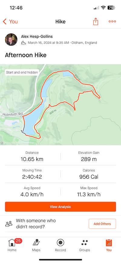
Alex Hesp-Gollins
Tuesday 17th of September 2024
@trevor Mapy.cz looks interesting, but appears to be a Czech-based mapping service and could be a useful free option for getting an overview. I think, the options mentioned above are likely still the most helpful for the majority of average hikers.
fero
Thursday 27th of June 2024
There is another interesting hiking app if you like location based "games". Check Hill Hunter GPS The goal is to visit places to earn points and win trophies.