
Have you ever found yourself wandering on what you thought was a well-marked trail, only to realise you’re going the wrong way? I’ve been there more times than I’d like to admit! Today, I’m reviewing AllTrails – the app that’s become a popular hiking companion for adventurers across the UK.
But the question remains: Is the Plus subscription worth your hard-earned pounds, or will the free version do the job? And how does it compare to UK-specific alternatives?
My Verdict
“AllTrails is a powerful hiking app with an impressive trail database and active community. While the free version is brilliant for casual walkers, I’ve found the Plus subscription (now called AllTrails Plus) to be worth every penny for serious hikers venturing into patchy signal areas. That said, there are better UK alternatives for detailed mapping, like OS Maps. AllTrails is more user-friendly and excellent for discovery, but sometimes lacks the map detail which is crucial when navigating challenging terrain in Britain.” – Alex Hesp-Gollins
My rating: 4/5
Quick Stats & Reviews
- Apple App Store: #9 in Health & Fitness, 4.99/5 with over 1 million reviews
- Google Play: 4.8/5 with 365K+ reviews and over 10 million downloads
Impressive, right? But numbers don’t tell the whole story, so let’s dive deeper.
What Is AllTrails and How Does the App Work?
AllTrails is essentially a massive library of hiking routes wrapped in a user-friendly interface. Imagine having a knowledgeable hiking buddy in your pocket who knows trails all over the UK (and globally) – currently boasting over 450,000 trails worldwide.
The app sources information through a clever mix of user-generated content and official trail data. From my experience, this creates an incredibly rich database that’s constantly being updated by fellow hikers who’ve actually walked these paths with photos to match.
You can access AllTrails through their website or download the app on iOS and Android devices. I’ve found myself planning routes on my laptop before heading out, then switching to the mobile app when I’m actually on the trail – seamless integration that makes life so much easier!
How AllTrails Works

Understanding the Core Features of AllTrails
Trail Database & Search
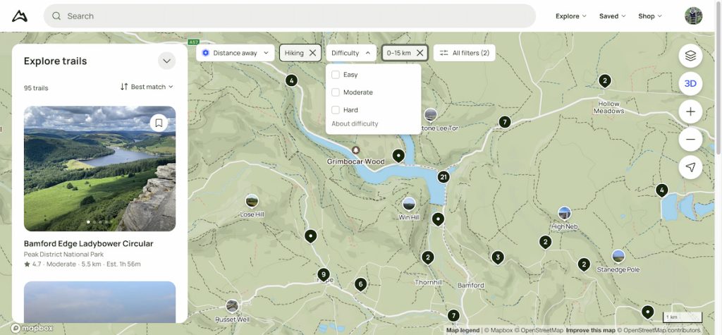
Looking for a gentle riverside walk near Manchester? Or perhaps a challenging mountain trek in the Cairngorms? AllTrails lets you filter trails by location, difficulty, length, elevation gain, and even trail features like “dog-friendly” or “wheelchair accessible.”
I absolutely love how I can narrow down options based on what I’m in the mood for or the ability of those I’m hiking with. Moderate ability & under 10 km – sorted.
User-Generated Reviews & Photos
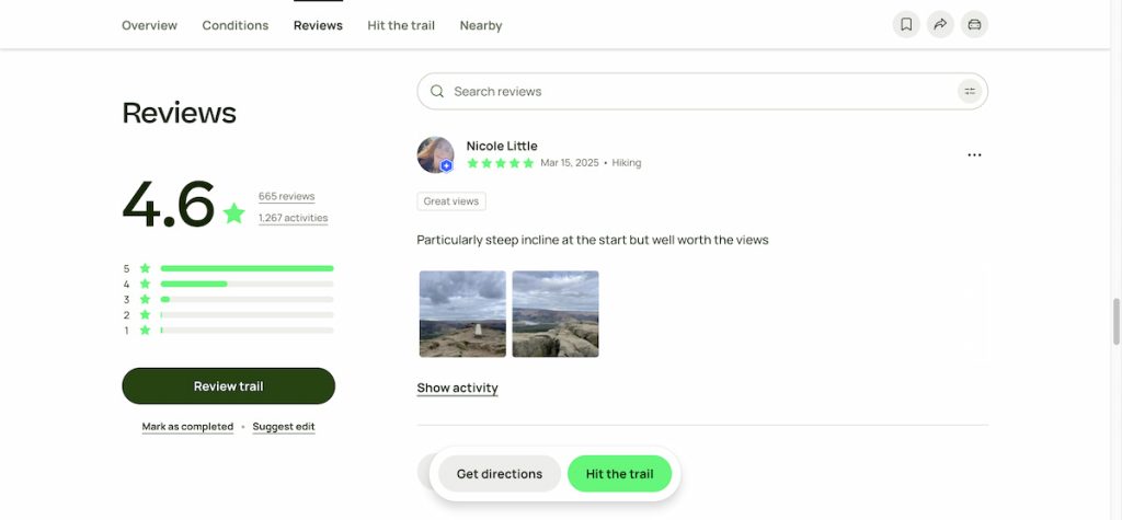
This is where AllTrails truly shines, in my opinion. Before setting off on any new trail, you can check recent reviews to see if that path across the moor is currently a boggy nightmare, or if the car park is closed for maintenance.
The photos from other hikers give you a genuine feel for what to expect – not just the glossy, perfect shots you’d find in a guidebook. I’ve avoided many disappointments, thanks to reviews warning about overcrowded viewpoints or misleading trail markers.
Navigation & Route Planning

The free version offers basic route planning with a general trail outline on the map.
However, upgrade to AllTrails Plus (formerly Pro), and you’ll unlock detailed navigation including off-route notifications (absolute lifesavers when mistakenly wandering off-track in the fog), offline maps, and 3D visualisation.
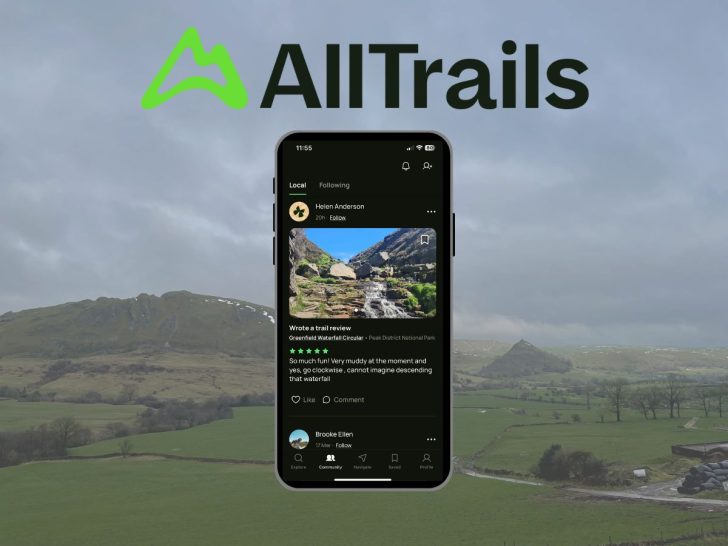
Community Engagement
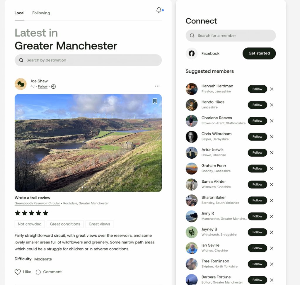
AllTrails has cultivated quite the hiking community. You can share your adventures, follow friends similar to Strava, and even join forum discussions about specific areas. It functions rather like a “Yelp for trails,” leveraging collective knowledge.
How to Use AllTrails to Find Hiking Trails in the UK
Finding trails is refreshingly straightforward. Simply:
- Open the app and allow location access (or manually enter a destination)
- Browse the map or list of nearby trails
- Use filters to narrow down options by difficulty, length, etc.
- Select a trail to view full details, elevation profile, and user reviews
@moretimeoutdoors Such a great app for finding new routes! The free version has plenty or you can pay for the full version for more features ✨🥾 (Not an ad – I’m just a big fan) #alltrails #walks #hike #adventure #explore #skiddaw #lakedistrict @AllTrails ♬ Bittersweet Symphony – Sandstorm
The UK coverage is actually quite impressive. I’ve successfully used AllTrails in the Lake District, Peak District, Snowdonia, and even some lesser-known corners of England. The trail stats are easy to interpret, with difficulty ratings that help manage expectations before you set off.
Is the Free Version of AllTrails Good Enough for UK Hikers?
The free version of AllTrails is surprisingly robust. You get:
- Basic map overlays (though not as detailed as OS Maps)
- The ability to find and save trails to your favourites
- Access to user reviews and trail conditions
- Trail photos from other hikers
- Route creation tools (primarily on desktop)
Here is what the AllTrails maps look like:
For casual walkers who stick to well-marked, popular routes in areas with decent mobile coverage, the free version might be perfectly adequate. I’ve used it exclusively before.

Limitations of Using the Free Version for Hiking in Britain
The free version does come with noteworthy limitations:
- Very limited offline functionality (crucial in the UK’s many signal-free areas)
- No off-route notifications (can be invaluable in areas with confusing path networks)
- No custom maps – Some users report routes marked on the AllTrails map can be unreliable
- Frequent prompts to upgrade, which some users find aggravating
Can You Download Maps With the Free AllTrails Account?
Here’s the straightforward answer: not really. The free version allows you to view maps while you have signal, but you can’t download them for offline use.
Some hikers recommend taking screenshots of routes before heading into areas with poor reception, but that’s a far from perfect solution and defeats the point. Given the UK’s notoriously patchy mobile coverage in our most beautiful hiking areas, this is arguably the biggest limitation of the free version.
AllTrails Plus Premium Features: Offline Maps and Advanced Navigation
Upgrading to AllTrails Plus (formerly Pro) unlocks several features that, in my experience, have proven invaluable for serious hiking:
- Offline maps – Essential for the Peak District, Lake District, parts of Wales, and the Scottish Highlands where mobile signal is more mythical than real
- Off-route notifications – Gentle alerts when you’ve strayed from the path (before you end up in completely the wrong valley!)
- Advanced map layers – Including satellite imagery and 3D views, which can be brilliant for identifying landmarks
- Real-time map overlays – Including weather forecasts, air quality, and pollen data (particularly useful given our unpredictable Peak District weather)
- Live Share/Lifeline – Allow designated contacts to track your real-time location and progress
- Ad-free experience – No more distracting upgrade prompts
Pricing and Free Trial Options for AllTrails Plus
As of April 2025, AllTrails Plus costs £35.99 annually (Just £2.99 per month). They frequently offer discounts – I’ve seen 50% off promotions that bring the first year down significantly.
AllTrails typically offers a 7-day free trial of AllTrails Plus features, which I’d recommend timing strategically before a big hiking trip. This gives you enough time to test the offline functionality and decide if it’s worth the investment.
In my view, AllTrails Plus is worth considering if:
- You hike regularly
- You explore areas with poor mobile reception
- You prefer detailed planning and navigation tools
- You often venture onto less well-marked paths
- You hike solo and want safety features like Live Share
How Does AllTrails Compare to Alternative Hiking Apps in the UK?
Having used several hiking apps extensively, I can offer some honest comparisons, particularly focusing on OS Maps – the gold standard for UK navigation.
AllTrails vs. OS Maps
Map Detail and Accuracy:
OS Maps is superior for detailed UK mapping, offering the official Ordnance Survey 1:25k and 1:50k maps with comprehensive terrain features, clear rights of way, and boundaries. AllTrails uses OpenStreetMap-based layers which, while decent, simply can’t match the granular detail and accuracy of OS Maps for UK terrain. This is particularly noticeable when navigating complex landscapes, identifying field boundaries, or determining exact public rights of way.
Discovery and Community:
AllTrails excels here with its vast database of user-generated trails, filters, reviews, and photos. OS Maps offers curated routes and some user-shared paths but lacks the vibrant community feedback and extensive discovery tools of AllTrails.
User Interface:
AllTrails has a more intuitive, user-friendly interface than OS Maps. The trail filtering system is particularly impressive compared to alternatives.
Cost and Value:
Both premium versions are similarly priced around £30-£36 annually. The choice depends on your priorities – discovery and community (AllTrails) versus mapping detail and accuracy (OS Maps).
Many serious UK hikers actually use both apps complementarily – AllTrails for discovering trails and checking recent conditions, and OS Maps for reliable navigation due to its superior mapping detail.
Pros & Cons of AllTrails for UK Hikers
Pros
- Extensive UK trail database with constant user updates
- Intuitive, user-friendly interface
- Active community providing real-time trail conditions
- Excellent filtering system to find perfect hikes, cycling or trail running
- Offline maps with AllTrails Plus subscription
- Safety features like Live Share and wrong-turn alerts
Cons
- Offline functionality locked behind subscription
- Less detailed topographical information than OS Maps
- Map accuracy can be questionable in complex terrain
- Lacks an OS map layer, a significant disadvantage for UK navigation
- Some user-generated content may be inaccurate or outdated
- Heavier battery drain than simpler apps
- Trail difficulty ratings can be subjective (what’s “moderate” to a seasoned Lake District hiker might be “hard” to someone used to gentle Cotswolds strolls)
Safety Considerations: Not Fully Relying on AllTrails
I can’t stress this enough, folks – no matter how brilliant AllTrails is, please don’t make it your only navigation tool in the British countryside. Our weather and terrain demand respect!
Always:
- Carry a portable charger (phones die at the most inconvenient moments)
- Bring paper maps and a compass, especially in remote areas
- Cross-reference AllTrails information with official sources when possible
- Tell someone where you’re going and when you expect to return
- Pack appropriate gear – check this day walk kit list for essentials
I’ve learned this the hard way after an unfortunate incident in the Snowdonia when my phone died unexpectedly, leaving me thankful for the paper map in my rucksack!

- Daypack: Choose a 10-20L daypack to carry all your gear comfortably.
- Clothing: Wear layered, moisture-wicking clothing and pack a waterproof jacket and waterproof trousers for changing weather.
- Footwear: Sturdy walking boots or trail shoes are essential for the varied terrain.
- Water & Snacks: Carry enough water (at least 1L per hour) and bring energy-rich snacks.
- Navigation: Always have a map and compass, and optionally, bring a reliable GPS app to stay on track.
- First Aid Kit: Include essential items like blister treatments and painkillers. A compact First Aid Kit is ideal.
- Emergency Items: A headtorch, whistle, and multi-tool can be vital in unforeseen situations.
Please note some of these links may earn us a commission from qualified purchases at no additional cost to you, which helps fund the free content we provide.
FAQs for AllTrails
How much does AllTrails Plus cost?
Currently £35.99 annually or £2.99 monthly, though watch for regular promotions.
Does AllTrails work offline in remote UK areas?
Yes, but only with AllTrails Plus, and you must download maps before losing signal.
Can AllTrails replace paper OS maps?
While convenient, I wouldn’t recommend relying solely on AllTrails, especially in challenging terrain or poor weather conditions.
How frequently does AllTrails update its trails?
User reviews and conditions update in real-time, while trail information is refreshed regularly. I’ve found popular trails tend to have very current information.
Is there a free trial for AllTrails Plus?
Yes, typically 7 days, though sometimes they offer extended trials during promotions.
Can I export AllTrails routes to my GPS device?
Yes, with AllTrails Plus you can export GPX files compatible with most GPS devices.
Allowing you to plan on AllTrails but use your GPS in the field. You and also inport GPX files to AllTrails.
How do I cancel my AllTrails subscription?
If purchased through an app store, cancel via your store subscription settings. If directly through AllTrails, log in to your account settings on their website.
Is AllTrails more accurate than OS Maps for UK hiking?
No, OS Maps provides superior mapping accuracy and detail for UK terrain. AllTrails is better for discovery but may have inaccuracies in its routes.
So, there you have it – my comprehensive take on AllTrails for UK hikers. Would I recommend it? Absolutely. Is AllTrails Plus worth it? For serious hikers exploring beyond well-trodden paths, I think it’s worth every penny. But for casual walkers sticking to popular, well-signed routes, the free version might be perfectly adequate.