

Explore Shining Tor, the highest point in Cheshire, nestled above the stunning Goyt Valley.
This guide provides routes for both leisurely walks and more challenging hikes.
Set your sights high, and get ready to lace up your boots!
Getting to Shining Tor
To reach Shining Tor, you’ll need to drive and then walk to the trig point. Public transport doesn’t serve Shining Tor directly; however, Buxton, the closest town with transport links, is a mere 10-minute drive away.
Generally, Shinning Tor is not accessible via public transport.
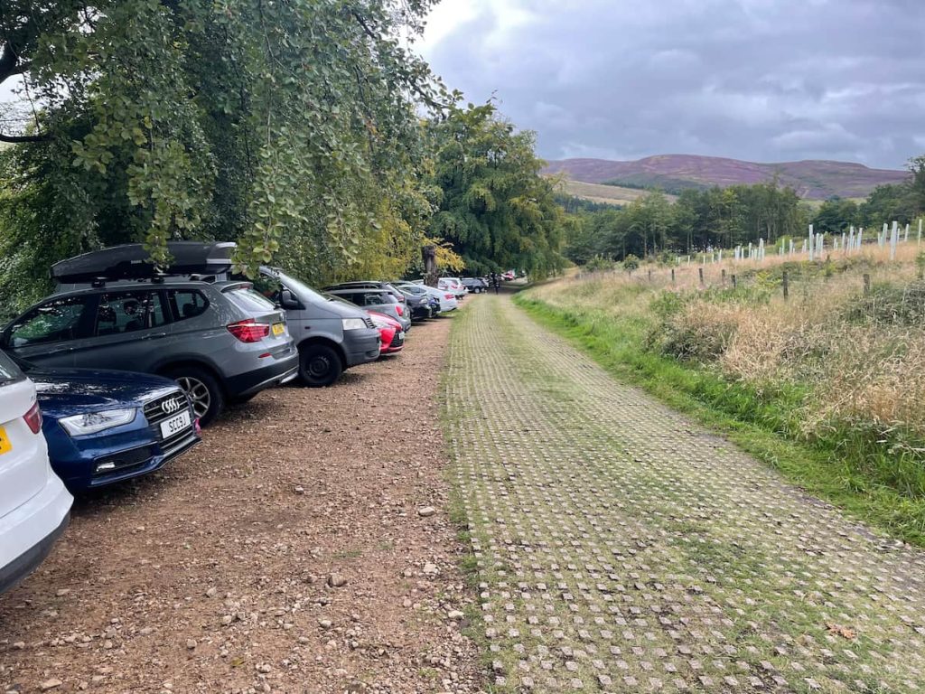
Shining Tor Parking
There is a range of free parking near Shining Tor.
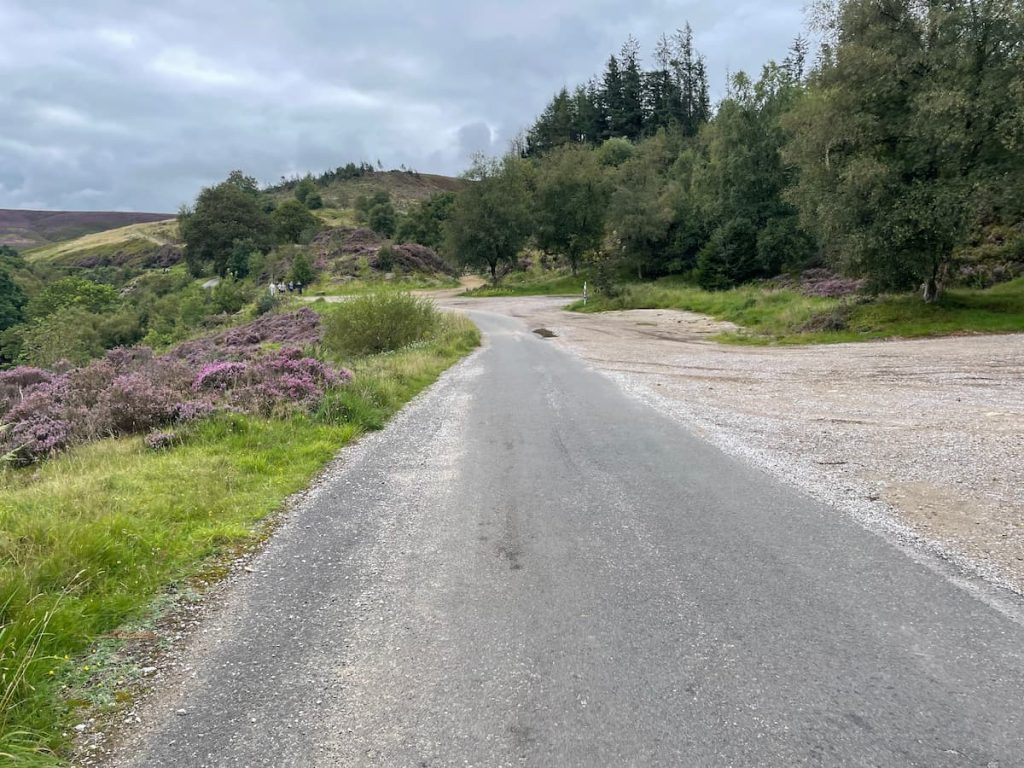
Depending on which walk your want to go on will determine where you should park. If your planning a long walk, you should park in the areas surrounding Errwood Reservoir. If you are looking for some of the closest parking spots, you should park at, Pym Chair for a short walk.
Parking Around Errwood Reservoir (Long Walk):
- “The Street” Car Park – ///inspects.addicted.detective
- Errwood Hall Car Park – ///pots.unzipped.signal (Not accessible Sundays & Bank Holidays)
- Goyt’s Ln – ///voltage.tasteful.reception
Parking Around Pym Chair (Short & Direct Walk)
If you’re looking for a short and direct route to Shinning tor, which follows a well-paved path, you can park at the Pym Chair car park, although there are limited spaces here, so be prepared to arrive early or later on in the afternoon during busy periods.
Shining Tor Maps & Routes
- Long Circular Route: 11.5km (7.2 mi) ~ 3-4hrs
- Short & Direct Route: 6.7km (4.3mi) ~ 2-2.5hrs
Shining Tor Walk (Ciruclar), Via Errwood Hall & Reservoir (Long)
🔵 Medium | 🚶♂️ 11.5km (7mi) | ⛰️ Total Ascent: 441m (1446 ft) | ⏱️ 4 Hours
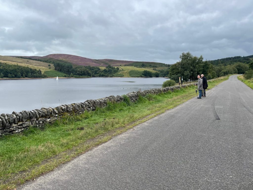
Download file for GPSThis scenic route follows the serene edge of Errwood Reservoir before leading you up through the hills to the historic ruins of Errwood Hall. From there, you’ll ascend to the breathtaking summit of Shining Tor. The trail then gracefully descends, wrapping around the reservoir’s far side and culminating with a crossing over the dam, guiding you back to where your journey began.
Which hiking map app should I use? I recommend OS Maps Online for its unparalleled accuracy. However, if you’re a beginner, you might find AllTrails to be more user-friendly. For a detailed review of the best UK map apps, read my full review.
Step-by-Step Guide
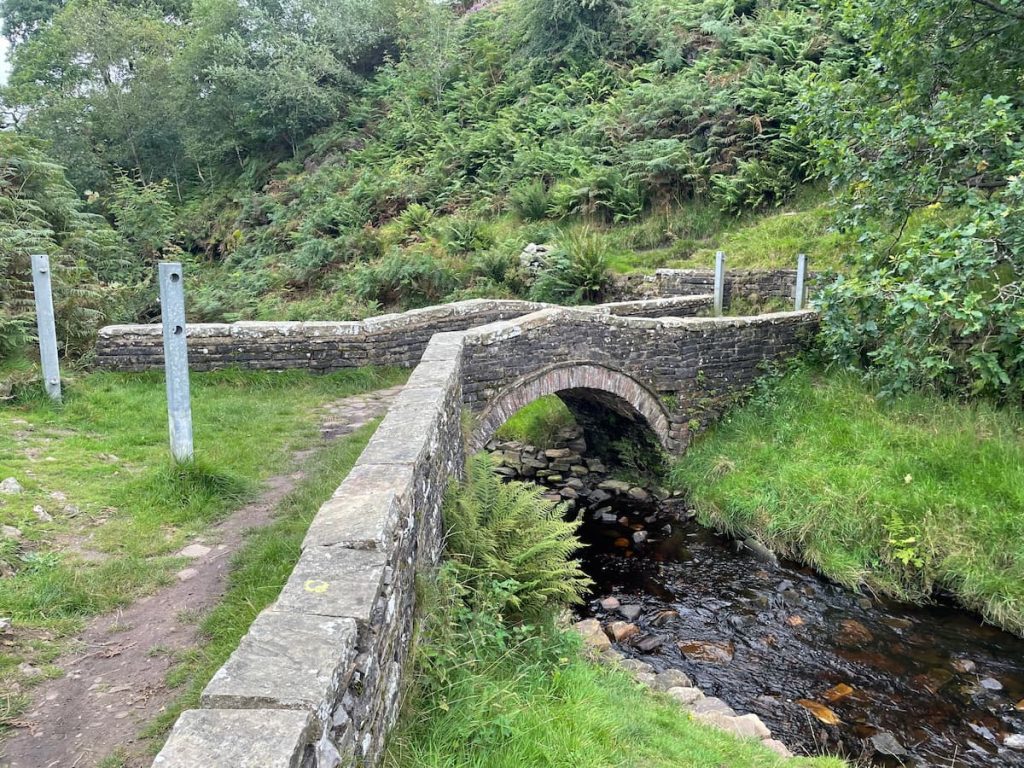
1.If you begin at “The Street” car park and head down the road with the reservoir on your left. You’ll cross a bridge before reaching Errwood Hall car park.
2. From Errwood Hall car park, move away from the reservoir and climb the hill towards the trees.

3. Once inside the wooded area, follow the well-maintained trail and descend the hill. After a short distance, you’ll come upon a U-turn in the trail. Follow this curve, which will lead you to the ruins of Errwood Hall.
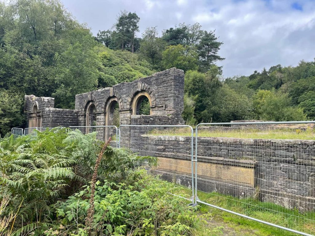
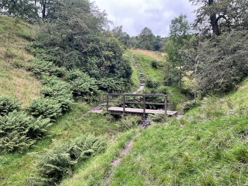
4. Having admired the ruins, continue on the path, loop around, cross the stream (note it might be slippy), cross the bridge, and ascend the hill to your left.
5. You’ll then reach a gravel path. Follow this uphill. This is the steepest part of the walk, so you might want to take short breaks.
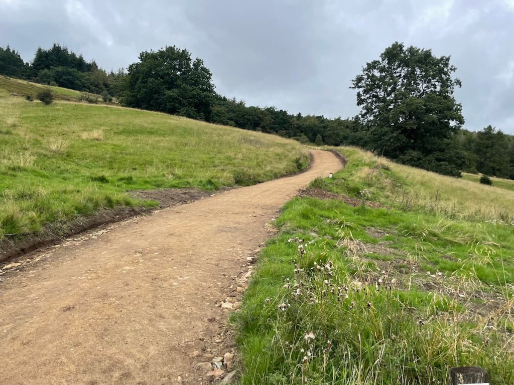
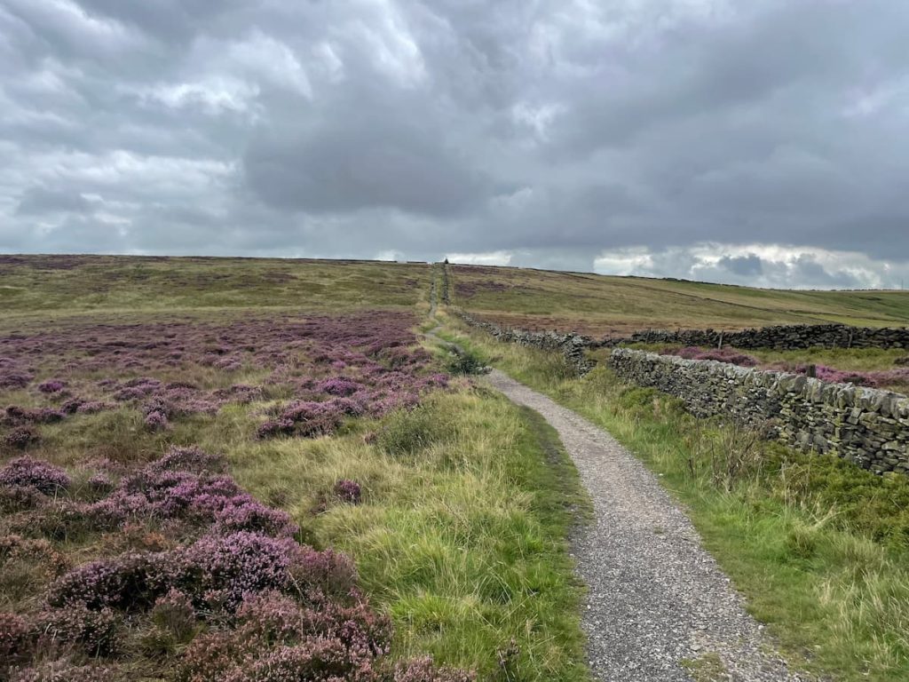
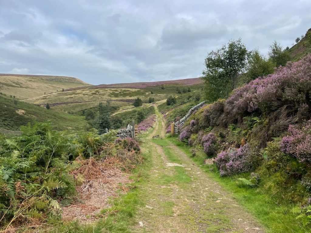
6. Eventually, you’ll emerge from the woods onto the moorlands with a stone-paved path. Turn left here.

7. Continue along the paved path, and in due time, you’ll reach the summit and trig point of Shining Tor!
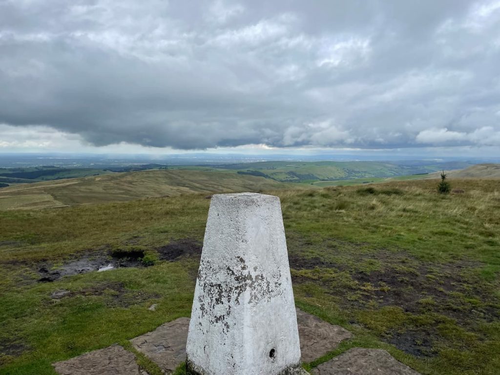
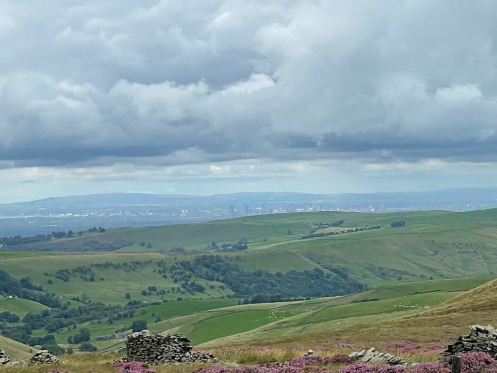
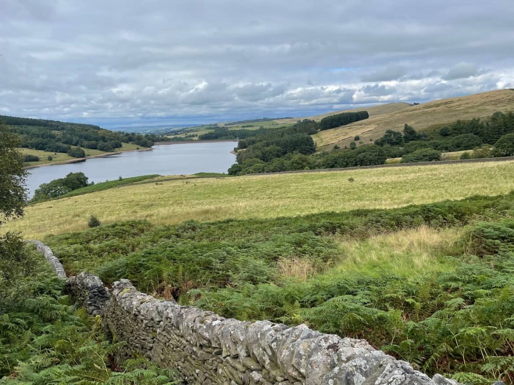
Don’t forget to pause and enjoy the views! On a clear day, you can see for miles — with Manchester plainly visible, and further to the left, Jodrell Bank Dish.
You’re at the highest point in Cheshire!
8. Keep to the same path, which descends and then rises on the opposite side.
9. At the path’s peak, first go right, then left after 200m.
If you’d like a shorter route? At the junction where you turned right, instead go left. This path descends and ends at Errwood Hall car park. From there, you can take the tarmac road back to the initial parking areas.
10. Descend the path until you reach a clearing with two paths. Choose the one on the right, which will lead you to Goytsclough Quarry car park.
11. Locate the path on your right, which leads to the river. Use the bridge to cross the River Goyt, then ascend the hill on the opposite side.
12. Continue on the path, but be cautious: some sections can be muddy, and only parts have elevated wooden walkways.
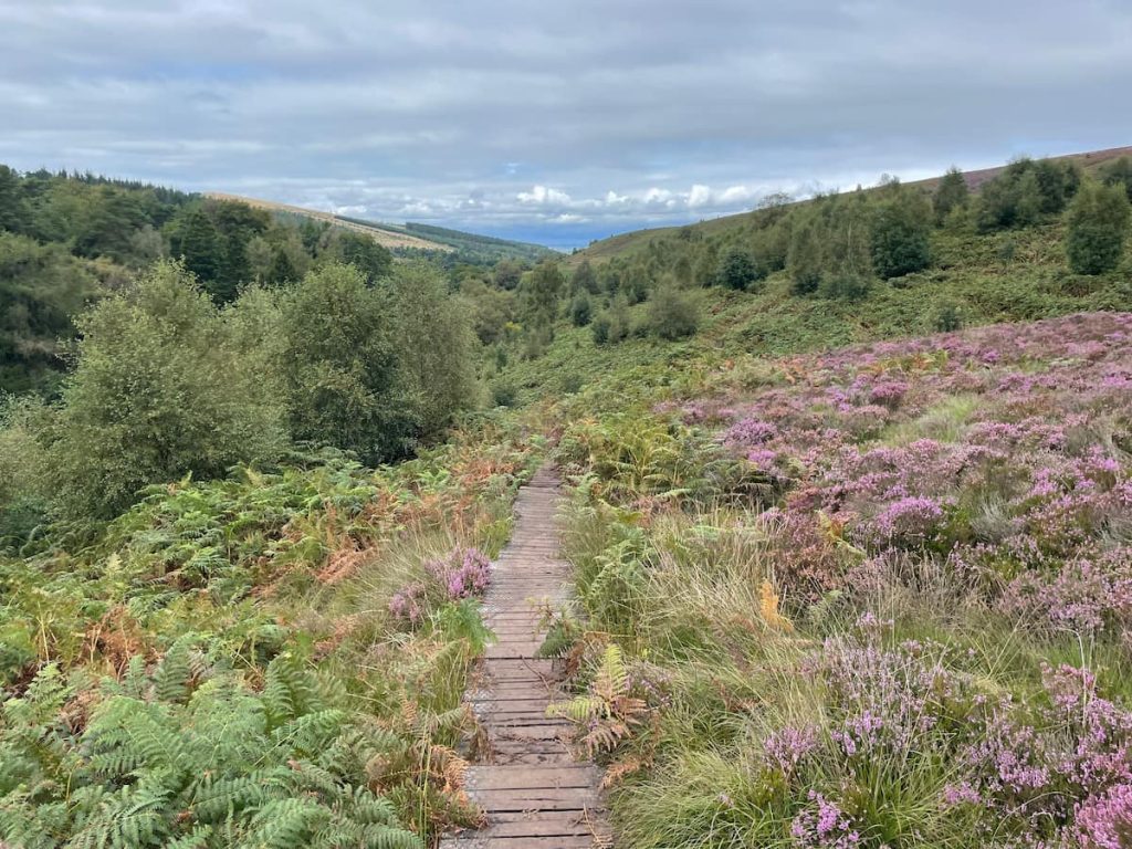
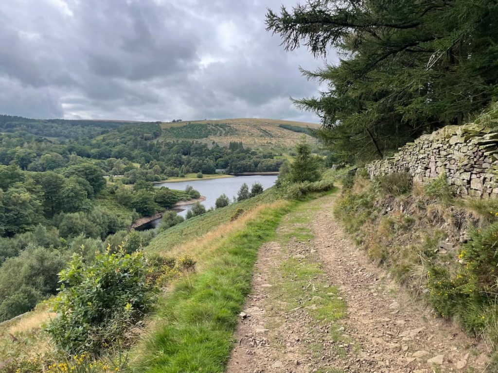
13. After passing through a wooden gate, you’ll be treated to a beautiful view of Errwood Reservoir.
14. Proceed down the track, which eventually loops to a stream crossing, taking you back to the other side of the valley.
Tip: Although there might be a shortcut shown on your map, be cautious. The stream doesn’t have a bridge, and if the water level is high, you’ll have to make quite a jump — not recommended for everyone.
15. Keep following the path as it winds through fields and patches of woodland.
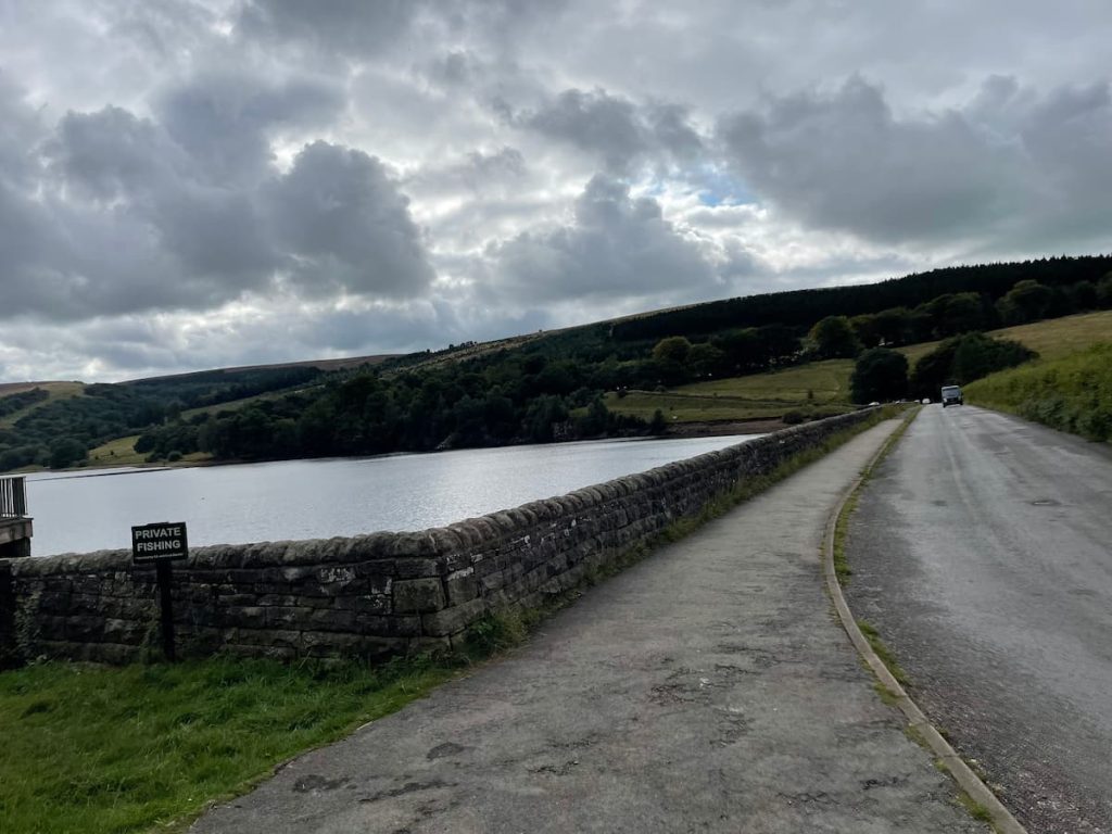
16. When you get to Goyt’s Ln, proceed downhill. Soon, you’ll be between the dams of Errwood and Fernilee Reservoirs. Cross this road, and a brief climb will bring you back to “The Street” car park, where you began.
- Daypack: Choose a 10-20L daypack to carry all your gear comfortably.
- Clothing: Wear layered, moisture-wicking clothing and pack a waterproof jacket and waterproof trousers for changing weather.
- Footwear: Sturdy walking boots or trail shoes are essential for the varied terrain.
- Water & Snacks: Carry enough water (at least 1L per hour) and bring energy-rich snacks.
- Navigation: Always have a map and compass, and optionally, bring a reliable GPS app to stay on track.
- First Aid Kit: Include essential items like blister treatments and painkillers. A compact First Aid Kit is ideal.
- Emergency Items: A headtorch, whistle, and multi-tool can be vital in unforeseen situations.
Please note some of these links may earn us a commission from qualified purchases at no additional cost to you, which helps fund the free content we provide.
Shining Tor Walk (Short)
🟢 Easy | 🚶♂️ 6.7 (4 mi) | ⛰️ Total Ascent: 169m (554ft) | ⏱️ 2 Hours
Download file for GPSThis route begins with a brief ascent up a hill, merging onto the main path that traverses the long moorland path. It culminates at the summit of Shining Tor before retracing the path back to the start.
Step-by-Step Guide
1.The journey begins from Pym Chair car park. From there, take a left onto the road and continue uphill. Soon, you’ll spot a gate on your right. Pass through it, and you’re on the main path of the walk.
2. Continue along the path, and you’ll journey past landmarks such as “Oldgate Nick” and Cats Tor. Eventually, the path will transform into paving stones. As you progress, absorb the breathtaking views of the surrounding area.
3. In time, you’ll reach the pinnacle of Shining Tor and its distinct trig point.
4. Once you’ve taken in the sights and are ready to head back, simply retrace your steps along the same path. Your adventure will conclude back at the Pym Chair car park.
Shining Tor Walk Amenities & Facilities
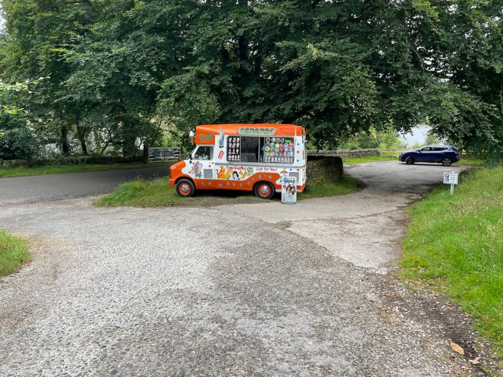
The area surrounding Shining Tor is largely missing amenities. However, during the summer months, you might spot an ice cream van stationed at “The Street” car park, the starting point of the long Shinning Tor Walk.
For a broader range of services, Buxton is your best bet. Just a 10-minute drive away, this prominent town in the Peak District has a large Morrisons, several pubs, and other essentials to meet your needs.
Shining Tor – FAQs
How long is Shining Tor walk?
Shining Tor Walk (Via Errwood Hall & Reservoir – Long): The distance is 11.5km (7.2 mi) and it takes approximately 3-4 hours to complete.
Shining Tor Walk (Short & Direct): The distance is 6.7km (4.3mi) and it takes approximately 2-2.5 hours to complete.
What can you see from Shining Tor?
From Shining Tor, on a clear day, you can enjoy far-reaching views with Manchester clearly visible, and further to the left, you can see the Jodrell Bank Dish.
Where do you park for the Shining Tor?
There are multiple parking options:
For a longer walk, park around Errwood Reservoir at:
– “The Street” Car Park: ///inspects.addicted.detective
– Errwood Hall Car Park: ///pots.unzipped.signal (Note: Not accessible on Sundays & Bank Holidays)
– Goyt’s Ln: ///voltage.tasteful.reception
For a short & direct walk, park at:
– Pym Chair car park (Be aware of limited spaces during peak times)
Is Shining Tor dog friendly?
Yes, Shinning Tor is dog friendly. Like most areas in the Peak District, dogs are generally allowed, but always ensure they are under control, especially around livestock.
How high is Shining Tor?
Shining Tor is the highest point in Cheshire, with an elevation of 559 meters (1,834 ft) above sea level.
Shining Tor is also the 7th highest peak in the Peak District.
Milo T.
Thursday 4th of July 2024
heard shining tor is haunted, anyone seen a ghost up there? asking for a friend haha.
Sienna W.
Friday 31st of May 2024
Can anyone tell me if there are any restrictions for dogs? want to take my lab but not sure if it's allowed, thx.
Clara H.
Tuesday 2nd of July 2024
Dogs are welcome but please keep them on a lead to protect wildlife.
Dave M.
Thursday 20th of June 2024
Been there with my dog last month, no problems. You're good to go!
Lucas B.
Saturday 6th of April 2024
is it just me or are these routes getting overhyped? been to shining tor last year it was allright but nothing extraordinary.
Raj P.
Tuesday 20th of February 2024
I'm curious about the fauna one might encounter on the Shining Tor walks. The area is known for its scenic beauty but I haven't read much about the wildlife there. Any insights from someone who's been there recently?
Tim R.
Sunday 10th of December 2023
Great detail on the walking routes. We've been looking for a family friendly hike and this looks perfect. Kids will be thrilled to see Errwood Hall along the way. Thanks for sharing.