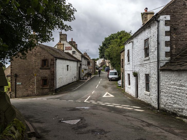
At over 1,500 feet above sea level, Flash holds the title of Britain’s highest village. But its elevation is just the beginning of the story.
Perched on the border of three counties, this remote Staffordshire Moorlands settlement was once a haven for counterfeiters who exploited the confusion of overlapping jurisdictions.
Today, it’s better known for dramatic moorland scenery and some of the Peak District’s finest walks nearby.
A History of Flash Village
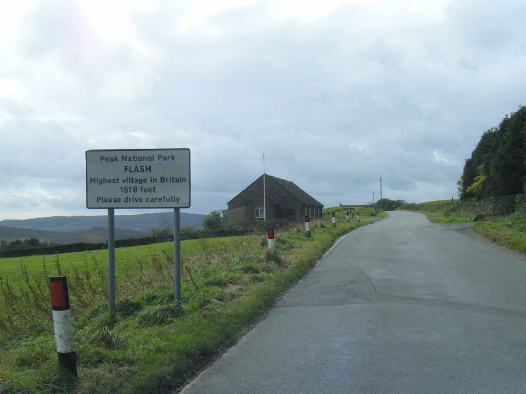
Ordnance Survey confirms Flash as the highest village in the United Kingdom, standing at 1,519 feet (463 metres) above sea level. All of the village’s buildings sit entirely above the 450-metre contour line, securing its title over other claimants like Wanlockhead in Scotland.
This extreme elevation, combined with its position on the southern slope of Axe Edge Moor, has shaped the village’s entire identity. The harsh moorland climate and geographical isolation created both challenges and opportunities that would define Flash for centuries.
A Haven for Outlaws
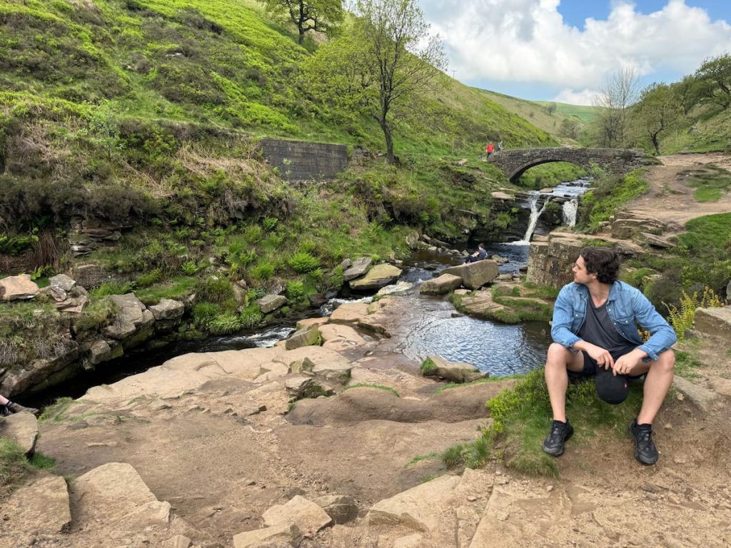
Flash’s location at the confluence of three county boundaries, Staffordshire, Derbyshire, and Cheshire, created a unique jurisdictional loophole. The meeting point of these counties, known as Three Shires Head, (Packhorse bridge seen in image) became a tactical sanctuary for anyone looking to evade the law.
When authorities from one county pursued criminals, the outlaws simply stepped across the boundary stream into neighbouring territory where the officers had no legal power. This allowed illegal activities like prize fighting and cock-fighting to flourish long after they’d been suppressed elsewhere.
The Legacy of Flash Money
The village’s most enduring contribution to history is linguistic. The term “flash money” supposedly originated here, referring to counterfeit coins produced by local gangs who repurposed button-making tools for illegal purposes.
The counterfeiting operation was eventually exposed when a servant girl informed the authorities, leading to arrests and hangings at Chester. But the impact lasted far beyond those prosecutions.
The word “flash” entered the English language as slang for counterfeit goods and ostentatious displays of wealth, a permanent reminder of Flash’s lawless past.
Community Spirit: The Tea Pot Club
Despite its dark reputation, Flash’s residents also pioneered remarkable community support systems. In 1846, locals established the Flash Loyal Union Society, better known as the Tea Pot Club.
This organisation functioned as a hyperlocal social insurance scheme, collecting funds from members to provide financial support during illness and cover burial costs. The charming name came from members collecting spare change in a communal teapot.
The Tea Pot Club predated the National Health Service by a century, demonstrating the resilience and solidarity that harsh moorland living demanded. Though forced to dissolve in the 1990s due to government regulations, its legacy continues with an annual Tea Pot Parade, and the original banner hangs in St. Paul’s Church.
Main Sights & Landmarks
The New Inn
Address: New Rd, Flash, Buxton SK17 0SW
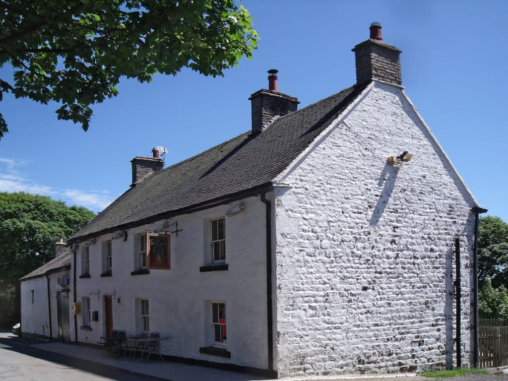
The New Inn proudly holds the title of Britain’s highest village pub, standing at 1,518 feet above sea level.
This 250-year-old building, constructed from local millstone grit, serves as the official starting point for the popular Flash and Three Shires Head walk. Inside, you’ll find one regular ale and one changing beer, often featuring brews from Storm Brewery of Macclesfield.
For walkers completing routes in the area, there’s no better finish than a pint at the top of England.
St. Paul’s Church
Address: Brown Ln, Flash, Buxton SK17 0SW
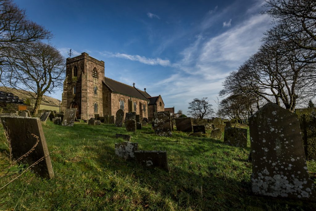
Though the village is known as Flash, it officially sits within the civil parish of Quarnford, and St. Paul’s Church reflects this history.
The current stone building dates from 1901, though a church has occupied the site since 1744. Inside, you’ll find magnificent stained glass windows, a fine organ, and intricately carved woodwork.
Flash Bar Stores
Flash Bar Stores claims the title of England’s highest shop. Serving hot and cold food throughout the year.
The name “Flash Bar” refers to its history as the site of a tollhouse built in 1771, which operated a toll bar on the old Macclesfield to Longnor turnpike road.
This video gives a nice overview of the village:

Walks Around Flash
Flash sits at the heart of some of the Peak District’s most dramatic walking country.
The exposed moorland offers spectacular views, but demands respect—conditions can change rapidly.
Three Shires Head Circular

Distance: 6 km (3.7 miles)
Duration: 2–2.5 hours
Difficulty: Moderate
This popular walk near Flash village takes you straight to the picturesque spot where Staffordshire, Derbyshire, and Cheshire meet.
The route follows old packhorse routes down to the River Dane, where an 18th-century bridge crosses a series of small waterfalls. This is Three Shires Head, the jurisdictional anomaly that made Flash’s lawless reputation possible.
The walk returns via open moorland with sweeping views across the southern Peak District.
What to know: The moors can be extremely muddy, particularly after rain. Dogs must be kept on leads due to free-roaming sheep. Avoid the route in bad weather, as the exposed terrain offers little shelter.
The Roaches Circular
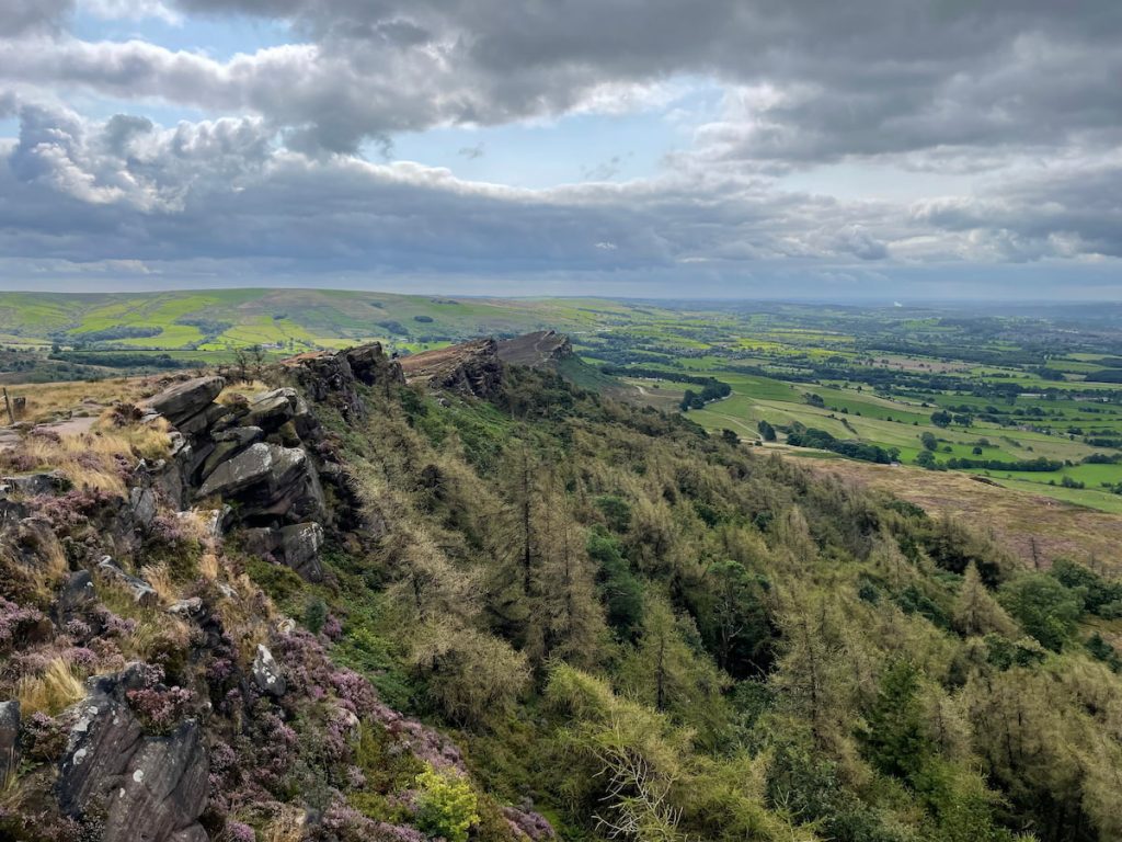
Distance: 6.6 km (4.1 miles)
Duration: 1.5–2 hours
Difficulty: Moderate
Located just off the A53 near Flash, The Roaches takes its name from the French “les roches” (the rocks) and offers one of the most distinctive ridge walks in the Peak District.
The route climbs past Hen Cloud before ascending to the main ridge, where the famous “winking man” rock formation stands watch over Staffordshire. At 505 metres, the trig point marks the 27th highest peak in the Peak District.
The descent takes you through Roaches forest, where you might spot climbers tackling the gritstone crags. Keep an eye out for Doxey Pool, said to be haunted by a mermaid who lures travellers to their doom.
History note: In the 1930s, five Bennett’s wallabies from Australia were released at The Roaches. Their descendants survived well into the 21st century, though the colony is now believed to be extinct.
Parkhouse & Chrome Hill (The Dragon’s Back)
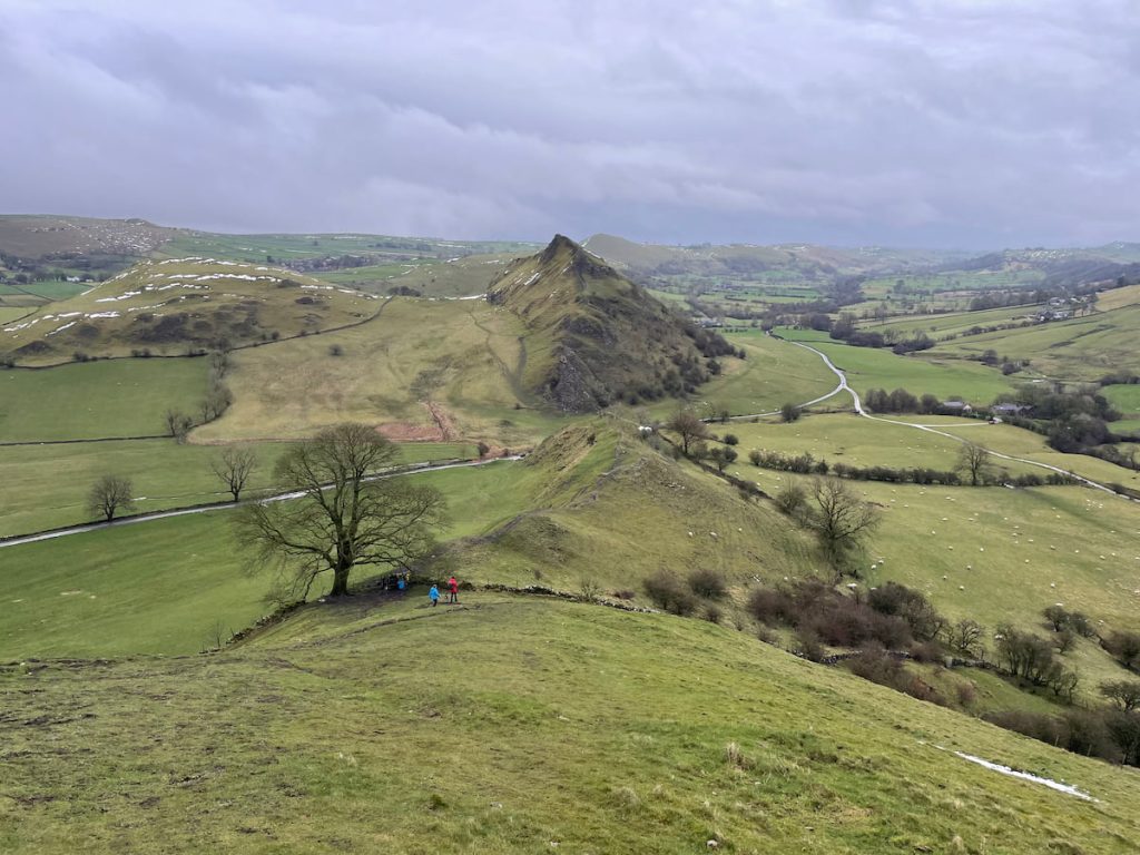
Distance: 7.2 km (4.5 miles)
Duration: 2.5 hours
Difficulty: Challenging
Parkhouse and Chrome Hill create one of the Peak District’s most recognisable landmarks. The two limestone hills rise from the valley floor in a distinctive spiny ridge that’s earned the nickname “The Dragon’s Back.”
Starting from Hollinsclough, the route crosses fields before tackling the steep ascent of Parkhouse Hill (optional), followed by the main climb up Chrome Hill. The summit scramble requires good footwear and a head for heights, but rewards you with panoramic views across the valley.
Pop culture: Chrome Hill featured in the TV series Peaky Blinders, showcasing its dramatic profile to millions of viewers.
This walk is not for casual hikers. The steep climbs and ridges demand confidence and proper equipment.
View Parkhouse & Chrome Hill walk
How to Get There
By Car
Flash sits directly on the A53, making it surprisingly accessible for such a remote village.
- From Buxton: 10 minutes (7 km / 4.5 miles)
- From Leek: 15 minutes (13 km / 8 miles)
Parking for The New Inn is available at the pub, and there are laybys along the A53 for walkers.
Winter warning: Snow regularly makes the A53 impassable during the winter months, cutting Flash off from surrounding towns. Check weather conditions before travelling between November and March.
Public Transport to Flash
Public transport to Flash is limited but possible with planning.
High Peak Buses Service 58 connects Buxton and Macclesfield via the scenic Cat & Fiddle road, with stops near Flash. The service runs on weekdays and Saturdays.
Ashbourne Community Transport operates a Sunday service connecting Flash to both Buxton and Leek, running once daily.
The nearest railway station is Buxton, which has connections to Manchester and beyond.
Nearby Towns & Local Area
Flash village lacks major commercial services, so visitors typically base themselves in one of the nearby market towns.
Buxton
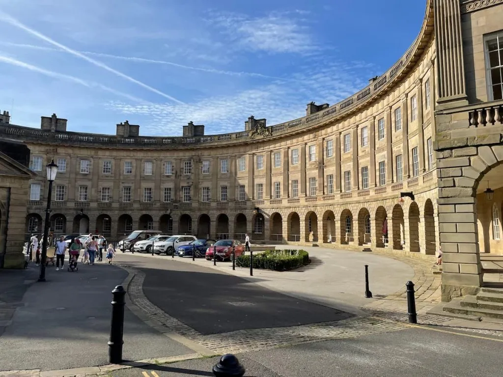
Buxton serves as the main gateway for tourism in the area. This historic spa town offers the widest range of accommodation, restaurants, and amenities, plus the nearest railway connections.
Leek
Known as the “Queen of the Moorlands,” Leek is the administrative and commercial centre for the Staffordshire Moorlands. The town is particularly known for its antiques shops and traditional markets.
Macclesfield
Historically linked to Flash village through the silk industry (particularly the Gradbach silk mill, which operated from 1640 to 1840), Macclesfield offers rail connections to London and Manchester and makes a good base for exploring the western Peak District.