
Visit the mischievously named Slippery Stones in the Upper Derwent Valley, a well-known and popular wild swimming spot in the Peak District National Park.
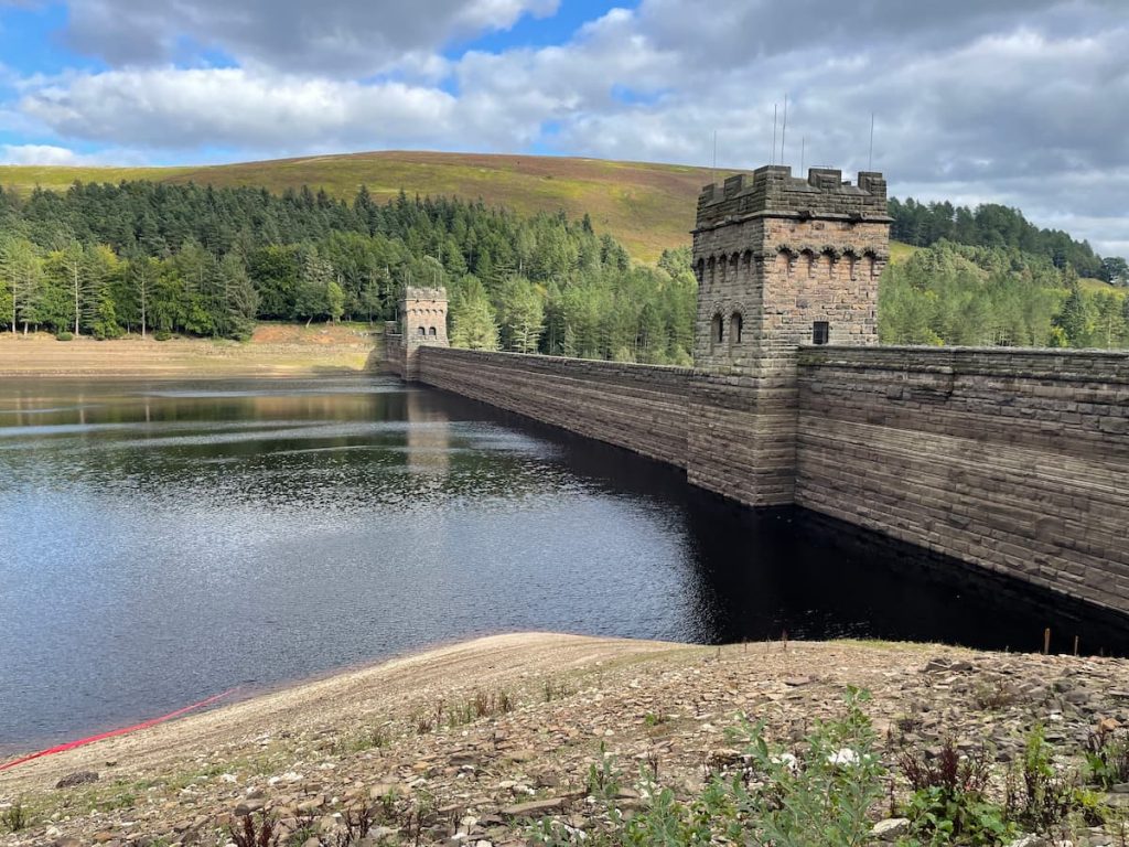
This long but breathtaking hike offers views of both Derwent and Howden Dams, as well as the tranquil woodland surrounding them.
So, lace up your boots as we cover everything you need to know before your next visit!
Getting to Slippery Stones
Public transport to the area is very limited. The only bus that stops at Fairholmes is the 257c, which runs from Sheffield Interchange to Glossop. You can view the timetable here.
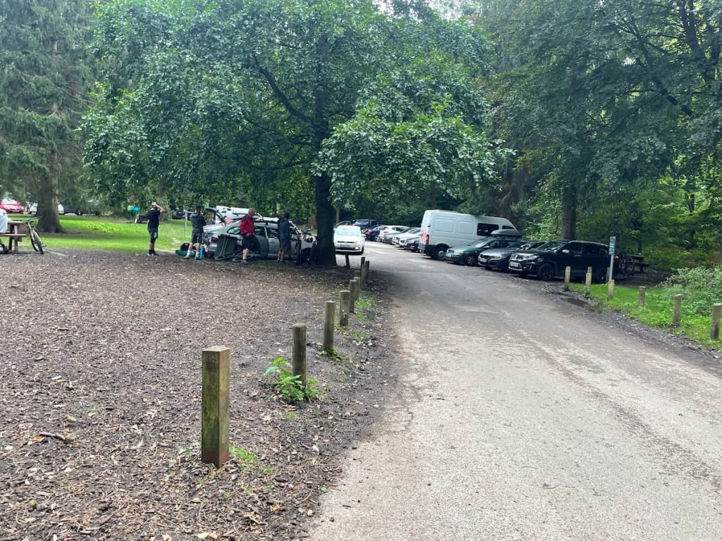
Due to the limited public transport, it’s more advisable to visit by car and park at the Fairholmes Visitor Centre.
Parking For Slippery Stones
You can park at the main visitor centre (Fairholmes), which is usually the closest spot. During the week, the road to Kings Tree is open, providing closer access to the swimming spot.
Fairholmes Visitors Centre (Paid)
- Address: Derwent Ln, Bamford, Hope Valley S33 0AQ
- Cost: £3.50 for 2hrs, £6 for all-day
The car park is fairly small, so make sure to arrive early to secure a spot.
If it’s full, there are several spots along Derwent Lane towards Ladybower Reservoir that you can try. You’ll have driven past these on your way to the visitor centre:
- Derwent Overlook Car Park
- Bridge End Car Park +15 min walk
Kings Tree (Mon-Fri)
- Address: Kings Tree, Hope Valley, S33 0BB
If you want to get as close as possible without doing the whole route, you can park at Kings Tree, which is just a mile from Slippery Stones.
However, parking is very limited and only available Monday through Friday, excluding bank holidays and weekends.
Slippery Stones Walking Map & Route
🟢 Easy/Intermediate | 🚶♂️ 16.7 km (10.4 mi) | ⛰️ Total ascent: 234 m (769 ft) | ⏱️ 3.5-4.5 Hrs
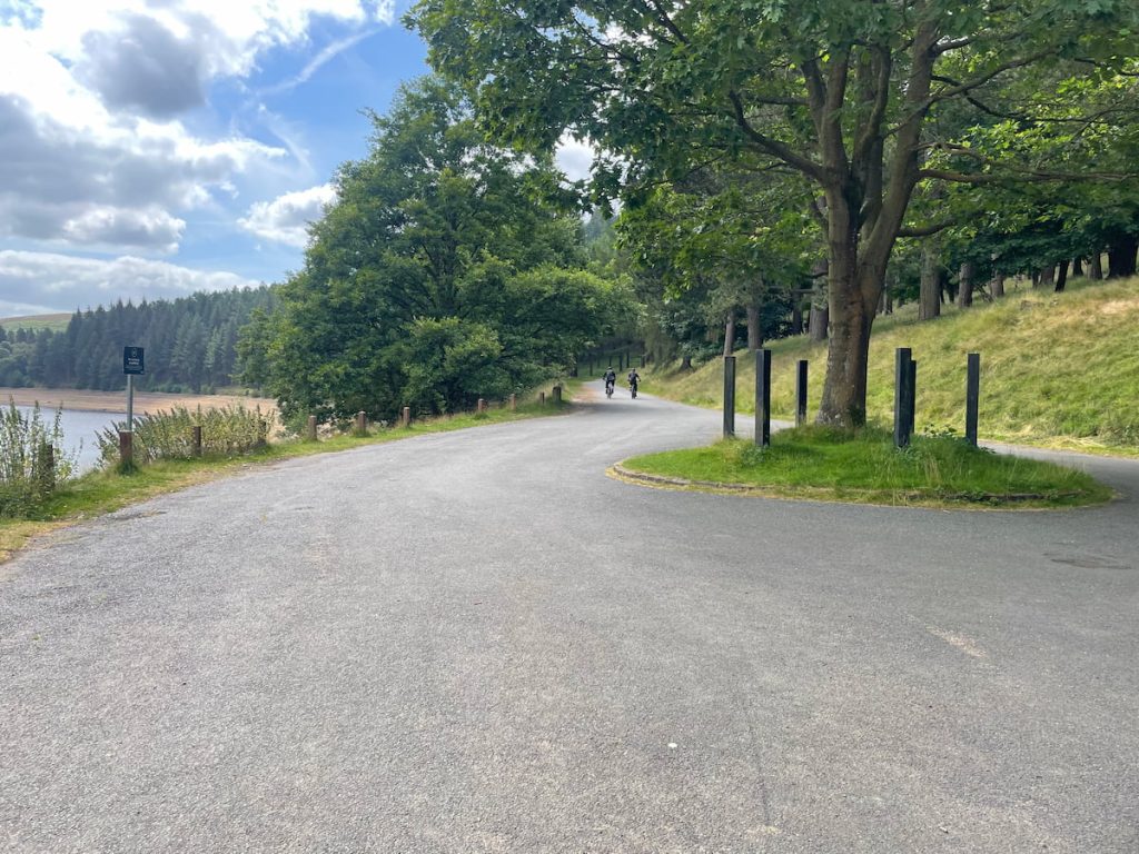
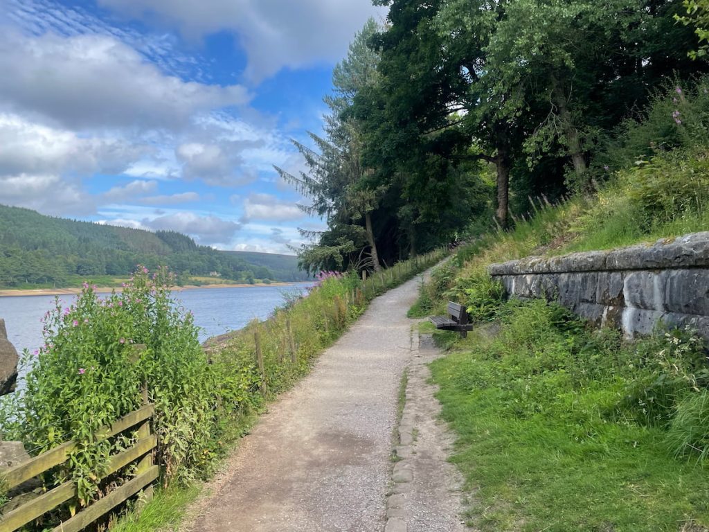
Download file for GPSThe route heads out of the visitor centre to the foot of Derwent Dam, going up on the right side. Then, it follows the water’s edge along the well-defined gravel path past Howden Dam until reaching the swimming spot at the far end of the reservoir. You then cross the stone bridge and continue along the tarmac road on the other side, back to the starting point.
Which hiking map app should I use? I recommend OS Maps Online for its unparalleled accuracy. However, if you’re a beginner, you might find AllTrails to be more user-friendly. For a detailed review of the best UK map apps, read my full review.
Slippery Stones Walk Step by Step – 16.7 km (10.5 mi) ~ 3.5-4.5hr
1. Head out from Fairholmes Visitor Centre and follow the road over the bridge. Shortly after, you will see the magnificent Derwent Dam wall.
2. Cross the field and ascend the staircase to your right. After this initial set of stairs, you’ll have a splendid side view of the dam wall.
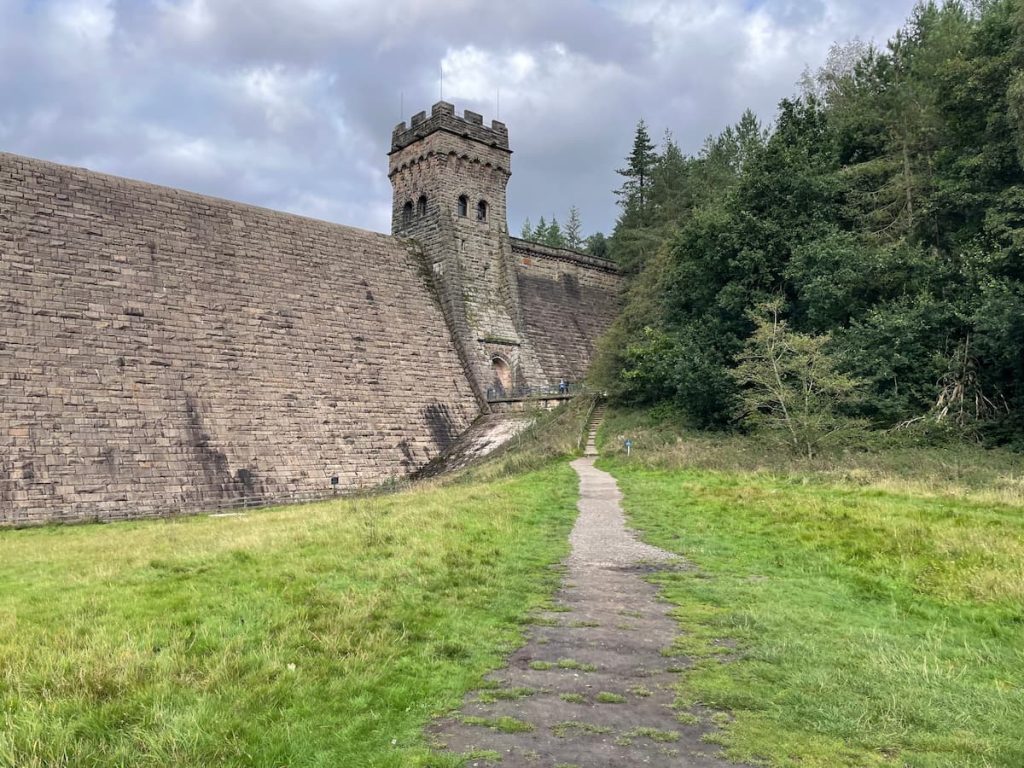
Note: When rain and water levels are high, water cascades from the top of the dam wall, creating a breathtaking waterfall-like spectacle!
3. Keep climbing the stairs. Upon reaching the top, turn left and follow the track, which gently winds along the water’s edge towards Howden Reservoir.
Note: At the time of writing, there is a small diversion in place as the stairs are being worked on, but it is fairly straightforward.
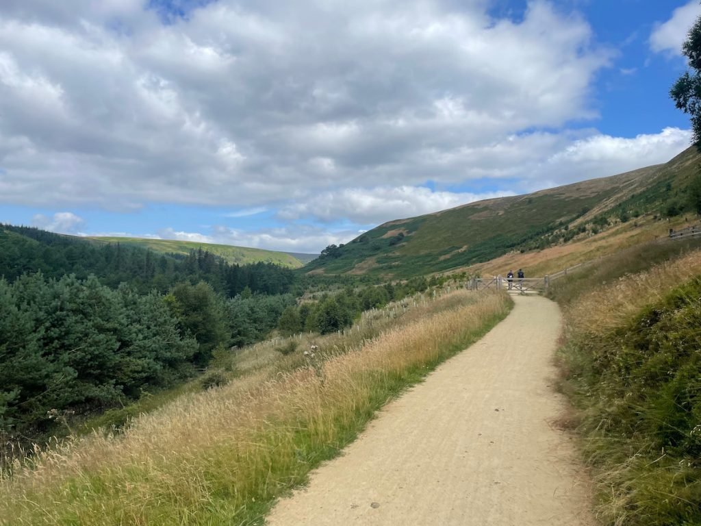
4. After a little over an hour on the footpath, you’ll emerge from the treeline, approaching the final section to the swimming spot.
You have two main options for swimming around Slippery Stones:
- At the Stone Packhorse Bridge: This is easily visible from the stone path.
- Upstream Plunge Pool: Slightly upstream from the stone bridge, cross the footbridge to an open area with a plunge pool, which tends to be less busy.
5. After spending some time in the area, cross over the stone footbridge and follow the path back down the other side of the reservoir.

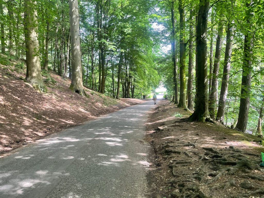
6. After a short while, you’ll reach a small roundabout with a tree in the middle called “Kings Tree.” From here, the route follows a full tarmac road along the water and past tree-lined woods.
7. Take in the magnificent views at various points. You can also explore the history of the area, such as viewing the workers’ Tin Town and surrounding buildings related to the area’s past. Before you make it back to the car park, there’s a great viewing point of Derwent Dam from the other side.
8. Follow the road back to the visitor centre, where the hike will end.
- Daypack: Choose a 10-20L daypack to carry all your gear comfortably.
- Clothing: Wear layered, moisture-wicking clothing and pack a waterproof jacket and waterproof trousers for changing weather.
- Footwear: Sturdy walking boots or trail shoes are essential for the varied terrain.
- Water & Snacks: Carry enough water (at least 1L per hour) and bring energy-rich snacks.
- Navigation: Always have a map and compass, and optionally, bring a reliable GPS app to stay on track.
- First Aid Kit: Include essential items like blister treatments and painkillers. A compact First Aid Kit is ideal.
- Emergency Items: A headtorch, whistle, and multi-tool can be vital in unforeseen situations.
Please note some of these links may earn us a commission from qualified purchases at no additional cost to you, which helps fund the free content we provide.
Swimming at Slippery Stones
Wild swimming offers a connection with nature and a sense of freedom.
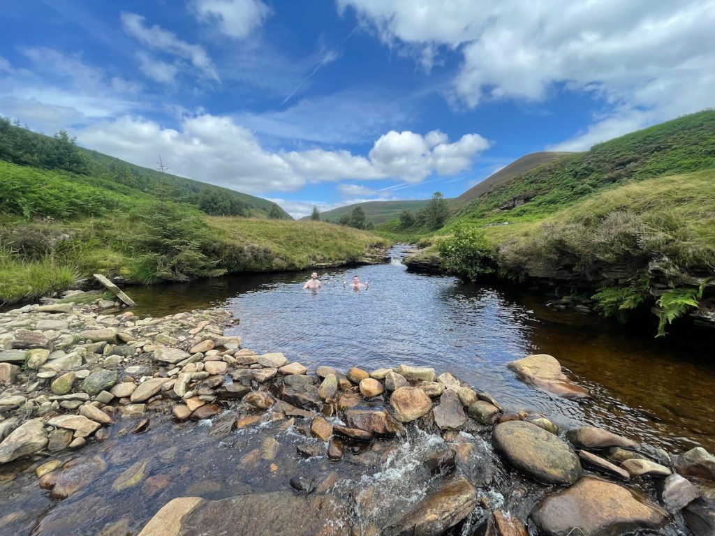
All the spots are formed by the River Derwent’s tributaries from the surrounding moorland. Depending on the weather, they can get quite deep, with some plunge pools reaching 4 metres (13 feet) in depth, so be sure to check before jumping from any height.
The rocks can also be very slippery (hence the name) and uneven underfoot, so be sure to take care.
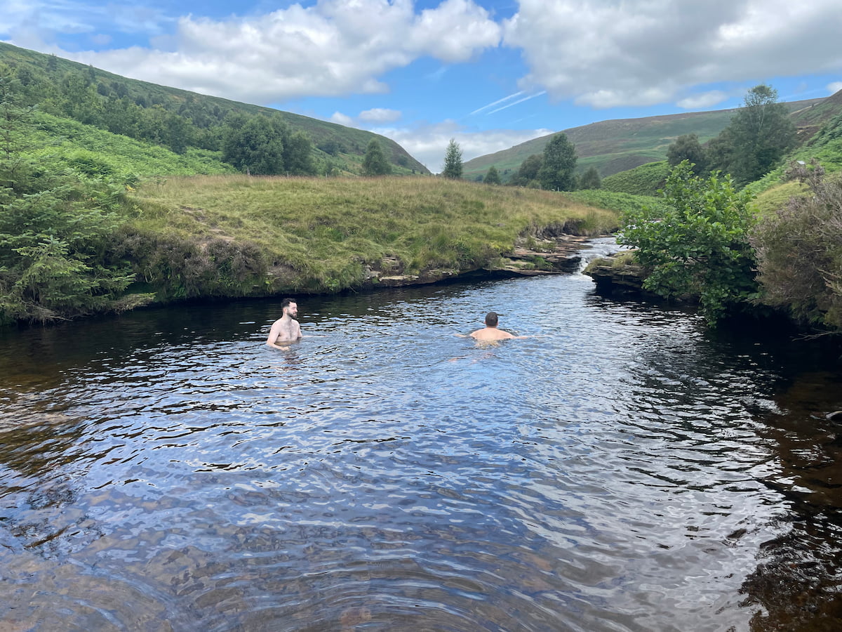
Are are two main swimming stops around Slippery Stones:
Packhorse Bridge Location
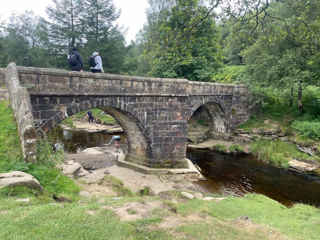
The location by the large stone bridge is hard to miss and has several natural platforms at the water’s edge, making for easy access, although the water here tends to be shallower.
This spot also tends to be the busier of the two.
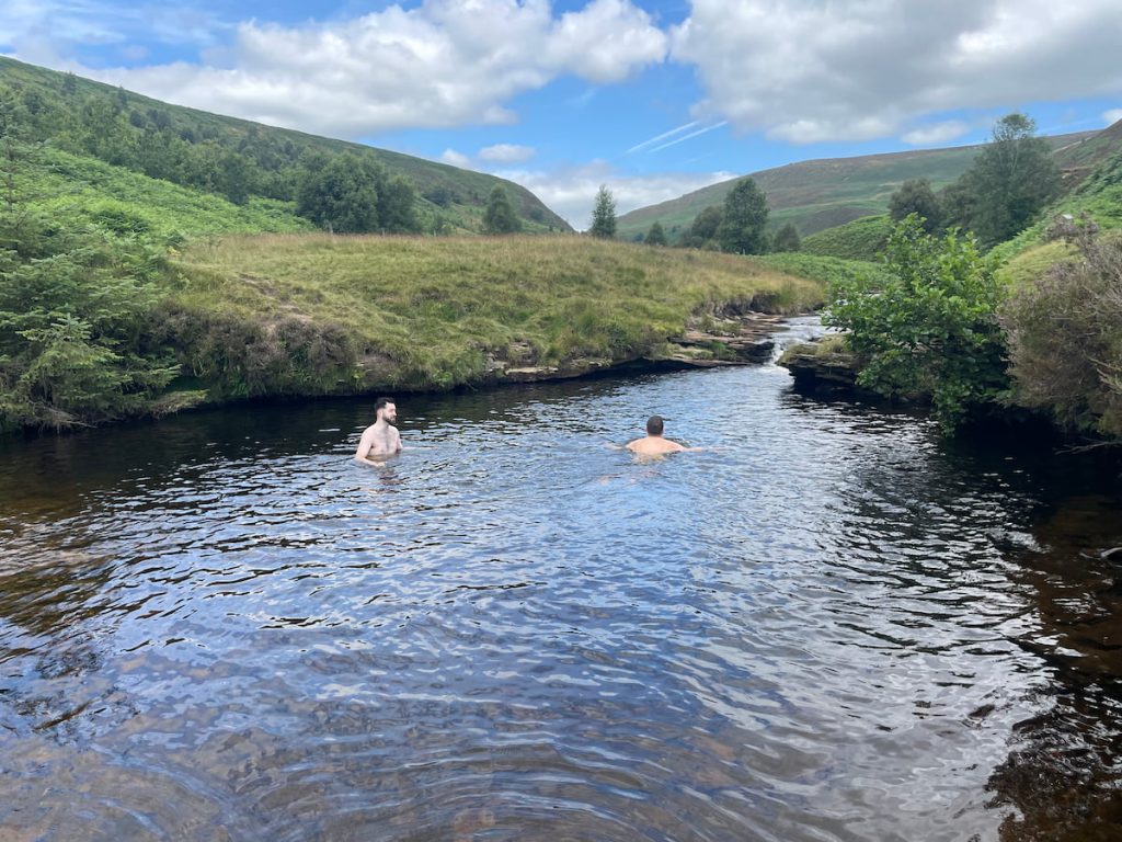
Upstream Waterfall Plunge Pool
Slightly further upstream is a particularly large and deep plunge pool, around 4 metres (13 feet) deep in July, surrounded by trickling water.
To reach this, cross the small footbridge into the clearing. The GPS route attached to this article leads here.
Wild Swimming Saftey Tips
While wild swimming can be an amazing experience, it does carry some inherent risks that you need to be aware of before you take the plunge.
Some tips for staying safe in the Peak District include:
- Check weather and water conditions, including depth, before swimming.
- Acclimatise slowly, and don’t overestimate your swimming ability. Even in the summer months, there’s a risk of cold water shock.
- Dry off and warm up quickly afterwards to prevent hypothermia.
- Never swim alone. Have a friend with you in case of emergencies.
- Watch out for blue-green algae.
- Follow local guidance and avoid restricted areas.
If you enjoyed this swimming stop, be sure to check out our article on the best Peak District wild swimming spots.
Local Amenities & Facilities
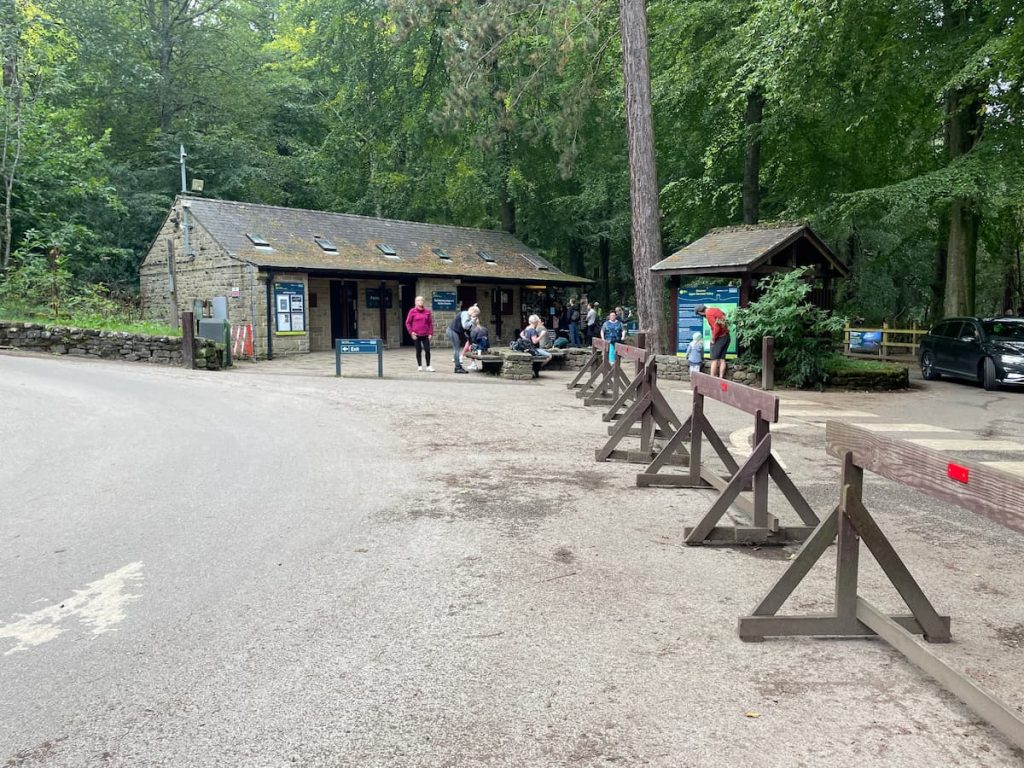
- Public Toilets
- Café
- Picnic Benches
- Ranger Outpost & Visitor Centre
- Mountain Bike & Cycle Hire – View details here (Also suitable for this walk. Est 1hr to cycle the same route)
If you fancy a more hearty meal or need a convenience store, Bamford is the nearest village, just a 10-15-minute drive away.
The closest shop for those seeking extra provisions is the Texaco petrol station near the train station.
Please note that there are limited rubbish and water facilities around the walk. Therefore, it’s advised to bring everything you might need with you and be prepared to take it all away with you.
Yorkshire Bridge Inn
A quintessential country pub and dog-friendly hotel, the Yorkshire Bridge Inn is located along the River Derwent, just a short distance from Ladybower Dam.
A traditional pub and, on sunnier days, an expansive beer garden.
Slippery Stones – FAQs
Can you drive up to Slippery Stones?
Generally not. Between Monday and Friday, if the road is open, you can drive and park at Kings Tree, which is close. However, most visitors will have to walk from Fairholmes Visitor Centre, about a 90-minute walk along the water’s edge.
This is a very long but accessible route.
How long does it take to walk Derwent Reservoir?
The Derwent Reservoir walk via Slippery Stones takes 3.5-4.5 hours and covers a long but flat distance.
If you’re looking for something shorter, consider the other Derwent Dam & Reservoir walk, which heads up into the surrounding hills for some fantastic views and takes around 2.5 hours.
Can you swim in Derwent Reservoir?
No. The Peak District National Park states that you aren’t allowed to swim in any reservoirs, including Derwent.
The closest spot would be the location at Slippery Stones mentioned in this article.