Derbyshire has a treasure trove of fascinating and varied walks, from the hustle and bustle of the surrounding towns and cities to the serene rolling countryside hills of the Peak District National Park.
There are plenty of options for miles of walks all year round. So, lace up your boots as I go over some of the best walks in Derbyshire!
In a hurry? Here’s a Quick Best list:
- 🏆 Best Overall: Mam Tor & the Great Ridge
- 💧 Best Reservoir: Staunton Harold Reservoir OR Carsington Water
- 🚶♂️ Best Trail: Monsal Trail
- 🏔️ Best Hill Hike: Stanage Edge
If you’re willing to expand your driving, check out the best Peak District walks, which are in the neighboring counties of Cheshire and Staffordshire.
Top Walks in Derbyshire
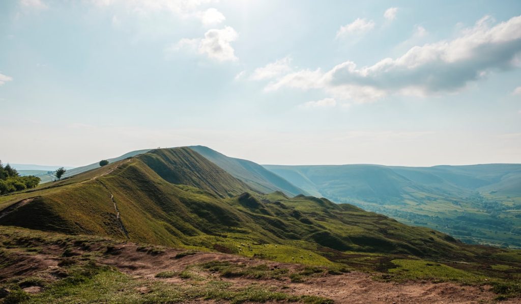
1. Mam Tor & the Great Ridge
🟡 Medium | 🚶♂️ 11.36 km (7.06 mi) | ⛰️ Total ascent: 473 m (1,552 ft) | ⏱️ 3-4 Hrs
Starting Point: National Trust Mam Nick Car Park (Paid)
One of the best-loved ridge walks in the Peak District, and Derbyshire is Mam Tor and the Great Ridge trail. It gives you stunning 360-degree views from the top, which extends for miles as you cross the ridge.
Large sections of the Mam tor path are well paved and easy to follow, making it a great walk for anyone new to exploring the Peak District National Park.
This particular route goes over Hollins Cross, Back Tor, Lose Hill, and into Castleton, covering a distance of 7.13 miles (11.5km). However, should you wish, it can be shortened significantly for those with less ability or appetite for a long walk.
2. Stanage Edge
🟡 Easy-Medium | 🚶♂️ 7 km (4.35 mi) | ⛰️ Total ascent: 219 m (719 ft) | ⏱️ 2-3 Hrs
Starting Point: Hollin Bank Car Park (Paid)
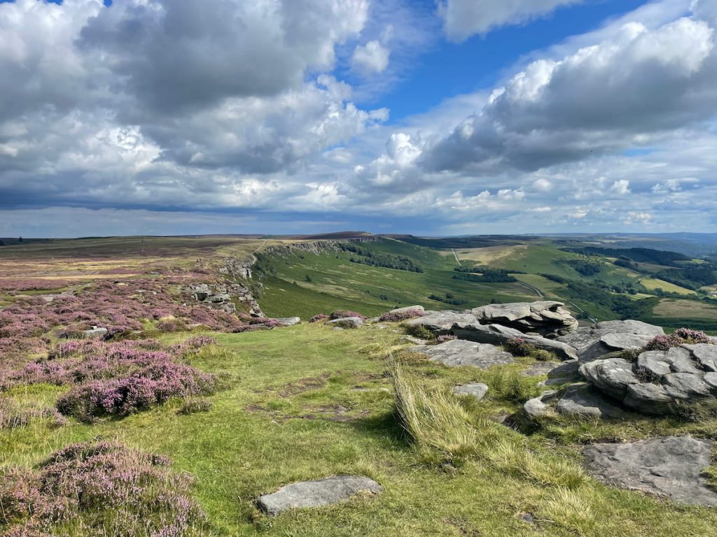
Stanage Edge is renowned for its striking cliffs. This area offers circular walking routes with spectacular views of the surrounding hills and moors, especially from its highest point, High Neb.
The route is adaptable, allowing walkers to lengthen or shorten their journey. Once you get on the Edge, the walk flattens as you cross the “long causeway”.
Stanage Edge is not only a walker’s delight but also a popular spot for climbers, boasting over 2,000 climbing routes across diverse terrains. Look out for the famous Robin Hood cave, which is said to be steeped in legend. The area is also known for recent celebrities, with Keira Knightly filmed here for Pride & Prejudice.
Download file for GPS3. Calke Abbey & Staunton Harold Reservoir (National Trust)
🟢 Easy | 🚶♂️ Variable Distances | ⛰️ Gentle Terrain | ⏱️ Flexible

Starting Point: National Trust Car Park – Calke Abbey OR National Trust Car Park – Staunton Harold
Discover the serene beauty of Calke Abbey and its surrounding landscapes with a leisurely walk around the abbey and Staunton Harold Reservoir. Nestled in the heart of the National Trust estate, this walk offers tranquil views over the water and the chance to explore the historic parkland of Calke Abbey.
With gentle terrain and various paths to choose from, it’s perfect for a relaxing stroll or a family outing. The area is rich in wildlife and history, providing a peaceful escape into nature.
This route is adaptable, allowing you to tailor the length and difficulty to suit your preferences, making it an ideal choice for anyone seeking a leisurely walk with plenty of scenic beauty.
View more information here
4. Dovedale & Thorpe Cloud
🟡 Easy-Medium | 🚶♂️ Variable Distances | ⛰️ Mixed Terrain | ⏱️ Flexible
Starting Point: Dovedale National Trust Car Park
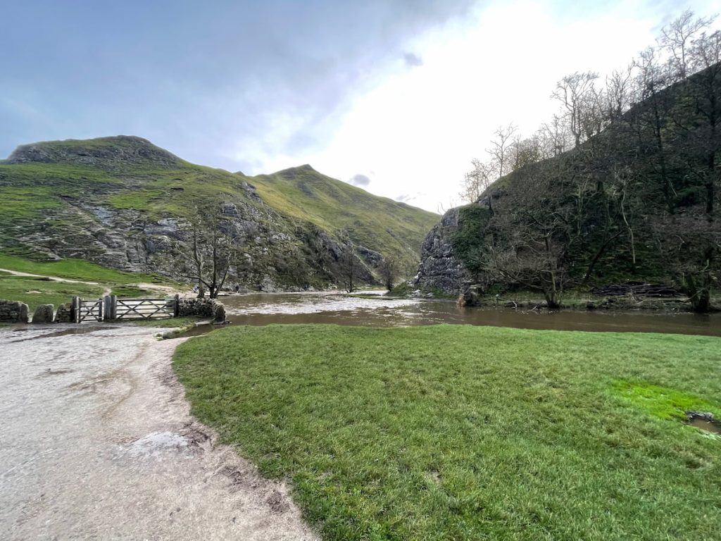
Dovedale, situated along the river Dove on the border of Staffordshire and the Derbyshire Peak District, has been a favourite spot for visitors since Victorian times. This area is loved for its long valley, Ilam Hall, quaint villages, and famous stepping stones walk.
There are a few walks to enjoy around Dovedale. A top choice is to walk along the river to Milldale, passing by Lover’s Leap and Reynard’s Cave. You might also like to take a short side trip to the top of Thorpe Cloud, where you’ll be rewarded with fantastic views of the surrounding area.
See OS Map Online – River Walk
See OS Map Online – Thrope Cloud
5. Lathkilldale
🔵 Easy-Medium | 🚶♂️ 6.6 km (4.1 mi) | ⛰️ Total Ascent: 139 m (455 ft) | ⏱️ 2-3 Hours
Starting Point: Near the village of Monyash
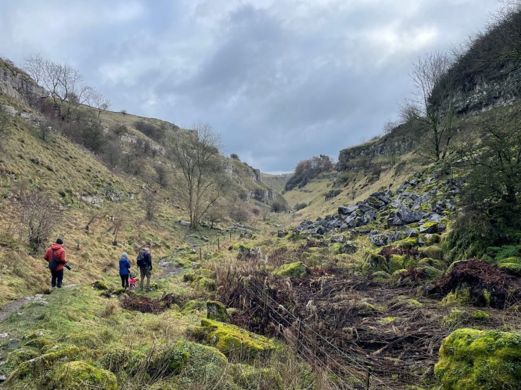
Lathkill Dale is a charming limestone valley in the Peak District featuring a river and waterfalls, surrounded by an area steeped in mining heritage.
The walk begins near Monyash village, close to Bakewell, and descends into the valley, following the river’s path. It then loops back, crossing the open fields above.
In Lathkill Dale Valley, you’ll find a delightful combination of craggy limestone cliffs, woods, caves, babbling streams, and even the odd wild swimmer.
- Daypack: Choose a 10-20L daypack to carry all your gear comfortably.
- Clothing: Wear layered, moisture-wicking clothing and pack a waterproof jacket and waterproof trousers for changing weather.
- Footwear: Sturdy walking boots or trail shoes are essential for the varied terrain.
- Water & Snacks: Carry enough water (at least 1L per hour) and bring energy-rich snacks.
- Navigation: Always have a map and compass, and optionally, bring a reliable GPS app to stay on track.
- First Aid Kit: Include essential items like blister treatments and painkillers. A compact First Aid Kit is ideal.
- Emergency Items: A headtorch, whistle, and multi-tool can be vital in unforeseen situations.
Please note some of these links may earn us a commission from qualified purchases at no additional cost to you, which helps fund the free content we provide.
6. Monsal Trail & Cheedale Stepping Stones
🟡 Easy-Medium | 🚶♂️ Variable Distances | ⛰️ Mixed Terrain | ⏱️ Flexible
Starting Point: Millers Dales Car Park
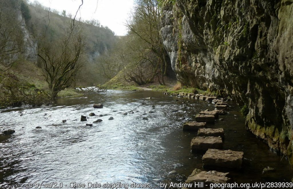
Chee Dale Stepping Stones and the Monsal trail it follows along offer a unique and enchanting experience for visitors.
The Monsal Trail is an old disused railway line that has been transformed into an 8.5-mile track with impressive tunnels and viaducts (such as Monsal Head). The flat trail makes it very accessible and is popular with both walkers and cyclists.
An exciting addition is a route to pass the Chee Dale stepping stones, which covers approximately 5km (3.2 miles). The route diverts from the Monsal trail and follows the river Wye before reopening.
Summer is the best time to visit the stepping stones, as the path can be muddy and the river levels high at other times, submerging the route.
View the other Peak District stepping stone walks.
7. Carsington Water

🟢 Easy | 🚶♂️ Various distances | ⛰️ Mostly flat | ⏱️ Adjustable
Starting Point: Carsington Water Visitor Centre
Carsington Water offers a great setting for a day out, with its easy-going trails winding around a large reservoir. The area is perfect for walkers of all ages and abilities, featuring mostly flat paths that make it accessible for everyone.
You can choose your own adventure here, with routes varying in length to suit your schedule and fitness level. The picturesque surroundings provide a backdrop of water views, wildlife, and the gentle hills of the Derbyshire countryside.
Whether you’re after a short, leisurely stroll or a longer walk to take in the full perimeter of the reservoir, Carsington Water caters to your needs. It’s a fantastic spot for bird watching, picnicking, and simply enjoying the peace and quiet of the great outdoors.
View more information here.
8. Bamford Edge
🔵 Medium | 🚶♂️ 5-9 km (3-6 mi) | ⛰️ Total Ascent: 210-320 m (690-1050 ft) | ⏱️ 1.5-3 Hrs
Starting point: Heatherdene Car Park
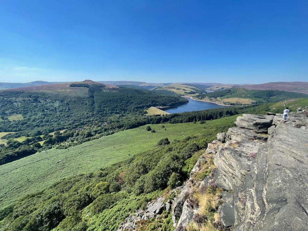
Bamford Edge is a popular spot for photography in the Peak District. It’s famous for its Peak District views from an overhanging rock. From here, you can see the stunning Ladybower Reservoir, Derwent, and other noticeable hills around.
There’s a straightforward 5km (about 3.3 miles) walk you can take. It starts with a quick climb from Heatherdene car park. Alternatively, you can choose a path that goes around in a loop. This way takes you through the village of Bamford (maybe stop at a pub) and then back, passing over the reservoir.
9. Derwent Valley & Dam or Ladybower Reservoir
🟢 Easy | 🚶♂️ Various distances | ⛰️ Mostly flat | ⏱️ Adjustable
Starting point: Heatherdene Car Park OR Fairholmes Car Park
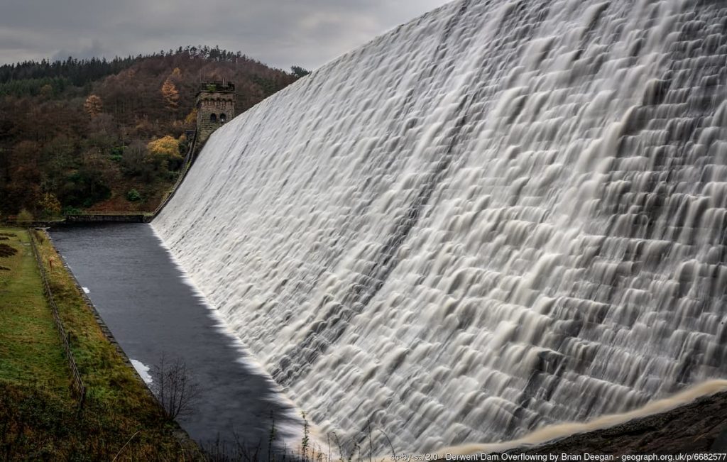
The area around Ladybower Reservoir and Derwent Dam is a haven for outdoor activities with various walking options.
If you want to view the impressive dam at Derwent park at Fairholmes Car Park and walk around that area. Or, if you want to mostly enjoy Ladybower Reservoir, opt to park at Heatherdene Car Park. Either way, you can enjoy the water around the biggest body of water in the Peak District, which holds a staggering 27,800,000 m3 of water.
Ladybower Reservoir Walking Guide
10. Kinder Scout
🟡 Medium-Hard | 🚶♂️ Various distances | ⛰️ Mostly Hilly | ⏱️ Adjustable
Starting Point: Mostly around Edale
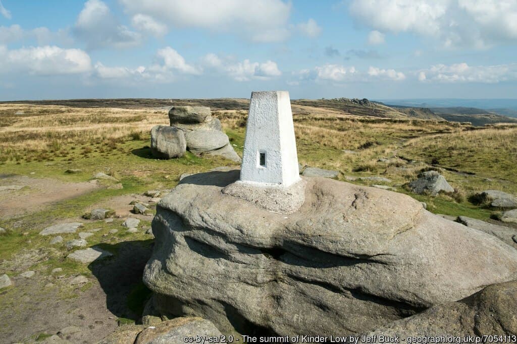
Kinder Scout is the highest mountain in the Peak District, offering a rewarding yet challenging hike.
Routes generally start from Edale and take several hours to complete a circular path. On the Kinder Plateau, you’ll find Kinder Downfall, a well-known Peak District waterfall. It’s located on the River Kinder, and during high winds, the water blows back on itself, creating a steam cloud visible from afar.
If you’re looking for one of the best hikes in the Peak District, Kinder Scout is one to tick off your list and claim the highest point in the Peaks while your at it.
11. Win Hill
🔴 Medium-Hard | 🚶♂️ 5.2 km (3.2 mi) | ⛰️ Total Ascent: 143 m (469 ft) | ⏱️ 1.5-2.5 Hrs

Starting Point: Heatherdene Car Park
Win Hill is known for its steep ascents, panoramic views, and historical significance.
This Win Hill walk is about 6km (3.7 mi) long and typically takes around 2 hours. The route starts at Heatherdene car park (The same starting point as Bamford Edge), crossing the Ladybower dam before ascending a steep hill to the summit of Win Hill, where you’ll be rewarded with stunning 360-degree views. The descent is gentler, leading you through a forest and back over the dam to the car park.
Due to its steepness, the climb can be challenging, but the effort is well worth it for the breathtaking views at the top. An anti-clockwise approach is recommended for those preferring a gentler ascent.
Others List / Honourable Mentions:
While there are far too many to list in detail, here’s an overview of some more popular walks around Derbyshire.
12. Solomons Temple: A short walk to an old Victorian folly just outside of Buxton.
13. Padley Gorge: A deep but narrow valley near the Longshaw Estate. The gorge is an ancient wooded stream with the Burbage Brook.
14. Lathkill Dale: Lathkill Dale is in the valley of the River Lathkill near Bakewell, where the river emerges into the dale from springs below Lathkill Head Cave, and a footpath follows along.
15. Birchen Edge: A gritstone rock and monument popular with walkers and novice climbers.
16. Cave Dale: This is a perpendicular dry limestone valley in which a former collapsed cave is located, just outside the village of Castleton and one of the best Castleton walks.
17. Winnats Pass: Limestone gorge named is a corruption of ‘wind gates’ due to the swirling winds through the pass that leads to the village of Castleton. The area is popular with photographers due to its stunning backdrop.
18. B29 ‘Overexposed’ Crash Site (Bleaklow): The wreckage of a U.S. Air Force bomber that crashed here in the moorland in November 1948.
19. Burbage Edge: Moorland walk and trig point close to Sheffield.
Geography of Derbyshire & Walk types
From the sprawling woodlands to grand estates, serene reservoirs, and undulating Hills, this region is a treasure trove for enthusiasts of the great outdoors.
At the core of Derbyshire’s geographical diversity are two distinct areas: the White Peak and the Dark Peak. These areas offer a stark contrast in scenery and form the backbone of the county’s natural beauty.
The White Peak is renowned for its gentle limestone valleys, crisscrossed by babbling brooks and dotted with quaint villages. This area is a haven for walkers who prefer leisurely strolls through lush fields and alongside flowing rivers. Here, the High Peak intersects, providing a blend of soft landscapes and slightly more challenging terrains.
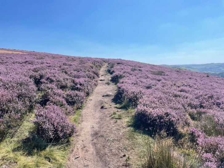
In contrast, the Dark Peak is characterized by its dramatic moorlands, rugged hills, and peat bogs. It’s a landscape that commands respect, with the Pennine range cutting through, offering more strenuous walking paths that appeal to the adventurous spirit. The moorland, especially, presents an iconic image of Derbyshire’s wild side, with vast expanses of heather that bloom into a sea of purple during late summer.
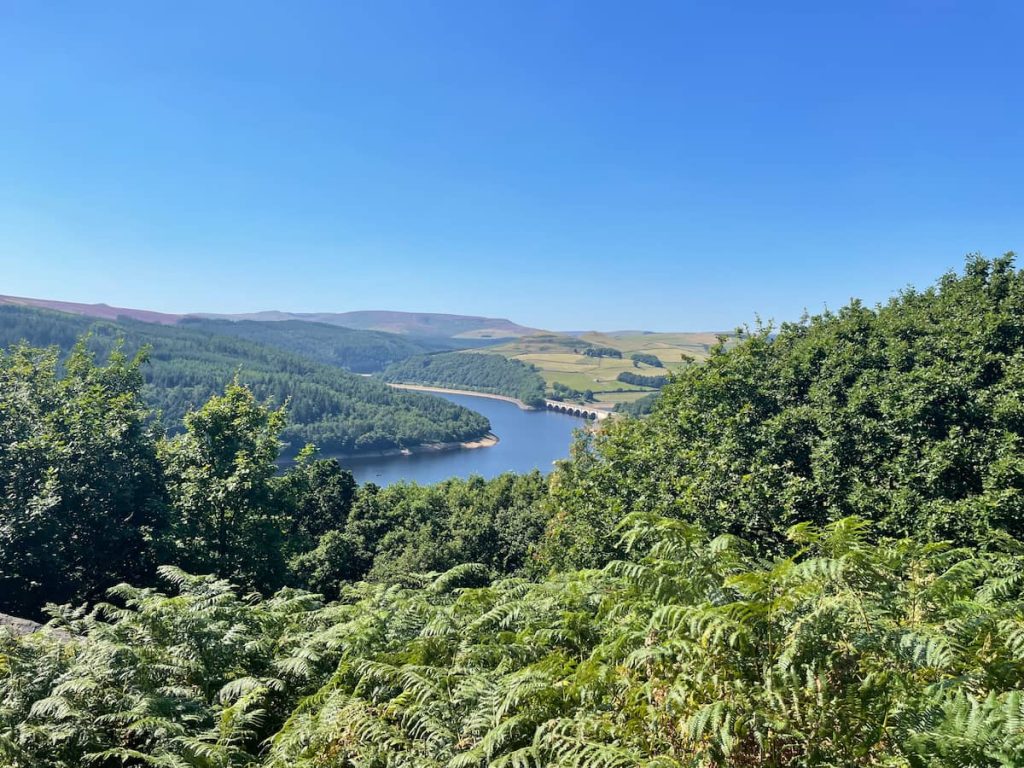
Amidst these peaks lies a network of Reservoirs, serving as peaceful retreats for both humans and wildlife. These water bodies not only play a crucial role in the region’s ecology but also offer serene settings for walks.
Walk Types: A Journey Through Derbyshire’s Landscapes
Derbyshire offers a plethora of walking experiences catering to all levels of fitness and interest. Whether you’re a casual stroller or a dedicated hiker of the dales, there’s a trail for you:
- Woodland Walks: These walks invite you to explore Derbyshire’s dense forests, where the canopy above and the soft forest floor beneath create a tranquil environment. Ideal for families, these paths often lead to hidden clearings and offer glimpses of wildlife. EG: Padley Gorge
- Estate Trails: Walking through Derbyshire’s historic estates allows you to step back in time. These walks are often well-maintained, with clear paths that guide you through landscaped gardens and past grand manor houses. EG: Chatsworth House, Calke Abbey or Haddon Hall.
- Reservoir Circuits: For those who love water views, circling around a reservoir offers flat, easy paths with stunning reflections of the sky and surrounding landscapes. These walks are perfect for contemplative strolls or bird-watching. EG: Ladybower, Harold, Derwent, Howden & Carsington Water.
- Hill Hikes: For the more daring, Derbyshire’s hills and peaks present a challenge. Trails in the High Peak, Nature Reserves, and along the Pennine, or Limestone Way offer exhilarating views and rugged terrain, appealing to those who seek a sense of accomplishment from their walks. Eg: Mam Tor, Win Hill, Kinder Scout and more.
- Moorland Treks: Venturing into the Dark Peak’s moorlands, these walks are for those who love vast, open landscapes. The terrain can be challenging, but the panoramic views and the experience of being amidst nature’s raw beauty are unparalleled. EG: Stanage Edge, Axe Edge Moor, and more.
Walks in Derbyshire are an opportunity to connect with nature and experience the stunning diversity of the English countryside. Whether it’s the lush, rolling fields of the White Peak or the wild, untamed beauty of the Dark Peak, this region invites you to embark on a journey of discovery and enjoyment amidst its geographical wonders.

RonnieB
Tuesday 2nd of July 2024
The detail on geography and the types of walks available in Derbyshire was most enlightening. Having visited a few of the locations myself, I share the sentiment that these landscapes are indeed breathtaking and well worth the visit. For those contemplating a visit, I can attest to the therapeutic effect of being immersed in such natural beauty.
MartyMcFly
Saturday 15th of June 2024
Imagine if we could time travel back to see what Derbyshire looked like in the ice age. Bet those walks would be pretty chilly, haha. Which walk do you think would look the coolest back then?
EllieS
Monday 20th of May 2024
Curious about the geological formations around Stanage Edge. Are the cliffs natural or some part man-made? It’s for a project I’m doing, and this article got me thinking there’s more to explore. Would love some insights from anyone who’s been or knows a bit.
tomthetrekker
Wednesday 8th of May 2024
Anyone ever tried to walk all these in one go? Asking for a friend who reckons he's superman or something, lol.
Chrissy87
Sunday 14th of April 2024
Really appreciate the mention of Calke Abbey & the reservoir. It's such a hidden gem! Perfect for weekend family walks. Not as crowded as other spots which is a blessing.